Property/Postcode Data Search:
PO19 3FJ maps, stats, and open data
PO19 3FJ is located in the Chichester West electoral ward, within the local authority district of Chichester and the English Parliamentary constituency of Chichester. The Sub Integrated Care Board (ICB) Location is NHS Sussex ICB - 70F and the police force is Sussex. This postcode has been in use since October 2019.
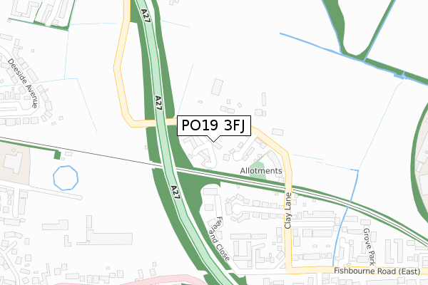
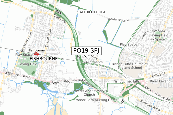
PO19 3FJ maps


Source: OS Open Zoomstack (Ordnance Survey)
Licence: Open Government Licence (requires attribution)
Attribution: Contains OS data © Crown copyright and database right 2025
Source: Open Postcode Geo
Licence: Open Government Licence (requires attribution)
Attribution: Contains OS data © Crown copyright and database right 2025; Contains Royal Mail data © Royal Mail copyright and database right 2025; Source: Office for National Statistics licensed under the Open Government Licence v.3.0
Licence: Open Government Licence (requires attribution)
Attribution: Contains OS data © Crown copyright and database right 2025
Source: Open Postcode Geo
Licence: Open Government Licence (requires attribution)
Attribution: Contains OS data © Crown copyright and database right 2025; Contains Royal Mail data © Royal Mail copyright and database right 2025; Source: Office for National Statistics licensed under the Open Government Licence v.3.0
PO19 3FJ geodata
| Easting | 484191 |
| Northing | 105019 |
| Latitude | 50.838576 |
| Longitude | -0.805689 |
Where is PO19 3FJ?
| Country | England |
| Postcode District | PO19 |
Politics
| Ward | Chichester West |
|---|---|
| Constituency | Chichester |
House Prices
Sales of detached houses in PO19 3FJ
2025 7 MAR £540,000 |
5, HUMPHREY PLACE, CHICHESTER, PO19 3FJ 2020 14 AUG £485,000 |
2020 27 MAY £504,500 |
4, HUMPHREY PLACE, CHICHESTER, PO19 3FJ 2019 23 DEC £500,000 |
1, HUMPHREY PLACE, CHICHESTER, PO19 3FJ 2019 9 DEC £615,000 |
3, HUMPHREY PLACE, CHICHESTER, PO19 3FJ 2019 6 DEC £529,950 |
6, HUMPHREY PLACE, CHICHESTER, PO19 3FJ 2019 6 DEC £539,950 |
9, HUMPHREY PLACE, CHICHESTER, PO19 3FJ 2019 18 OCT £425,000 |
Source: HM Land Registry Price Paid Data
Licence: Contains HM Land Registry data © Crown copyright and database right 2025. This data is licensed under the Open Government Licence v3.0.
Licence: Contains HM Land Registry data © Crown copyright and database right 2025. This data is licensed under the Open Government Licence v3.0.
Transport
Nearest bus stops to PO19 3FJ
| Frederick Road (Clay Lane) | Fishbourne | 113m |
| Frederick Road (Clay Lane) | Fishbourne | 135m |
| Appledram Lane North (Fishbourne Road East) | Fishbourne | 363m |
| Fishbourne Road West | Fishbourne | 367m |
| Fishbourne Road West | Fishbourne | 395m |
Nearest railway stations to PO19 3FJ
| Fishbourne Station | 0.7km |
| Chichester Station | 1.8km |
| Bosham Station | 3km |
Deprivation
29.5% of English postcodes are less deprived than PO19 3FJ:Food Standards Agency
Three nearest food hygiene ratings to PO19 3FJ (metres)
Finisterre

9 Albert Road
193m
The Old Rectory

Appledram Lane North
416m
The Palace Cafe

The Roman Palace
417m
➜ Get more ratings from the Food Standards Agency
Nearest post box to PO19 3FJ
| Last Collection | |||
|---|---|---|---|
| Location | Mon-Fri | Sat | Distance |
| The Woolpack Inn | 18:15 | 12:30 | 437m |
| Tesco Store | 16:00 | 11:30 | 579m |
| Neville Road | 16:15 | 12:15 | 862m |
PO19 3FJ ITL and PO19 3FJ LAU
The below table lists the International Territorial Level (ITL) codes (formerly Nomenclature of Territorial Units for Statistics (NUTS) codes) and Local Administrative Units (LAU) codes for PO19 3FJ:
| ITL 1 Code | Name |
|---|---|
| TLJ | South East (England) |
| ITL 2 Code | Name |
| TLJ2 | Surrey, East and West Sussex |
| ITL 3 Code | Name |
| TLJ27 | West Sussex (South West) |
| LAU 1 Code | Name |
| E07000225 | Chichester |
PO19 3FJ census areas
The below table lists the Census Output Area (OA), Lower Layer Super Output Area (LSOA), and Middle Layer Super Output Area (MSOA) for PO19 3FJ:
| Code | Name | |
|---|---|---|
| OA | E00160620 | |
| LSOA | E01031493 | Chichester 011B |
| MSOA | E02006571 | Chichester 011 |
Nearest postcodes to PO19 3FJ
| PO19 3JQ | Frederick Road | 49m |
| PO19 3JG | Clay Lane | 67m |
| PO19 3JF | Clay Lane | 136m |
| PO19 3JE | Albert Road | 196m |
| PO19 3JB | Clay Lane | 263m |
| PO19 3JD | Westmead Road | 293m |
| PO19 3JA | Fishbourne Road East | 308m |
| PO19 3HX | Fishbourne Road East | 363m |
| PO19 3HZ | Fishbourne Road East | 391m |
| PO19 3HY | Grove Park | 401m |