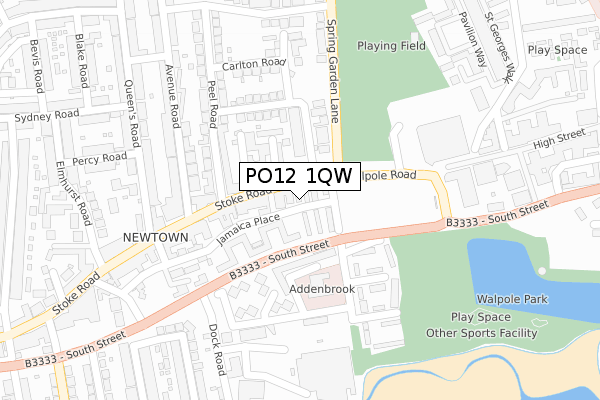
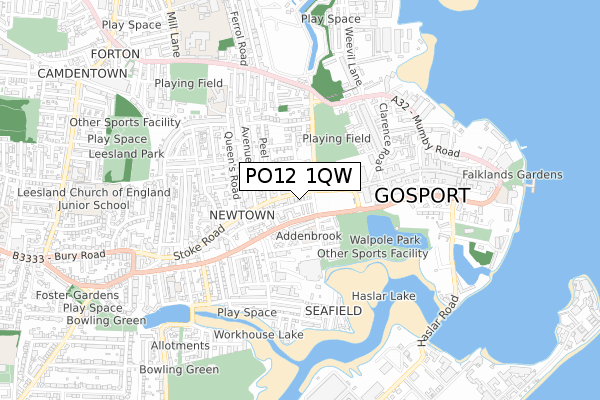
PO12 1QW is located in the Harbourside & Town electoral ward, within the local authority district of Gosport and the English Parliamentary constituency of Gosport. The Sub Integrated Care Board (ICB) Location is NHS Hampshire and Isle of Wight ICB - D9Y0V and the police force is Hampshire. This postcode has been in use since January 2020.


GetTheData
Source: OS Open Zoomstack (Ordnance Survey)
Licence: Open Government Licence (requires attribution)
Attribution: Contains OS data © Crown copyright and database right 2025
Source: Open Postcode Geo
Licence: Open Government Licence (requires attribution)
Attribution: Contains OS data © Crown copyright and database right 2025; Contains Royal Mail data © Royal Mail copyright and database right 2025; Source: Office for National Statistics licensed under the Open Government Licence v.3.0
| Easting | 461418 |
| Northing | 99778 |
| Latitude | 50.794311 |
| Longitude | -1.129941 |
GetTheData
Source: Open Postcode Geo
Licence: Open Government Licence
| Country | England |
| Postcode District | PO12 |
➜ See where PO12 is on a map ➜ Where is Gosport? | |
GetTheData
Source: Land Registry Price Paid Data
Licence: Open Government Licence
| Ward | Harbourside & Town |
| Constituency | Gosport |
GetTheData
Source: ONS Postcode Database
Licence: Open Government Licence
| Royal Arms (Stoke Road) | Newtown | 57m |
| Royal Arms (Stoke Road) | Newtown | 110m |
| Spring Garden Lane | Newtown | 118m |
| Spring Garden Lane | Newtown | 148m |
| Creek Road | Newtown | 232m |
| Portsmouth Harbour Station | 1.6km |
| Southsea Hoverport | 2.3km |
| Portsmouth & Southsea Station | 2.8km |
GetTheData
Source: NaPTAN
Licence: Open Government Licence
GetTheData
Source: ONS Postcode Database
Licence: Open Government Licence


➜ Get more ratings from the Food Standards Agency
GetTheData
Source: Food Standards Agency
Licence: FSA terms & conditions
| Last Collection | |||
|---|---|---|---|
| Location | Mon-Fri | Sat | Distance |
| Prince Of Wales Road | 17:30 | 11:30 | 52m |
| 149 Stoke Road | 18:30 | 12:15 | 163m |
| Safeway Store | 16:45 | 11:15 | 235m |
GetTheData
Source: Dracos
Licence: Creative Commons Attribution-ShareAlike
The below table lists the International Territorial Level (ITL) codes (formerly Nomenclature of Territorial Units for Statistics (NUTS) codes) and Local Administrative Units (LAU) codes for PO12 1QW:
| ITL 1 Code | Name |
|---|---|
| TLJ | South East (England) |
| ITL 2 Code | Name |
| TLJ3 | Hampshire and Isle of Wight |
| ITL 3 Code | Name |
| TLJ35 | South Hampshire |
| LAU 1 Code | Name |
| E07000088 | Gosport |
GetTheData
Source: ONS Postcode Directory
Licence: Open Government Licence
The below table lists the Census Output Area (OA), Lower Layer Super Output Area (LSOA), and Middle Layer Super Output Area (MSOA) for PO12 1QW:
| Code | Name | |
|---|---|---|
| OA | E00115926 | |
| LSOA | E01022810 | Gosport 008A |
| MSOA | E02004748 | Gosport 008 |
GetTheData
Source: ONS Postcode Directory
Licence: Open Government Licence
| PO12 1LT | Stoke Road | 18m |
| PO12 1JB | Stoke Road | 48m |
| PO12 1TA | Park Terraces | 49m |
| PO12 1TJ | Jamaica Place | 61m |
| PO12 1JN | Holly Street | 87m |
| PO12 1TB | Jamaica Place | 88m |
| PO12 1JP | Prince Of Wales Road | 112m |
| PO12 1NB | Endeavour Close | 135m |
| PO12 1FW | Spring Garden Lane | 150m |
| PO12 1TF | The Anchorage | 156m |
GetTheData
Source: Open Postcode Geo; Land Registry Price Paid Data
Licence: Open Government Licence