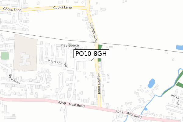
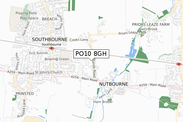
PO10 8GH is located in the Southbourne electoral ward, within the local authority district of Chichester and the English Parliamentary constituency of Chichester. The Sub Integrated Care Board (ICB) Location is NHS Sussex ICB - 70F and the police force is Sussex. This postcode has been in use since May 2018.


GetTheData
Source: OS Open Zoomstack (Ordnance Survey)
Licence: Open Government Licence (requires attribution)
Attribution: Contains OS data © Crown copyright and database right 2025
Source: Open Postcode Geo
Licence: Open Government Licence (requires attribution)
Attribution: Contains OS data © Crown copyright and database right 2025; Contains Royal Mail data © Royal Mail copyright and database right 2025; Source: Office for National Statistics licensed under the Open Government Licence v.3.0
| Easting | 477505 |
| Northing | 105811 |
| Latitude | 50.846629 |
| Longitude | -0.900458 |
GetTheData
Source: Open Postcode Geo
Licence: Open Government Licence
| Country | England |
| Postcode District | PO10 |
➜ See where PO10 is on a map ➜ Where is Southbourne? | |
GetTheData
Source: Land Registry Price Paid Data
Licence: Open Government Licence
| Ward | Southbourne |
| Constituency | Chichester |
GetTheData
Source: ONS Postcode Database
Licence: Open Government Licence
3, WINDSOR CLOSE, SOUTHBOURNE, EMSWORTH, PO10 8GH 2021 9 FEB £429,950 |
GetTheData
Source: HM Land Registry Price Paid Data
Licence: Contains HM Land Registry data © Crown copyright and database right 2025. This data is licensed under the Open Government Licence v3.0.
| Inlands Road (Main Road A259) | Southbourne | 242m |
| Inlands Road (Main Road A259) | Southbourne | 267m |
| Travellers Joy (Main Road A259) | Southbourne | 388m |
| Travellers Joy (Main Road A259) | Southbourne | 400m |
| Farm Lane (Main Road) | Nutbourne | 417m |
| Southbourne Station | 0.6km |
| Nutbourne Station | 1.2km |
| Emsworth Station | 2.7km |
GetTheData
Source: NaPTAN
Licence: Open Government Licence
| Percentage of properties with Next Generation Access | 100.0% |
| Percentage of properties with Superfast Broadband | 100.0% |
| Percentage of properties with Ultrafast Broadband | 0.0% |
| Percentage of properties with Full Fibre Broadband | 0.0% |
Superfast Broadband is between 30Mbps and 300Mbps
Ultrafast Broadband is > 300Mbps
| Percentage of properties unable to receive 2Mbps | 0.0% |
| Percentage of properties unable to receive 5Mbps | 0.0% |
| Percentage of properties unable to receive 10Mbps | 0.0% |
| Percentage of properties unable to receive 30Mbps | 0.0% |
GetTheData
Source: Ofcom
Licence: Ofcom Terms of Use (requires attribution)
GetTheData
Source: ONS Postcode Database
Licence: Open Government Licence


➜ Get more ratings from the Food Standards Agency
GetTheData
Source: Food Standards Agency
Licence: FSA terms & conditions
| Last Collection | |||
|---|---|---|---|
| Location | Mon-Fri | Sat | Distance |
| Inlands Lane | 16:00 | 08:00 | 267m |
| Harmans Main Road | 17:20 | 11:45 | 568m |
| Southbourne Post Office | 16:00 | 11:30 | 662m |
GetTheData
Source: Dracos
Licence: Creative Commons Attribution-ShareAlike
The below table lists the International Territorial Level (ITL) codes (formerly Nomenclature of Territorial Units for Statistics (NUTS) codes) and Local Administrative Units (LAU) codes for PO10 8GH:
| ITL 1 Code | Name |
|---|---|
| TLJ | South East (England) |
| ITL 2 Code | Name |
| TLJ2 | Surrey, East and West Sussex |
| ITL 3 Code | Name |
| TLJ27 | West Sussex (South West) |
| LAU 1 Code | Name |
| E07000225 | Chichester |
GetTheData
Source: ONS Postcode Directory
Licence: Open Government Licence
The below table lists the Census Output Area (OA), Lower Layer Super Output Area (LSOA), and Middle Layer Super Output Area (MSOA) for PO10 8GH:
| Code | Name | |
|---|---|---|
| OA | E00160820 | |
| LSOA | E01031535 | Chichester 009E |
| MSOA | E02006569 | Chichester 009 |
GetTheData
Source: ONS Postcode Directory
Licence: Open Government Licence
| PO18 8RJ | Inlands Road | 116m |
| PO18 8RD | Inlands Road | 192m |
| PO10 8JH | Main Road | 272m |
| PO10 8JZ | Goodwood Court | 274m |
| PO10 8LQ | Cooks Lane | 353m |
| PO18 8RY | Main Road | 362m |
| PO18 8RL | Main Road | 371m |
| PO10 8JX | New Road | 383m |
| PO18 8RZ | School Lane | 396m |
| PO10 8JQ | Main Road | 403m |
GetTheData
Source: Open Postcode Geo; Land Registry Price Paid Data
Licence: Open Government Licence