PL7 2JG maps, stats, and open data
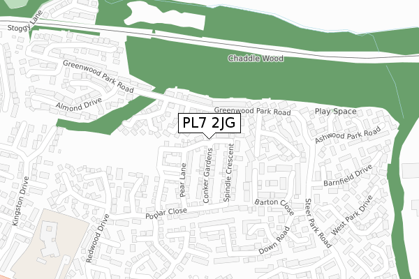
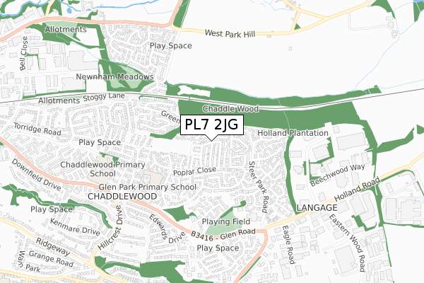
PL7 2JG is located in the Plympton Chaddlewood electoral ward, within the unitary authority of Plymouth and the English Parliamentary constituency of South West Devon. The Sub Integrated Care Board (ICB) Location is NHS Devon ICB - 15N and the police force is Devon & Cornwall. This postcode has been in use since February 2018.
PL7 2JG maps


Licence: Open Government Licence (requires attribution)
Attribution: Contains OS data © Crown copyright and database right 2025
Source: Open Postcode Geo
Licence: Open Government Licence (requires attribution)
Attribution: Contains OS data © Crown copyright and database right 2025; Contains Royal Mail data © Royal Mail copyright and database right 2025; Source: Office for National Statistics licensed under the Open Government Licence v.3.0
PL7 2JG geodata
| Easting | 255969 |
| Northing | 56553 |
| Latitude | 50.391157 |
| Longitude | -4.027611 |
Where is PL7 2JG?
| Country | England |
| Postcode District | PL7 |
Politics
| Ward | Plympton Chaddlewood |
|---|---|
| Constituency | South West Devon |
House Prices
Sales of detached houses in PL7 2JG
93, SPINDLE CRESCENT, PLYMOUTH, PL7 2JG 2024 10 APR £297,000 |
2022 25 NOV £400,000 |
2022 20 MAY £467,500 |
85, SPINDLE CRESCENT, PLYMOUTH, PL7 2JG 2019 26 SEP £334,995 |
61, SPINDLE CRESCENT, PLYMOUTH, PL7 2JG 2019 22 AUG £329,995 |
2019 26 JUL £324,000 |
63, SPINDLE CRESCENT, PLYMOUTH, PL7 2JG 2019 25 JUL £329,995 |
2019 28 JUN £349,995 |
73, SPINDLE CRESCENT, PLYMOUTH, PL7 2JG 2019 28 JUN £329,995 |
75, SPINDLE CRESCENT, PLYMOUTH, PL7 2JG 2019 21 JUN £329,995 |
Licence: Contains HM Land Registry data © Crown copyright and database right 2025. This data is licensed under the Open Government Licence v3.0.
Transport
Nearest bus stops to PL7 2JG
| Culverwood Close (Greenwood Park Road) | Chaddlewood | 132m |
| Culverwood Close (Greenwood Park Close) | Chaddlewood | 143m |
| Raleigh Court (Greenwood Park Road) | Chaddlewood | 191m |
| Raleigh Court (Greenwood Park Road) | Chaddlewood | 192m |
| Barnfield Drive (Steer Park Road) | Chaddlewood | 244m |
Broadband
Broadband access in PL7 2JG (2020 data)
| Percentage of properties with Next Generation Access | 100.0% |
| Percentage of properties with Superfast Broadband | 100.0% |
| Percentage of properties with Ultrafast Broadband | 100.0% |
| Percentage of properties with Full Fibre Broadband | 100.0% |
Superfast Broadband is between 30Mbps and 300Mbps
Ultrafast Broadband is > 300Mbps
Broadband limitations in PL7 2JG (2020 data)
| Percentage of properties unable to receive 2Mbps | 0.0% |
| Percentage of properties unable to receive 5Mbps | 0.0% |
| Percentage of properties unable to receive 10Mbps | 0.0% |
| Percentage of properties unable to receive 30Mbps | 0.0% |
Deprivation
38.6% of English postcodes are less deprived than PL7 2JG:Food Standards Agency
Three nearest food hygiene ratings to PL7 2JG (metres)


➜ Get more ratings from the Food Standards Agency
Nearest post box to PL7 2JG
| Last Collection | |||
|---|---|---|---|
| Location | Mon-Fri | Sat | Distance |
| Hemerdon | 16:30 | 07:10 | 717m |
| Westfield | 17:15 | 10:45 | 1,265m |
| Brixton Post Office | 17:00 | 10:45 | 4,439m |
PL7 2JG ITL and PL7 2JG LAU
The below table lists the International Territorial Level (ITL) codes (formerly Nomenclature of Territorial Units for Statistics (NUTS) codes) and Local Administrative Units (LAU) codes for PL7 2JG:
| ITL 1 Code | Name |
|---|---|
| TLK | South West (England) |
| ITL 2 Code | Name |
| TLK4 | Devon |
| ITL 3 Code | Name |
| TLK41 | Plymouth |
| LAU 1 Code | Name |
| E06000026 | Plymouth |
PL7 2JG census areas
The below table lists the Census Output Area (OA), Lower Layer Super Output Area (LSOA), and Middle Layer Super Output Area (MSOA) for PL7 2JG:
| Code | Name | |
|---|---|---|
| OA | E00076322 | |
| LSOA | E01015107 | Plymouth 018A |
| MSOA | E02003139 | Plymouth 018 |
Nearest postcodes to PL7 2JG
| PL7 2WW | Gilbert Court | 36m |
| PL7 2WL | Grenville Court | 72m |
| PL7 2WN | Walsingham Court | 74m |
| PL7 2WE | Greenwood Park Road | 99m |
| PL7 2WB | Culverwood Close | 131m |
| PL7 2WJ | Raleigh Court | 159m |
| PL7 2WQ | Westmoor Close | 168m |
| PL7 2GU | Barton Close | 181m |
| PL7 2GL | Boulden Close | 202m |
| PL7 2GE | Poplar Close | 208m |