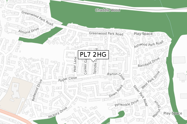
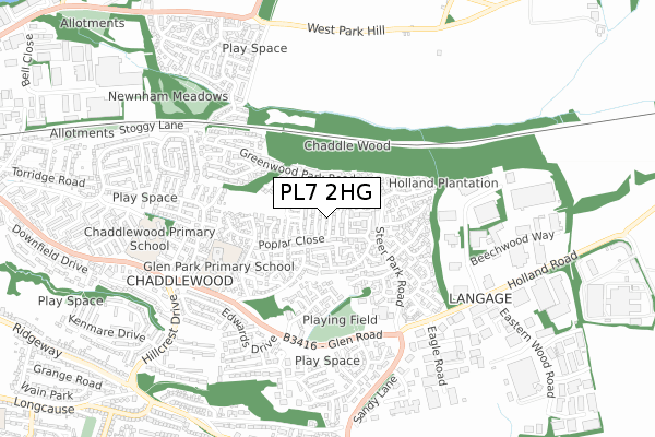
PL7 2HG is located in the Plympton Chaddlewood electoral ward, within the unitary authority of Plymouth and the English Parliamentary constituency of South West Devon. The Sub Integrated Care Board (ICB) Location is NHS Devon ICB - 15N and the police force is Devon & Cornwall. This postcode has been in use since January 2018.


GetTheData
Source: OS Open Zoomstack (Ordnance Survey)
Licence: Open Government Licence (requires attribution)
Attribution: Contains OS data © Crown copyright and database right 2025
Source: Open Postcode Geo
Licence: Open Government Licence (requires attribution)
Attribution: Contains OS data © Crown copyright and database right 2025; Contains Royal Mail data © Royal Mail copyright and database right 2025; Source: Office for National Statistics licensed under the Open Government Licence v.3.0
| Easting | 256004 |
| Northing | 56468 |
| Latitude | 50.390401 |
| Longitude | -4.027086 |
GetTheData
Source: Open Postcode Geo
Licence: Open Government Licence
| Country | England |
| Postcode District | PL7 |
➜ See where PL7 is on a map ➜ Where is Plymouth? | |
GetTheData
Source: Land Registry Price Paid Data
Licence: Open Government Licence
| Ward | Plympton Chaddlewood |
| Constituency | South West Devon |
GetTheData
Source: ONS Postcode Database
Licence: Open Government Licence
2025 31 JAN £340,000 |
2024 15 NOV £345,000 |
2022 7 OCT £370,000 |
3, PLUM WALK, PLYMOUTH, PL7 2HG 2019 18 APR £284,995 |
8, PLUM WALK, PLYMOUTH, PL7 2HG 2019 8 MAR £289,995 |
2018 20 DEC £289,995 |
2018 24 AUG £284,995 |
GetTheData
Source: HM Land Registry Price Paid Data
Licence: Contains HM Land Registry data © Crown copyright and database right 2025. This data is licensed under the Open Government Licence v3.0.
| Culverwood Close (Greenwood Park Road) | Chaddlewood | 175m |
| Culverwood Close (Greenwood Park Close) | Chaddlewood | 176m |
| Barnfield Drive (Steer Park Road) | Chaddlewood | 208m |
| Barnfield Drive (Steer Park Road) | Chaddlewood | 213m |
| Raleigh Court (Greenwood Park Road) | Chaddlewood | 272m |
GetTheData
Source: NaPTAN
Licence: Open Government Licence
| Percentage of properties with Next Generation Access | 100.0% |
| Percentage of properties with Superfast Broadband | 100.0% |
| Percentage of properties with Ultrafast Broadband | 100.0% |
| Percentage of properties with Full Fibre Broadband | 100.0% |
Superfast Broadband is between 30Mbps and 300Mbps
Ultrafast Broadband is > 300Mbps
| Percentage of properties unable to receive 2Mbps | 0.0% |
| Percentage of properties unable to receive 5Mbps | 0.0% |
| Percentage of properties unable to receive 10Mbps | 0.0% |
| Percentage of properties unable to receive 30Mbps | 0.0% |
GetTheData
Source: Ofcom
Licence: Ofcom Terms of Use (requires attribution)
GetTheData
Source: ONS Postcode Database
Licence: Open Government Licence


➜ Get more ratings from the Food Standards Agency
GetTheData
Source: Food Standards Agency
Licence: FSA terms & conditions
| Last Collection | |||
|---|---|---|---|
| Location | Mon-Fri | Sat | Distance |
| Hemerdon | 16:30 | 07:10 | 804m |
| Westfield | 17:15 | 10:45 | 1,338m |
| Brixton Post Office | 17:00 | 10:45 | 4,359m |
GetTheData
Source: Dracos
Licence: Creative Commons Attribution-ShareAlike
The below table lists the International Territorial Level (ITL) codes (formerly Nomenclature of Territorial Units for Statistics (NUTS) codes) and Local Administrative Units (LAU) codes for PL7 2HG:
| ITL 1 Code | Name |
|---|---|
| TLK | South West (England) |
| ITL 2 Code | Name |
| TLK4 | Devon |
| ITL 3 Code | Name |
| TLK41 | Plymouth |
| LAU 1 Code | Name |
| E06000026 | Plymouth |
GetTheData
Source: ONS Postcode Directory
Licence: Open Government Licence
The below table lists the Census Output Area (OA), Lower Layer Super Output Area (LSOA), and Middle Layer Super Output Area (MSOA) for PL7 2HG:
| Code | Name | |
|---|---|---|
| OA | E00076324 | |
| LSOA | E01015111 | Plymouth 018C |
| MSOA | E02003139 | Plymouth 018 |
GetTheData
Source: ONS Postcode Directory
Licence: Open Government Licence
| PL7 2GU | Barton Close | 99m |
| PL7 2WB | Culverwood Close | 119m |
| PL7 2WW | Gilbert Court | 126m |
| PL7 2WL | Grenville Court | 128m |
| PL7 2JE | Fern Close | 134m |
| PL7 2GL | Boulden Close | 143m |
| PL7 2WQ | Westmoor Close | 148m |
| PL7 2WN | Walsingham Court | 153m |
| PL7 2GE | Poplar Close | 163m |
| PL7 2GH | Bakers Close | 163m |
GetTheData
Source: Open Postcode Geo; Land Registry Price Paid Data
Licence: Open Government Licence