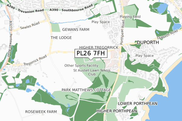
PL26 7FH is located in the St Mewan & Grampound electoral ward, within the unitary authority of Cornwall and the English Parliamentary constituency of St Austell and Newquay. The Sub Integrated Care Board (ICB) Location is NHS Cornwall and the Isles of Scilly ICB - 11N and the police force is Devon & Cornwall. This postcode has been in use since November 2018.


GetTheData
Source: OS Open Zoomstack (Ordnance Survey)
Licence: Open Government Licence (requires attribution)
Attribution: Contains OS data © Crown copyright and database right 2025
Source: Open Postcode Geo
Licence: Open Government Licence (requires attribution)
Attribution: Contains OS data © Crown copyright and database right 2025; Contains Royal Mail data © Royal Mail copyright and database right 2025; Source: Office for National Statistics licensed under the Open Government Licence v.3.0
| Easting | 202444 |
| Northing | 51241 |
| Latitude | 50.327889 |
| Longitude | -4.777015 |
GetTheData
Source: Open Postcode Geo
Licence: Open Government Licence
| Country | England |
| Postcode District | PL26 |
➜ See where PL26 is on a map | |
GetTheData
Source: Land Registry Price Paid Data
Licence: Open Government Licence
| Ward | St Mewan & Grampound |
| Constituency | St Austell And Newquay |
GetTheData
Source: ONS Postcode Database
Licence: Open Government Licence
| St Austell Hospital (Porthpean Road) | St Austell | 278m |
| Duporth Turn (Porthpean Road) | St Austell | 462m |
| Duporth Turn | St Austell | 470m |
| Duporth Two Coves | Charlestown | 713m |
| Duporth Two Coves | Charlestown | 722m |
| St Austell Station | 1.6km |
GetTheData
Source: NaPTAN
Licence: Open Government Licence
GetTheData
Source: ONS Postcode Database
Licence: Open Government Licence


➜ Get more ratings from the Food Standards Agency
GetTheData
Source: Food Standards Agency
Licence: FSA terms & conditions
| Last Collection | |||
|---|---|---|---|
| Location | Mon-Fri | Sat | Distance |
| Southbourne Road | 17:15 | 11:45 | 727m |
| Asda | 17:45 | 12:00 | 777m |
| Sawles Road | 17:30 | 10:00 | 870m |
GetTheData
Source: Dracos
Licence: Creative Commons Attribution-ShareAlike
The below table lists the International Territorial Level (ITL) codes (formerly Nomenclature of Territorial Units for Statistics (NUTS) codes) and Local Administrative Units (LAU) codes for PL26 7FH:
| ITL 1 Code | Name |
|---|---|
| TLK | South West (England) |
| ITL 2 Code | Name |
| TLK3 | Cornwall and Isles of Scilly |
| ITL 3 Code | Name |
| TLK30 | Cornwall and Isles of Scilly |
| LAU 1 Code | Name |
| E06000052 | Cornwall |
GetTheData
Source: ONS Postcode Directory
Licence: Open Government Licence
The below table lists the Census Output Area (OA), Lower Layer Super Output Area (LSOA), and Middle Layer Super Output Area (MSOA) for PL26 7FH:
| Code | Name | |
|---|---|---|
| OA | E00096347 | |
| LSOA | E01019067 | Cornwall 041E |
| MSOA | E02003964 | Cornwall 041 |
GetTheData
Source: ONS Postcode Directory
Licence: Open Government Licence
| PL26 6AS | Porthpean Road | 436m |
| PL26 6AT | Ridgewood Close | 448m |
| PL26 6AN | 488m | |
| PL26 7AJ | 489m | |
| PL25 4PX | Pellymounter Road | 539m |
| PL26 6AL | The Drive | 560m |
| PL26 6BP | Quarry Walk | 560m |
| PL25 4PF | Edyvean Place | 575m |
| PL25 4PY | Codling Close | 583m |
| PL26 6BN | Bay View Road | 615m |
GetTheData
Source: Open Postcode Geo; Land Registry Price Paid Data
Licence: Open Government Licence