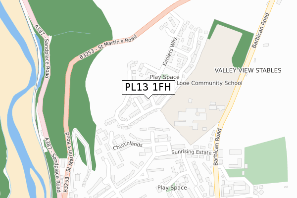
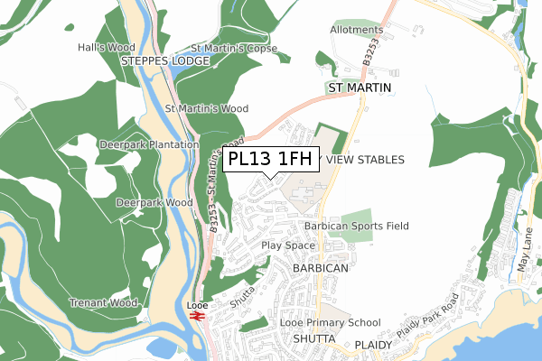
PL13 1FH is located in the Looe East & Deviock electoral ward, within the unitary authority of Cornwall and the English Parliamentary constituency of South East Cornwall. The Sub Integrated Care Board (ICB) Location is NHS Cornwall and the Isles of Scilly ICB - 11N and the police force is Devon & Cornwall. This postcode has been in use since June 2018.


GetTheData
Source: OS Open Zoomstack (Ordnance Survey)
Licence: Open Government Licence (requires attribution)
Attribution: Contains OS data © Crown copyright and database right 2025
Source: Open Postcode Geo
Licence: Open Government Licence (requires attribution)
Attribution: Contains OS data © Crown copyright and database right 2025; Contains Royal Mail data © Royal Mail copyright and database right 2025; Source: Office for National Statistics licensed under the Open Government Licence v.3.0
| Easting | 225717 |
| Northing | 54590 |
| Latitude | 50.365327 |
| Longitude | -4.451916 |
GetTheData
Source: Open Postcode Geo
Licence: Open Government Licence
| Country | England |
| Postcode District | PL13 |
➜ See where PL13 is on a map ➜ Where is Looe? | |
GetTheData
Source: Land Registry Price Paid Data
Licence: Open Government Licence
| Ward | Looe East & Deviock |
| Constituency | South East Cornwall |
GetTheData
Source: ONS Postcode Database
Licence: Open Government Licence
| Glebelands (Sunrising Estate) | Looe | 211m |
| Looe School (Barbican Road) | Looe | 246m |
| Post Box (Sunrising Estate) | Looe | 248m |
| Top Of Sunrise Estate (Sunrising Estate) | Looe | 252m |
| Barbican Road | Looe | 318m |
| Looe Station | 0.7km |
| Sandplace Station | 2.5km |
| Causeland Station | 4.6km |
GetTheData
Source: NaPTAN
Licence: Open Government Licence
| Percentage of properties with Next Generation Access | 100.0% |
| Percentage of properties with Superfast Broadband | 100.0% |
| Percentage of properties with Ultrafast Broadband | 100.0% |
| Percentage of properties with Full Fibre Broadband | 100.0% |
Superfast Broadband is between 30Mbps and 300Mbps
Ultrafast Broadband is > 300Mbps
| Percentage of properties unable to receive 2Mbps | 0.0% |
| Percentage of properties unable to receive 5Mbps | 0.0% |
| Percentage of properties unable to receive 10Mbps | 0.0% |
| Percentage of properties unable to receive 30Mbps | 0.0% |
GetTheData
Source: Ofcom
Licence: Ofcom Terms of Use (requires attribution)
GetTheData
Source: ONS Postcode Database
Licence: Open Government Licence


➜ Get more ratings from the Food Standards Agency
GetTheData
Source: Food Standards Agency
Licence: FSA terms & conditions
| Last Collection | |||
|---|---|---|---|
| Location | Mon-Fri | Sat | Distance |
| Quarry | 11:00 | 10:45 | 524m |
| North Road | 11:15 | 11:15 | 1,114m |
| Beech Terrace | 11:15 | 11:15 | 1,240m |
GetTheData
Source: Dracos
Licence: Creative Commons Attribution-ShareAlike
The below table lists the International Territorial Level (ITL) codes (formerly Nomenclature of Territorial Units for Statistics (NUTS) codes) and Local Administrative Units (LAU) codes for PL13 1FH:
| ITL 1 Code | Name |
|---|---|
| TLK | South West (England) |
| ITL 2 Code | Name |
| TLK3 | Cornwall and Isles of Scilly |
| ITL 3 Code | Name |
| TLK30 | Cornwall and Isles of Scilly |
| LAU 1 Code | Name |
| E06000052 | Cornwall |
GetTheData
Source: ONS Postcode Directory
Licence: Open Government Licence
The below table lists the Census Output Area (OA), Lower Layer Super Output Area (LSOA), and Middle Layer Super Output Area (MSOA) for PL13 1FH:
| Code | Name | |
|---|---|---|
| OA | E00094776 | |
| LSOA | E01018774 | Cornwall 028E |
| MSOA | E02003901 | Cornwall 028 |
GetTheData
Source: ONS Postcode Directory
Licence: Open Government Licence
| PL13 1PS | Kimlers Way | 42m |
| PL13 1FD | Chough Close | 88m |
| PL13 1LZ | Sunrising Bungalows | 100m |
| PL13 1FE | Salter Close | 104m |
| PL13 1PU | Limmicks Road | 168m |
| PL13 1NR | Churchlands | 192m |
| PL13 1NA | Sunrising | 205m |
| PL13 1NQ | Sunrising | 248m |
| PL13 1NB | Sunrising | 252m |
| PL13 1PT | Ranneys Close | 256m |
GetTheData
Source: Open Postcode Geo; Land Registry Price Paid Data
Licence: Open Government Licence