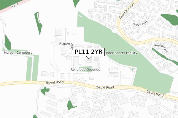
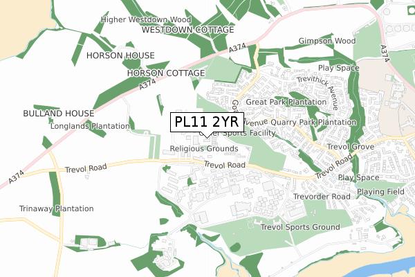
PL11 2YR is located in the Torpoint electoral ward, within the unitary authority of Cornwall and the English Parliamentary constituency of South East Cornwall. The Sub Integrated Care Board (ICB) Location is NHS Cornwall and the Isles of Scilly ICB - 11N and the police force is Devon & Cornwall. This postcode has been in use since December 2018.


GetTheData
Source: OS Open Zoomstack (Ordnance Survey)
Licence: Open Government Licence (requires attribution)
Attribution: Contains OS data © Crown copyright and database right 2025
Source: Open Postcode Geo
Licence: Open Government Licence (requires attribution)
Attribution: Contains OS data © Crown copyright and database right 2025; Contains Royal Mail data © Royal Mail copyright and database right 2025; Source: Office for National Statistics licensed under the Open Government Licence v.3.0
| Easting | 241966 |
| Northing | 55235 |
| Latitude | 50.375714 |
| Longitude | -4.223903 |
GetTheData
Source: Open Postcode Geo
Licence: Open Government Licence
| Country | England |
| Postcode District | PL11 |
➜ See where PL11 is on a map ➜ Where is Torpoint? | |
GetTheData
Source: Land Registry Price Paid Data
Licence: Open Government Licence
| Ward | Torpoint |
| Constituency | South East Cornwall |
GetTheData
Source: ONS Postcode Database
Licence: Open Government Licence
| Hms Raleigh | Torpoint | 157m |
| Hms Raleigh (Trevol Road) | Torpoint | 168m |
| Trevol Business Park (Trevol Road) | Torpoint | 206m |
| Trevol Business Park | Torpoint | 213m |
| Goad Avenue | Torpoint | 230m |
| Dockyard (Plymouth) Station | 3.5km |
| Keyham Station | 3.5km |
| Saltash Station | 3.7km |
GetTheData
Source: NaPTAN
Licence: Open Government Licence
GetTheData
Source: ONS Postcode Database
Licence: Open Government Licence


➜ Get more ratings from the Food Standards Agency
GetTheData
Source: Food Standards Agency
Licence: FSA terms & conditions
| Last Collection | |||
|---|---|---|---|
| Location | Mon-Fri | Sat | Distance |
| Hms Raleigh | 16:30 | 09:15 | 174m |
| Goad Avenue | 16:30 | 09:45 | 507m |
| North Road | 17:00 | 10:30 | 1,178m |
GetTheData
Source: Dracos
Licence: Creative Commons Attribution-ShareAlike
The below table lists the International Territorial Level (ITL) codes (formerly Nomenclature of Territorial Units for Statistics (NUTS) codes) and Local Administrative Units (LAU) codes for PL11 2YR:
| ITL 1 Code | Name |
|---|---|
| TLK | South West (England) |
| ITL 2 Code | Name |
| TLK3 | Cornwall and Isles of Scilly |
| ITL 3 Code | Name |
| TLK30 | Cornwall and Isles of Scilly |
| LAU 1 Code | Name |
| E06000052 | Cornwall |
GetTheData
Source: ONS Postcode Directory
Licence: Open Government Licence
The below table lists the Census Output Area (OA), Lower Layer Super Output Area (LSOA), and Middle Layer Super Output Area (MSOA) for PL11 2YR:
| Code | Name | |
|---|---|---|
| OA | E00094905 | |
| LSOA | E01033294 | Cornwall 034E |
| MSOA | E02003903 | Cornwall 034 |
GetTheData
Source: ONS Postcode Directory
Licence: Open Government Licence
| PL11 2TB | Trevol Road | 72m |
| PL11 2QJ | Lamorna Park | 260m |
| PL11 2HQ | Kernow Close | 304m |
| PL11 2QG | Trelawney Way | 323m |
| PL11 2PP | Grove Park | 350m |
| PL11 2QF | Trelawney Close | 366m |
| PL11 2PY | Borough Park | 416m |
| PL11 2HJ | Wavish Park | 423m |
| PL11 2PZ | Penlee Park | 446m |
| PL11 2HH | Langdon Down Way | 453m |
GetTheData
Source: Open Postcode Geo; Land Registry Price Paid Data
Licence: Open Government Licence