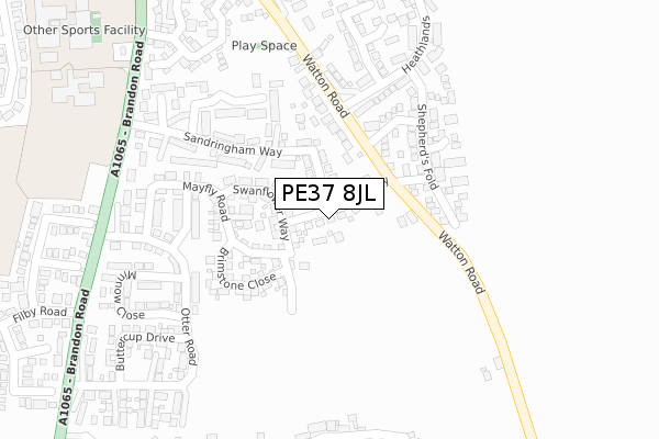
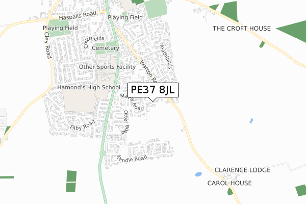
PE37 8JL is located in the Swaffham electoral ward, within the local authority district of Breckland and the English Parliamentary constituency of South West Norfolk. The Sub Integrated Care Board (ICB) Location is NHS Norfolk and Waveney ICB - 26A and the police force is Norfolk. This postcode has been in use since March 2019.


GetTheData
Source: OS Open Zoomstack (Ordnance Survey)
Licence: Open Government Licence (requires attribution)
Attribution: Contains OS data © Crown copyright and database right 2025
Source: Open Postcode Geo
Licence: Open Government Licence (requires attribution)
Attribution: Contains OS data © Crown copyright and database right 2025; Contains Royal Mail data © Royal Mail copyright and database right 2025; Source: Office for National Statistics licensed under the Open Government Licence v.3.0
| Easting | 582445 |
| Northing | 307710 |
| Latitude | 52.636483 |
| Longitude | 0.694759 |
GetTheData
Source: Open Postcode Geo
Licence: Open Government Licence
| Country | England |
| Postcode District | PE37 |
➜ See where PE37 is on a map ➜ Where is Swaffham? | |
GetTheData
Source: Land Registry Price Paid Data
Licence: Open Government Licence
| Ward | Swaffham |
| Constituency | South West Norfolk |
GetTheData
Source: ONS Postcode Database
Licence: Open Government Licence
18, SEDGE ROAD, SWAFFHAM, PE37 8JL 2019 20 NOV £335,000 |
GetTheData
Source: HM Land Registry Price Paid Data
Licence: Contains HM Land Registry data © Crown copyright and database right 2025. This data is licensed under the Open Government Licence v3.0.
| Filby Road (Brandon Road) | Swaffham | 376m |
| Filby Road (Brandon Road) | Swaffham | 386m |
| Hammond's High School (Brandon Road) | Swaffham | 445m |
| The Oaklands (Watton Road) | Swaffham | 483m |
| The Oaklands (Watton Road) | Swaffham | 508m |
GetTheData
Source: NaPTAN
Licence: Open Government Licence
| Percentage of properties with Next Generation Access | 100.0% |
| Percentage of properties with Superfast Broadband | 100.0% |
| Percentage of properties with Ultrafast Broadband | 100.0% |
| Percentage of properties with Full Fibre Broadband | 100.0% |
Superfast Broadband is between 30Mbps and 300Mbps
Ultrafast Broadband is > 300Mbps
| Percentage of properties unable to receive 2Mbps | 0.0% |
| Percentage of properties unable to receive 5Mbps | 0.0% |
| Percentage of properties unable to receive 10Mbps | 0.0% |
| Percentage of properties unable to receive 30Mbps | 0.0% |
GetTheData
Source: Ofcom
Licence: Ofcom Terms of Use (requires attribution)
GetTheData
Source: ONS Postcode Database
Licence: Open Government Licence


➜ Get more ratings from the Food Standards Agency
GetTheData
Source: Food Standards Agency
Licence: FSA terms & conditions
| Last Collection | |||
|---|---|---|---|
| Location | Mon-Fri | Sat | Distance |
| Southfields | 17:15 | 11:45 | 391m |
| London Street Post Office | 17:15 | 12:00 | 796m |
| Wolferton Drive | 17:00 | 12:00 | 838m |
GetTheData
Source: Dracos
Licence: Creative Commons Attribution-ShareAlike
The below table lists the International Territorial Level (ITL) codes (formerly Nomenclature of Territorial Units for Statistics (NUTS) codes) and Local Administrative Units (LAU) codes for PE37 8JL:
| ITL 1 Code | Name |
|---|---|
| TLH | East |
| ITL 2 Code | Name |
| TLH1 | East Anglia |
| ITL 3 Code | Name |
| TLH17 | Breckland and South Norfolk |
| LAU 1 Code | Name |
| E07000143 | Breckland |
GetTheData
Source: ONS Postcode Directory
Licence: Open Government Licence
The below table lists the Census Output Area (OA), Lower Layer Super Output Area (LSOA), and Middle Layer Super Output Area (MSOA) for PE37 8JL:
| Code | Name | |
|---|---|---|
| OA | E00134461 | |
| LSOA | E01026458 | Breckland 007D |
| MSOA | E02005509 | Breckland 007 |
GetTheData
Source: ONS Postcode Directory
Licence: Open Government Licence
| PE37 8JF | Mayfly Road | 114m |
| PE37 8BS | Sandringham Way | 141m |
| PE37 8HF | Watton Road | 144m |
| PE37 7TW | Iceni Drive | 153m |
| PE37 7TP | Saxon Court | 177m |
| PE37 8JG | Fieldfare Way | 192m |
| PE37 7TR | Shepherds Fold | 202m |
| PE37 8BZ | Cygnet Walk | 230m |
| PE37 7TN | Roman Crescent | 236m |
| PE37 8JE | Otter Road | 248m |
GetTheData
Source: Open Postcode Geo; Land Registry Price Paid Data
Licence: Open Government Licence