Property/Postcode Data Search:
PE31 7ZU maps, stats, and open data
PE31 7ZU is located in the Heacham electoral ward, within the local authority district of King's Lynn and West Norfolk and the English Parliamentary constituency of North West Norfolk. The Sub Integrated Care Board (ICB) Location is NHS Norfolk and Waveney ICB - 26A and the police force is Norfolk. This postcode has been in use since March 2019.
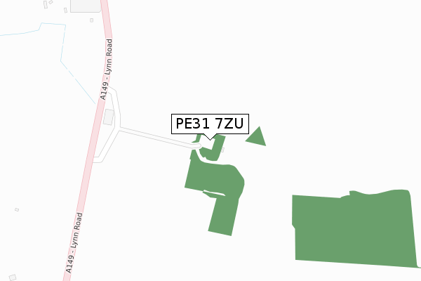
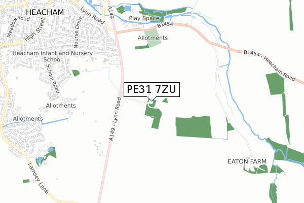
PE31 7ZU maps


Source: OS Open Zoomstack (Ordnance Survey)
Licence: Open Government Licence (requires attribution)
Attribution: Contains OS data © Crown copyright and database right 2025
Source: Open Postcode Geo
Licence: Open Government Licence (requires attribution)
Attribution: Contains OS data © Crown copyright and database right 2025; Contains Royal Mail data © Royal Mail copyright and database right 2025; Source: Office for National Statistics licensed under the Open Government Licence v.3.0
Licence: Open Government Licence (requires attribution)
Attribution: Contains OS data © Crown copyright and database right 2025
Source: Open Postcode Geo
Licence: Open Government Licence (requires attribution)
Attribution: Contains OS data © Crown copyright and database right 2025; Contains Royal Mail data © Royal Mail copyright and database right 2025; Source: Office for National Statistics licensed under the Open Government Licence v.3.0
PE31 7ZU geodata
| Easting | 568744 |
| Northing | 336817 |
| Latitude | 52.902324 |
| Longitude | 0.507476 |
Where is PE31 7ZU?
| Country | England |
| Postcode District | PE31 |
Politics
| Ward | Heacham |
|---|---|
| Constituency | North West Norfolk |
Transport
Nearest bus stops to PE31 7ZU
| Broadway (A149) | Heacham | 525m |
| Broadway (A149) | Heacham | 543m |
| Ringstead Road (Lynn Road) | Heacham | 727m |
| Ringstead Road (Lynn Road) | Heacham | 742m |
| Nourse Drive (Lynn Road) | Heacham | 948m |
Deprivation
50.2% of English postcodes are less deprived than PE31 7ZU:Food Standards Agency
Three nearest food hygiene ratings to PE31 7ZU (metres)
Farmer Fred Adventure Playbarn

Caley Mill
249m
Silk Road

Lynn Road
645m
Lavender Lounge

Norfolk Lavender Ltd Caley Mill
675m
➜ Get more ratings from the Food Standards Agency
Nearest post box to PE31 7ZU
| Last Collection | |||
|---|---|---|---|
| Location | Mon-Fri | Sat | Distance |
| Heacham Post Office | 17:45 | 12:15 | 1,109m |
| Collingwood Close | 16:30 | 08:25 | 1,130m |
| Cheney Crescent | 16:30 | 08:45 | 1,236m |
PE31 7ZU ITL and PE31 7ZU LAU
The below table lists the International Territorial Level (ITL) codes (formerly Nomenclature of Territorial Units for Statistics (NUTS) codes) and Local Administrative Units (LAU) codes for PE31 7ZU:
| ITL 1 Code | Name |
|---|---|
| TLH | East |
| ITL 2 Code | Name |
| TLH1 | East Anglia |
| ITL 3 Code | Name |
| TLH16 | North and West Norfolk |
| LAU 1 Code | Name |
| E07000146 | King's Lynn and West Norfolk |
PE31 7ZU census areas
The below table lists the Census Output Area (OA), Lower Layer Super Output Area (LSOA), and Middle Layer Super Output Area (MSOA) for PE31 7ZU:
| Code | Name | |
|---|---|---|
| OA | E00135578 | |
| LSOA | E01026676 | King's Lynn and West Norfolk 003A |
| MSOA | E02005553 | King's Lynn and West Norfolk 003 |
Nearest postcodes to PE31 7ZU
| PE31 7JF | Lynn Road | 436m |
| PE31 7JJ | Broadway | 671m |
| PE31 7DH | School Road | 694m |
| PE31 7SG | Pocahontas Way | 707m |
| PE31 7SF | Rolfe Crescent | 712m |
| PE31 7EW | Woodside Avenue | 752m |
| PE31 7SQ | Bridge Close | 760m |
| PE31 7SJ | Dix Close | 780m |
| PE31 7DG | Woodend Road | 782m |
| PE31 7SH | Torrey Close | 793m |