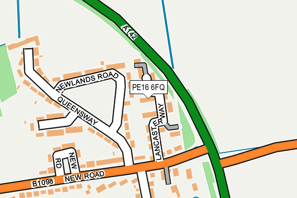
PE16 6FQ is located in the Chatteris North & Manea electoral ward, within the local authority district of Fenland and the English Parliamentary constituency of North East Cambridgeshire. The Sub Integrated Care Board (ICB) Location is NHS Cambridgeshire and Peterborough ICB - 06H and the police force is Cambridgeshire. This postcode has been in use since March 2017.


GetTheData
Source: OS OpenMap – Local (Ordnance Survey)
Source: OS VectorMap District (Ordnance Survey)
Licence: Open Government Licence (requires attribution)
| Easting | 540293 |
| Northing | 286531 |
| Latitude | 52.458732 |
| Longitude | 0.063400 |
GetTheData
Source: Open Postcode Geo
Licence: Open Government Licence
| Country | England |
| Postcode District | PE16 |
➜ See where PE16 is on a map ➜ Where is Chatteris? | |
GetTheData
Source: Land Registry Price Paid Data
Licence: Open Government Licence
| Ward | Chatteris North & Manea |
| Constituency | North East Cambridgeshire |
GetTheData
Source: ONS Postcode Database
Licence: Open Government Licence
| Green Park | Chatteris | 191m |
| Green Park | Chatteris | 192m |
| New Road | Chatteris | 623m |
| New Road | Chatteris | 625m |
| King Edward Road (High Street) | Chatteris | 1,020m |
GetTheData
Source: NaPTAN
Licence: Open Government Licence
| Percentage of properties with Next Generation Access | 100.0% |
| Percentage of properties with Superfast Broadband | 100.0% |
| Percentage of properties with Ultrafast Broadband | 0.0% |
| Percentage of properties with Full Fibre Broadband | 0.0% |
Superfast Broadband is between 30Mbps and 300Mbps
Ultrafast Broadband is > 300Mbps
| Median download speed | 40.0Mbps |
| Average download speed | 44.8Mbps |
| Maximum download speed | 77.18Mbps |
| Median upload speed | 10.0Mbps |
| Average upload speed | 11.7Mbps |
| Maximum upload speed | 20.00Mbps |
| Percentage of properties unable to receive 2Mbps | 0.0% |
| Percentage of properties unable to receive 5Mbps | 0.0% |
| Percentage of properties unable to receive 10Mbps | 0.0% |
| Percentage of properties unable to receive 30Mbps | 0.0% |
GetTheData
Source: Ofcom
Licence: Ofcom Terms of Use (requires attribution)
GetTheData
Source: ONS Postcode Database
Licence: Open Government Licence


➜ Get more ratings from the Food Standards Agency
GetTheData
Source: Food Standards Agency
Licence: FSA terms & conditions
| Last Collection | |||
|---|---|---|---|
| Location | Mon-Fri | Sat | Distance |
| Queensway | 16:45 | 11:45 | 241m |
| Glebe Close-st Martins | 17:00 | 11:45 | 709m |
| New Road | 16:45 | 11:45 | 806m |
GetTheData
Source: Dracos
Licence: Creative Commons Attribution-ShareAlike
The below table lists the International Territorial Level (ITL) codes (formerly Nomenclature of Territorial Units for Statistics (NUTS) codes) and Local Administrative Units (LAU) codes for PE16 6FQ:
| ITL 1 Code | Name |
|---|---|
| TLH | East |
| ITL 2 Code | Name |
| TLH1 | East Anglia |
| ITL 3 Code | Name |
| TLH12 | Cambridgeshire CC |
| LAU 1 Code | Name |
| E07000010 | Fenland |
GetTheData
Source: ONS Postcode Directory
Licence: Open Government Licence
The below table lists the Census Output Area (OA), Lower Layer Super Output Area (LSOA), and Middle Layer Super Output Area (MSOA) for PE16 6FQ:
| Code | Name | |
|---|---|---|
| OA | E00091121 | |
| LSOA | E01018062 | Fenland 011A |
| MSOA | E02003752 | Fenland 011 |
GetTheData
Source: ONS Postcode Directory
Licence: Open Government Licence
| PE16 6DE | Newlands Road | 110m |
| PE16 6DB | New Road | 115m |
| PE16 6DD | Queensway | 169m |
| PE16 6DA | New Road | 187m |
| PE16 6QS | The Pastures | 212m |
| PE16 6DF | Queensway | 247m |
| PE16 6DW | Green Park | 263m |
| PE16 6BZ | Delve Terrace | 283m |
| PE16 6DJ | Green Park | 300m |
| PE16 6DH | Windsor Close | 357m |
GetTheData
Source: Open Postcode Geo; Land Registry Price Paid Data
Licence: Open Government Licence