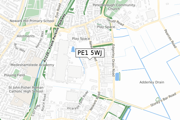
PE1 5WJ is located in the East electoral ward, within the unitary authority of Peterborough and the English Parliamentary constituency of Peterborough. The Sub Integrated Care Board (ICB) Location is NHS Cambridgeshire and Peterborough ICB - 06H and the police force is Cambridgeshire. This postcode has been in use since January 2018.


GetTheData
Source: OS Open Zoomstack (Ordnance Survey)
Licence: Open Government Licence (requires attribution)
Attribution: Contains OS data © Crown copyright and database right 2025
Source: Open Postcode Geo
Licence: Open Government Licence (requires attribution)
Attribution: Contains OS data © Crown copyright and database right 2025; Contains Royal Mail data © Royal Mail copyright and database right 2025; Source: Office for National Statistics licensed under the Open Government Licence v.3.0
| Easting | 521468 |
| Northing | 300038 |
| Latitude | 52.584608 |
| Longitude | -0.208581 |
GetTheData
Source: Open Postcode Geo
Licence: Open Government Licence
| Country | England |
| Postcode District | PE1 |
➜ See where PE1 is on a map ➜ Where is Peterborough? | |
GetTheData
Source: Land Registry Price Paid Data
Licence: Open Government Licence
| Ward | East |
| Constituency | Peterborough |
GetTheData
Source: ONS Postcode Database
Licence: Open Government Licence
| Newark Road | Eastern Industry | 333m |
| Newark Road | Eastern Industry | 339m |
| Saracen Way (Newark Road) | Eastern Industry | 366m |
| Saracen Way (Newark Road) | Eastern Industry | 427m |
| Sainsbury's (Oxney Road) | Newark | 464m |
| Peterborough Station | 3km |
GetTheData
Source: NaPTAN
Licence: Open Government Licence
GetTheData
Source: ONS Postcode Database
Licence: Open Government Licence


➜ Get more ratings from the Food Standards Agency
GetTheData
Source: Food Standards Agency
Licence: FSA terms & conditions
| Last Collection | |||
|---|---|---|---|
| Location | Mon-Fri | Sat | Distance |
| Oxney Road-franklin Crescent | 18:30 | 12:45 | 540m |
| Hill Close Post Office | 17:30 | 11:45 | 767m |
| Reeves Way | 17:45 | 12:30 | 888m |
GetTheData
Source: Dracos
Licence: Creative Commons Attribution-ShareAlike
The below table lists the International Territorial Level (ITL) codes (formerly Nomenclature of Territorial Units for Statistics (NUTS) codes) and Local Administrative Units (LAU) codes for PE1 5WJ:
| ITL 1 Code | Name |
|---|---|
| TLH | East |
| ITL 2 Code | Name |
| TLH1 | East Anglia |
| ITL 3 Code | Name |
| TLH11 | Peterborough |
| LAU 1 Code | Name |
| E06000031 | Peterborough |
GetTheData
Source: ONS Postcode Directory
Licence: Open Government Licence
The below table lists the Census Output Area (OA), Lower Layer Super Output Area (LSOA), and Middle Layer Super Output Area (MSOA) for PE1 5WJ:
| Code | Name | |
|---|---|---|
| OA | E00078957 | |
| LSOA | E01015616 | Peterborough 013F |
| MSOA | E02003249 | Peterborough 013 |
GetTheData
Source: ONS Postcode Directory
Licence: Open Government Licence
| PE1 5WG | Newark Road | 81m |
| PE1 5UP | Empson Road | 199m |
| PE1 5EL | Stevern Way | 247m |
| PE1 5YQ | Myrtle House Caravan Park | 255m |
| PE1 5YD | Newark Road | 336m |
| PE1 5YF | Palmers Road | 336m |
| PE1 5YJ | Newark Road | 337m |
| PE1 5PY | Meadenvale | 384m |
| PE1 5YG | Edgerley Drain Road | 417m |
| PE1 5NQ | Marriott Court | 421m |
GetTheData
Source: Open Postcode Geo; Land Registry Price Paid Data
Licence: Open Government Licence