OX7 6FA open data databoard
OX7 6FA is located in the Ascott and Shipton electoral ward, within the local authority district of West Oxfordshire and the English Parliamentary constituency of Witney. The Sub Integrated Care Board (ICB) Location is NHS Buckinghamshire, Oxfordshire and Berkshire West ICB - 10Q and the police force is Thames Valley. This postcode has been in use since February 2020.
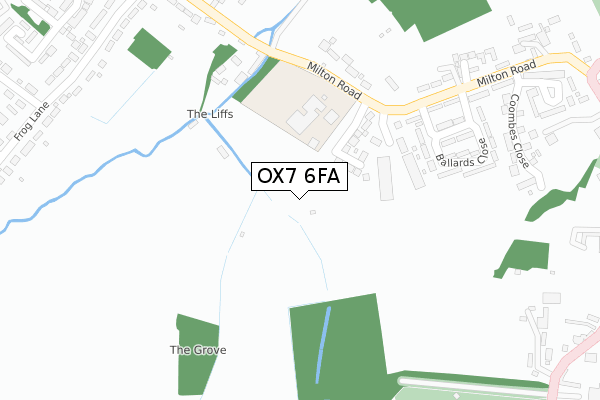
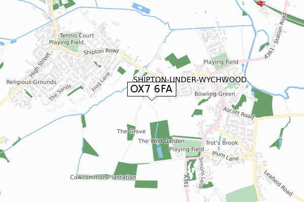
OX7 6FA maps


Licence: Open Government Licence (requires attribution)
Attribution: Contains OS data © Crown copyright and database right 2025
Source: Open Postcode Geo
Licence: Open Government Licence (requires attribution)
Attribution: Contains OS data © Crown copyright and database right 2025; Contains Royal Mail data © Royal Mail copyright and database right 2025; Source: Office for National Statistics licensed under the Open Government Licence v.3.0
OX7 6FA geodata
| Easting | 427274 |
| Northing | 217873 |
| Latitude | 51.858789 |
| Longitude | -1.605360 |
Where is OX7 6FA?
| Country | England |
| Postcode District | OX7 |
Politics
| Ward | Ascott And Shipton |
|---|---|
| Constituency | Witney |
Transport
Nearest bus stops to OX7 6FA
| Post Office (Milton Road) | Shipton-under-wychwood | 329m |
| Post Office (Milton Road) | Shipton-under-wychwood | 348m |
| Frog Lane | Milton-under-wychwood | 423m |
| High Street | Shipton-under-wychwood | 509m |
| High Street | Shipton-under-wychwood | 559m |
Nearest railway stations to OX7 6FA
| Shipton Station | 1.2km |
| Ascott-under-Wychwood Station | 3km |
| Kingham Station | 5.1km |
Deprivation
5.9% of English postcodes are less deprived than OX7 6FA:Food Standards Agency
Three nearest food hygiene ratings to OX7 6FA (metres)


➜ Get more ratings from the Food Standards Agency
Nearest post box to OX7 6FA
| Last Collection | |||
|---|---|---|---|
| Location | Mon-Fri | Sat | Distance |
| Church Street | 16:45 | 09:15 | 608m |
| Shipton Station | 16:45 | 09:15 | 1,005m |
| Bruern Abbey | 15:45 | 08:15 | 2,635m |
OX7 6FA ITL and OX7 6FA LAU
The below table lists the International Territorial Level (ITL) codes (formerly Nomenclature of Territorial Units for Statistics (NUTS) codes) and Local Administrative Units (LAU) codes for OX7 6FA:
| ITL 1 Code | Name |
|---|---|
| TLJ | South East (England) |
| ITL 2 Code | Name |
| TLJ1 | Berkshire, Buckinghamshire and Oxfordshire |
| ITL 3 Code | Name |
| TLJ14 | Oxfordshire CC |
| LAU 1 Code | Name |
| E07000181 | West Oxfordshire |
OX7 6FA census areas
The below table lists the Census Output Area (OA), Lower Layer Super Output Area (LSOA), and Middle Layer Super Output Area (MSOA) for OX7 6FA:
| Code | Name | |
|---|---|---|
| OA | E00146502 | |
| LSOA | E01028763 | West Oxfordshire 003A |
| MSOA | E02005995 | West Oxfordshire 003 |
Nearest postcodes to OX7 6FA
| OX7 6BE | St Michaels Close | 269m |
| OX7 6BG | Ballards Close | 272m |
| OX7 6BD | Milton Road | 311m |
| OX7 6JS | Shipton Road | 323m |
| OX7 6NS | Willis Court | 346m |
| OX7 6BU | Coombes Close | 373m |
| OX7 6BX | Tothill | 442m |
| OX7 6JT | Shipton Road | 445m |
| OX7 6JZ | Frog Lane | 465m |
| OX7 6JR | Shipton Road | 498m |