OX7 5SU open data databoard
- Home
- Postcode
- OX
- OX7
- OX7 5
OX7 5SU is located in the Chipping Norton electoral ward, within the local authority district of West Oxfordshire and the English Parliamentary constituency of Witney. The Sub Integrated Care Board (ICB) Location is NHS Buckinghamshire, Oxfordshire and Berkshire West ICB - 10Q and the police force is Thames Valley. This postcode has been in use since January 2018.
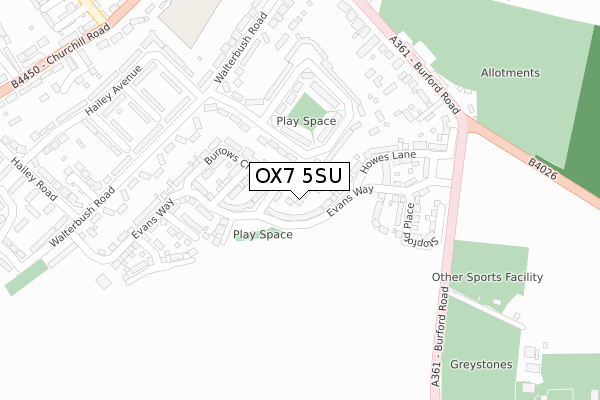
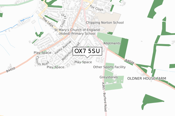
OX7 5SU maps


Source: OS Open Zoomstack (Ordnance Survey)
Licence: Open Government Licence (requires attribution)
Attribution: Contains OS data © Crown copyright and database right 2025
Source: Open Postcode GeoLicence: Open Government Licence (requires attribution)
Attribution: Contains OS data © Crown copyright and database right 2025; Contains Royal Mail data © Royal Mail copyright and database right 2025; Source: Office for National Statistics licensed under the Open Government Licence v.3.0
OX7 5SU geodata
| Easting | 431385 |
| Northing | 226190 |
| Latitude | 51.933350 |
| Longitude | -1.544913 |
Where is OX7 5SU?
| Country | England |
| Postcode District | OX7 |
Politics
| Ward | Chipping Norton |
|---|
| Constituency | Witney |
|---|
Transport
Nearest bus stops to OX7 5SU
| Walterbush Road | Chipping Norton | 234m |
| Walterbush Road | Chipping Norton | 239m |
| Hailey Crescent (Walterbush Road) | Chipping Norton | 336m |
| Hailey Crescent (Walterbush Road) | Chipping Norton | 336m |
| Chipping Norton School (Burford Road) | Chipping Norton | 351m |
Broadband
Broadband access in OX7 5SU (2020 data)
| Percentage of properties with Next Generation Access | 100.0% |
| Percentage of properties with Superfast Broadband | 100.0% |
| Percentage of properties with Ultrafast Broadband | 0.0% |
| Percentage of properties with Full Fibre Broadband | 0.0% |
Superfast Broadband is between 30Mbps and 300Mbps
Ultrafast Broadband is > 300Mbps
Broadband speed in OX7 5SU (2019 data)
Download
| Median download speed | 44.5Mbps |
| Average download speed | 46.3Mbps |
| Maximum download speed | 73.37Mbps |
Upload
| Median upload speed | 10.0Mbps |
| Average upload speed | 10.7Mbps |
| Maximum upload speed | 18.01Mbps |
Broadband limitations in OX7 5SU (2020 data)
| Percentage of properties unable to receive 2Mbps | 0.0% |
| Percentage of properties unable to receive 5Mbps | 0.0% |
| Percentage of properties unable to receive 10Mbps | 0.0% |
| Percentage of properties unable to receive 30Mbps | 0.0% |
Deprivation
69% of English postcodes are less deprived than
OX7 5SU:
Food Standards Agency
Three nearest food hygiene ratings to OX7 5SU (metres)
Chippy Honey
Beech Haven Care Home
Banana Moon Day Nursery
➜ Get more ratings from the Food Standards Agency
Nearest post box to OX7 5SU
| | Last Collection | |
|---|
| Location | Mon-Fri | Sat | Distance |
|---|
| Churchill Road | 17:00 | 12:00 | 441m |
| Market Square | 17:00 | 12:00 | 919m |
| Chipping Norton Post Office | 18:15 | 12:00 | 987m |
OX7 5SU ITL and OX7 5SU LAU
The below table lists the International Territorial Level (ITL) codes (formerly Nomenclature of Territorial Units for Statistics (NUTS) codes) and Local Administrative Units (LAU) codes for OX7 5SU:
| ITL 1 Code | Name |
|---|
| TLJ | South East (England) |
| ITL 2 Code | Name |
|---|
| TLJ1 | Berkshire, Buckinghamshire and Oxfordshire |
| ITL 3 Code | Name |
|---|
| TLJ14 | Oxfordshire CC |
| LAU 1 Code | Name |
|---|
| E07000181 | West Oxfordshire |
OX7 5SU census areas
The below table lists the Census Output Area (OA), Lower Layer Super Output Area (LSOA), and Middle Layer Super Output Area (MSOA) for OX7 5SU:
| Code | Name |
|---|
| OA | E00146597 | |
|---|
| LSOA | E01028781 | West Oxfordshire 001B |
|---|
| MSOA | E02005993 | West Oxfordshire 001 |
|---|
Nearest postcodes to OX7 5SU


