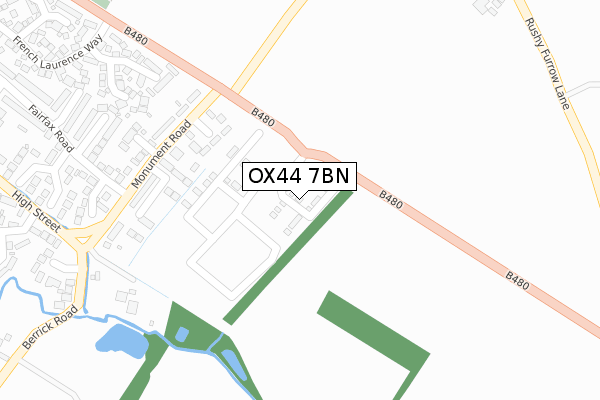
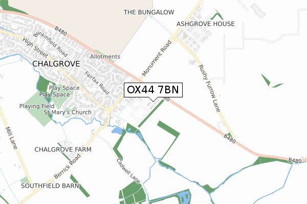
OX44 7BN is located in the Chalgrove electoral ward, within the local authority district of South Oxfordshire and the English Parliamentary constituency of Henley. The Sub Integrated Care Board (ICB) Location is NHS Buckinghamshire, Oxfordshire and Berkshire West ICB - 10Q and the police force is Thames Valley. This postcode has been in use since December 2019.


GetTheData
Source: OS Open Zoomstack (Ordnance Survey)
Licence: Open Government Licence (requires attribution)
Attribution: Contains OS data © Crown copyright and database right 2025
Source: Open Postcode Geo
Licence: Open Government Licence (requires attribution)
Attribution: Contains OS data © Crown copyright and database right 2025; Contains Royal Mail data © Royal Mail copyright and database right 2025; Source: Office for National Statistics licensed under the Open Government Licence v.3.0
| Easting | 464416 |
| Northing | 196657 |
| Latitude | 51.665013 |
| Longitude | -1.070014 |
GetTheData
Source: Open Postcode Geo
Licence: Open Government Licence
| Country | England |
| Postcode District | OX44 |
➜ See where OX44 is on a map ➜ Where is Chalgrove? | |
GetTheData
Source: Land Registry Price Paid Data
Licence: Open Government Licence
| Ward | Chalgrove |
| Constituency | Henley |
GetTheData
Source: ONS Postcode Database
Licence: Open Government Licence
19, HICKS CLOSE, CHALGROVE, OXFORD, OX44 7BN 2022 24 JUN £565,000 |
11, HICKS CLOSE, CHALGROVE, OXFORD, OX44 7BN 2021 11 FEB £605,000 |
1, HICKS CLOSE, CHALGROVE, OXFORD, OX44 7BN 2020 30 OCT £595,000 |
12, HICKS CLOSE, CHALGROVE, OXFORD, OX44 7BN 2020 28 OCT £515,000 |
2, HICKS CLOSE, CHALGROVE, OXFORD, OX44 7BN 2020 2 OCT £499,995 |
10, HICKS CLOSE, CHALGROVE, OXFORD, OX44 7BN 2020 25 SEP £615,000 |
9, HICKS CLOSE, CHALGROVE, OXFORD, OX44 7BN 2020 14 AUG £499,995 |
17, HICKS CLOSE, CHALGROVE, OXFORD, OX44 7BN 2020 26 JUN £517,500 |
6, HICKS CLOSE, CHALGROVE, OXFORD, OX44 7BN 2020 26 MAR £380,000 |
4, HICKS CLOSE, CHALGROVE, OXFORD, OX44 7BN 2020 20 MAR £370,000 |
GetTheData
Source: HM Land Registry Price Paid Data
Licence: Contains HM Land Registry data © Crown copyright and database right 2025. This data is licensed under the Open Government Licence v3.0.
| Fairfax Road (Monument Road) | Chalgrove | 279m |
| Fairfax Road (Monument Road) | Chalgrove | 302m |
| Church Lane (High Street) | Chalgrove | 484m |
| Church Lane (High Street) | Chalgrove | 505m |
| The Red Lion Ph (High Street) | Chalgrove | 777m |
GetTheData
Source: NaPTAN
Licence: Open Government Licence
GetTheData
Source: ONS Postcode Database
Licence: Open Government Licence


➜ Get more ratings from the Food Standards Agency
GetTheData
Source: Food Standards Agency
Licence: FSA terms & conditions
| Last Collection | |||
|---|---|---|---|
| Location | Mon-Fri | Sat | Distance |
| Monumont Road | 17:30 | 09:15 | 185m |
| Monument Industrial Estate | 17:30 | 11:00 | 418m |
| Chalgrove Post Office | 17:30 | 11:20 | 837m |
GetTheData
Source: Dracos
Licence: Creative Commons Attribution-ShareAlike
The below table lists the International Territorial Level (ITL) codes (formerly Nomenclature of Territorial Units for Statistics (NUTS) codes) and Local Administrative Units (LAU) codes for OX44 7BN:
| ITL 1 Code | Name |
|---|---|
| TLJ | South East (England) |
| ITL 2 Code | Name |
| TLJ1 | Berkshire, Buckinghamshire and Oxfordshire |
| ITL 3 Code | Name |
| TLJ14 | Oxfordshire CC |
| LAU 1 Code | Name |
| E07000179 | South Oxfordshire |
GetTheData
Source: ONS Postcode Directory
Licence: Open Government Licence
The below table lists the Census Output Area (OA), Lower Layer Super Output Area (LSOA), and Middle Layer Super Output Area (MSOA) for OX44 7BN:
| Code | Name | |
|---|---|---|
| OA | E00145734 | |
| LSOA | E01028609 | South Oxfordshire 007D |
| MSOA | E02005964 | South Oxfordshire 007 |
GetTheData
Source: ONS Postcode Directory
Licence: Open Government Licence
| OX44 7RN | Chiltern Close | 173m |
| OX44 7RL | Farm Close | 222m |
| OX44 7RH | Monument Road | 248m |
| OX44 7QN | The Springs | 303m |
| OX44 7SE | Cromwell Close | 360m |
| OX44 7YD | Sixpenny Lane | 363m |
| OX44 7RU | Argosy Close | 378m |
| OX44 7RY | Beverley Close | 399m |
| OX44 7RT | Rupert Close | 420m |
| OX44 7RG | Franklin Close | 452m |
GetTheData
Source: Open Postcode Geo; Land Registry Price Paid Data
Licence: Open Government Licence