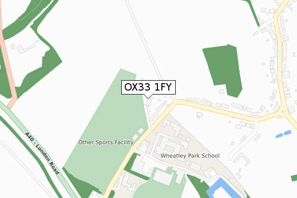
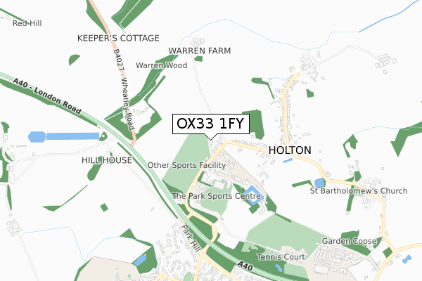
OX33 1FY is located in the Forest Hill & Holton electoral ward, within the local authority district of South Oxfordshire and the English Parliamentary constituency of Henley. The Sub Integrated Care Board (ICB) Location is NHS Buckinghamshire, Oxfordshire and Berkshire West ICB - 10Q and the police force is Thames Valley. This postcode has been in use since November 2018.


GetTheData
Source: OS Open Zoomstack (Ordnance Survey)
Licence: Open Government Licence (requires attribution)
Attribution: Contains OS data © Crown copyright and database right 2025
Source: Open Postcode Geo
Licence: Open Government Licence (requires attribution)
Attribution: Contains OS data © Crown copyright and database right 2025; Contains Royal Mail data © Royal Mail copyright and database right 2025; Source: Office for National Statistics licensed under the Open Government Licence v.3.0
| Easting | 459633 |
| Northing | 206684 |
| Latitude | 51.755685 |
| Longitude | -1.137449 |
GetTheData
Source: Open Postcode Geo
Licence: Open Government Licence
| Country | England |
| Postcode District | OX33 |
➜ See where OX33 is on a map ➜ Where is Holton? | |
GetTheData
Source: Land Registry Price Paid Data
Licence: Open Government Licence
| Ward | Forest Hill & Holton |
| Constituency | Henley |
GetTheData
Source: ONS Postcode Database
Licence: Open Government Licence
1, HOME CLOSE, HOLTON, OXFORD, OX33 1FY 2023 12 JAN £420,000 |
ORCHARD VIEW, HOME CLOSE, HOLTON, OXFORD, OX33 1FY 2021 19 MAR £540,000 |
HIGHVIEW, HOME CLOSE, HOLTON, OXFORD, OX33 1FY 2019 10 SEP £725,000 |
MILLVIEW HOUSE, HOME CLOSE, HOLTON, OXFORD, OX33 1FY 2018 7 DEC £880,000 |
GetTheData
Source: HM Land Registry Price Paid Data
Licence: Contains HM Land Registry data © Crown copyright and database right 2025. This data is licensed under the Open Government Licence v3.0.
| Holton Turn (A40 Slip Road) | Holton | 421m |
| Holton Turn (A40 Slip Road) | Wheatley | 435m |
| Bus Shelter (Holton Village Turn) | Holton | 456m |
| Bus Shelter (Holton Village Turn) | Holton | 480m |
| Park Hill Roundabout (Park Hill) | Wheatley | 616m |
GetTheData
Source: NaPTAN
Licence: Open Government Licence
| Percentage of properties with Next Generation Access | 100.0% |
| Percentage of properties with Superfast Broadband | 100.0% |
| Percentage of properties with Ultrafast Broadband | 0.0% |
| Percentage of properties with Full Fibre Broadband | 0.0% |
Superfast Broadband is between 30Mbps and 300Mbps
Ultrafast Broadband is > 300Mbps
| Percentage of properties unable to receive 2Mbps | 0.0% |
| Percentage of properties unable to receive 5Mbps | 0.0% |
| Percentage of properties unable to receive 10Mbps | 0.0% |
| Percentage of properties unable to receive 30Mbps | 0.0% |
GetTheData
Source: Ofcom
Licence: Ofcom Terms of Use (requires attribution)
GetTheData
Source: ONS Postcode Database
Licence: Open Government Licence


➜ Get more ratings from the Food Standards Agency
GetTheData
Source: Food Standards Agency
Licence: FSA terms & conditions
| Last Collection | |||
|---|---|---|---|
| Location | Mon-Fri | Sat | Distance |
| Holton | 16:20 | 08:30 | 476m |
| Church Road | 16:30 | 09:30 | 867m |
| Wheatley Post Office | 18:15 | 11:45 | 1,010m |
GetTheData
Source: Dracos
Licence: Creative Commons Attribution-ShareAlike
The below table lists the International Territorial Level (ITL) codes (formerly Nomenclature of Territorial Units for Statistics (NUTS) codes) and Local Administrative Units (LAU) codes for OX33 1FY:
| ITL 1 Code | Name |
|---|---|
| TLJ | South East (England) |
| ITL 2 Code | Name |
| TLJ1 | Berkshire, Buckinghamshire and Oxfordshire |
| ITL 3 Code | Name |
| TLJ14 | Oxfordshire CC |
| LAU 1 Code | Name |
| E07000179 | South Oxfordshire |
GetTheData
Source: ONS Postcode Directory
Licence: Open Government Licence
The below table lists the Census Output Area (OA), Lower Layer Super Output Area (LSOA), and Middle Layer Super Output Area (MSOA) for OX33 1FY:
| Code | Name | |
|---|---|---|
| OA | E00145876 | |
| LSOA | E01028639 | South Oxfordshire 002B |
| MSOA | E02005959 | South Oxfordshire 002 |
GetTheData
Source: ONS Postcode Directory
Licence: Open Government Licence
| OX33 1QF | 47m | |
| OX33 1PZ | 264m | |
| OX33 1QB | Barns Close | 378m |
| OX33 1QL | 389m | |
| OX33 1PS | 475m | |
| OX33 1PU | 518m | |
| OX33 1PT | Bury Hook Corner | 524m |
| OX33 1NE | Park Hill | 567m |
| OX33 1PY | 703m | |
| OX33 1NG | Westfield Road | 733m |
GetTheData
Source: Open Postcode Geo; Land Registry Price Paid Data
Licence: Open Government Licence