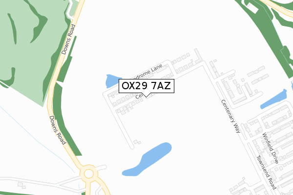
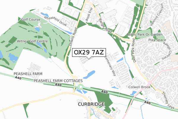
OX29 7AZ open data databoard
OX29 7AZ is located in the Witney West electoral ward, within the local authority district of West Oxfordshire and the English Parliamentary constituency of Witney. The Sub Integrated Care Board (ICB) Location is NHS Buckinghamshire, Oxfordshire and Berkshire West ICB - 10Q and the police force is Thames Valley. This postcode has been in use since October 2019.
OX29 7AZ maps


Licence: Open Government Licence (requires attribution)
Attribution: Contains OS data © Crown copyright and database right 2025
Source: Open Postcode Geo
Licence: Open Government Licence (requires attribution)
Attribution: Contains OS data © Crown copyright and database right 2025; Contains Royal Mail data © Royal Mail copyright and database right 2025; Source: Office for National Statistics licensed under the Open Government Licence v.3.0
OX29 7AZ geodata
| Easting | 432984 |
| Northing | 209424 |
| Latitude | 51.782518 |
| Longitude | -1.523251 |
Where is OX29 7AZ?
| Country | England |
| Postcode District | OX29 |
Politics
| Ward | Witney West |
|---|---|
| Constituency | Witney |
House Prices
Sales of detached houses in OX29 7AZ
139, CENTENARY WAY, WITNEY, OX29 7AZ 2022 5 MAY £600,000 |
117, CENTENARY WAY, WITNEY, OX29 7AZ 2022 18 JAN £535,000 |
135, CENTENARY WAY, WITNEY, OX29 7AZ 2021 22 DEC £455,000 |
137, CENTENARY WAY, WITNEY, OX29 7AZ 2021 17 DEC £457,000 |
127, CENTENARY WAY, WITNEY, OX29 7AZ 2021 10 DEC £402,000 |
129, CENTENARY WAY, WITNEY, OX29 7AZ 2021 30 NOV £402,000 |
115, CENTENARY WAY, WITNEY, OX29 7AZ 2021 29 SEP £427,000 |
113, CENTENARY WAY, WITNEY, OX29 7AZ 2020 26 MAR £510,000 |
107, CENTENARY WAY, WITNEY, OX29 7AZ 2019 18 DEC £520,000 |
97, CENTENARY WAY, WITNEY, OX29 7AZ 2019 27 SEP £375,000 |
Licence: Contains HM Land Registry data © Crown copyright and database right 2025. This data is licensed under the Open Government Licence v3.0.
Transport
Nearest bus stops to OX29 7AZ
| Well Lane (Main Road) | Curbridge | 566m |
| Well Lane (Main Road) | Curbridge | 580m |
| Abbott Diabetes Care (Range Road) | Witney | 592m |
| Manor Farm (Main Road) | Curbridge | 892m |
| Idbury Close (Ralegh Crescent) | Witney | 899m |
Deprivation
2.1% of English postcodes are less deprived than OX29 7AZ:Food Standards Agency
Three nearest food hygiene ratings to OX29 7AZ (metres)


➜ Get more ratings from the Food Standards Agency
Nearest post box to OX29 7AZ
| Last Collection | |||
|---|---|---|---|
| Location | Mon-Fri | Sat | Distance |
| Burwell Farm Post Office | 17:00 | 12:00 | 1,848m |
| Brize Norton Road | 16:45 | 08:15 | 2,071m |
| Minster Lovell Post Office | 16:45 | 09:45 | 2,160m |
OX29 7AZ ITL and OX29 7AZ LAU
The below table lists the International Territorial Level (ITL) codes (formerly Nomenclature of Territorial Units for Statistics (NUTS) codes) and Local Administrative Units (LAU) codes for OX29 7AZ:
| ITL 1 Code | Name |
|---|---|
| TLJ | South East (England) |
| ITL 2 Code | Name |
| TLJ1 | Berkshire, Buckinghamshire and Oxfordshire |
| ITL 3 Code | Name |
| TLJ14 | Oxfordshire CC |
| LAU 1 Code | Name |
| E07000181 | West Oxfordshire |
OX29 7AZ census areas
The below table lists the Census Output Area (OA), Lower Layer Super Output Area (LSOA), and Middle Layer Super Output Area (MSOA) for OX29 7AZ:
| Code | Name | |
|---|---|---|
| OA | E00146793 | |
| LSOA | E01028820 | West Oxfordshire 009B |
| MSOA | E02006001 | West Oxfordshire 009 |
Nearest postcodes to OX29 7AZ
| OX29 7NY | Main Road | 561m |
| OX29 0YN | Range Road | 612m |
| OX29 7NW | Orchard Mews | 704m |
| OX29 7NU | Church Row | 712m |
| OX29 0AA | 745m | |
| OX28 5FQ | Sherbourne Road | 755m |
| OX29 7NT | Main Road | 776m |
| OX28 5FH | Sherbourne Road | 799m |
| OX28 5FF | Westcote Close | 822m |
| OX28 5FE | Idbury Close | 834m |