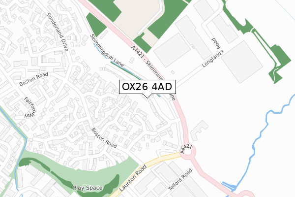
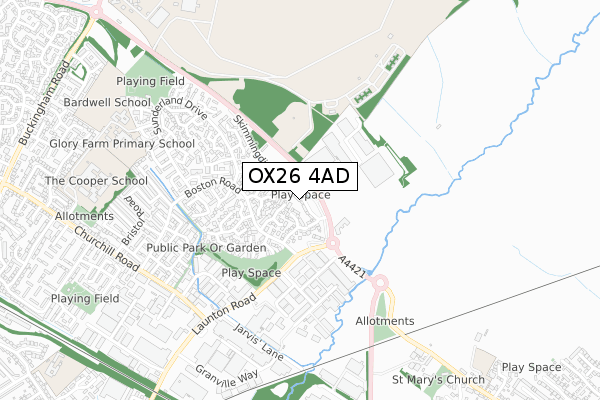
OX26 4AD open data databoard
OX26 4AD is located in the Bicester East electoral ward, within the local authority district of Cherwell and the English Parliamentary constituency of Banbury. The Sub Integrated Care Board (ICB) Location is NHS Buckinghamshire, Oxfordshire and Berkshire West ICB - 10Q and the police force is Thames Valley. This postcode has been in use since August 2018.
OX26 4AD maps


Licence: Open Government Licence (requires attribution)
Attribution: Contains OS data © Crown copyright and database right 2025
Source: Open Postcode Geo
Licence: Open Government Licence (requires attribution)
Attribution: Contains OS data © Crown copyright and database right 2025; Contains Royal Mail data © Royal Mail copyright and database right 2025; Source: Office for National Statistics licensed under the Open Government Licence v.3.0
OX26 4AD geodata
| Easting | 459833 |
| Northing | 223552 |
| Latitude | 51.907308 |
| Longitude | -1.131641 |
Where is OX26 4AD?
| Country | England |
| Postcode District | OX26 |
Politics
| Ward | Bicester East |
|---|---|
| Constituency | Banbury |
House Prices
Sales of detached houses in OX26 4AD
2022 16 SEP £550,000 |
2019 11 OCT £450,000 |
10, VULCAN VIEW, BICESTER, OX26 4AD 2019 13 SEP £445,000 |
2019 27 AUG £470,000 |
44, VULCAN VIEW, BICESTER, OX26 4AD 2019 12 AUG £460,000 |
43, VULCAN VIEW, BICESTER, OX26 4AD 2019 26 JUL £465,000 |
46, VULCAN VIEW, BICESTER, OX26 4AD 2019 28 JUN £540,000 |
45, VULCAN VIEW, BICESTER, OX26 4AD 2019 28 JUN £510,000 |
2, VULCAN VIEW, BICESTER, OX26 4AD 2019 27 JUN £490,000 |
2019 24 JUN £460,000 |
Licence: Contains HM Land Registry data © Crown copyright and database right 2025. This data is licensed under the Open Government Licence v3.0.
Transport
Nearest bus stops to OX26 4AD
| Benson Close (Boston Road) | Glory Farm | 204m |
| Scampton Close (Boston Road) | Glory Farm | 205m |
| Benson Close (Boston Road) | Glory Farm | 218m |
| Scampton Close (Boston Road) | Glory Farm | 222m |
| Fulmar Court (Sunderland Drive) | Glory Farm | 277m |
Nearest railway stations to OX26 4AD
| Bicester North Station | 1.4km |
| Bicester Village Station | 2km |
Broadband
Broadband access in OX26 4AD (2020 data)
| Percentage of properties with Next Generation Access | 100.0% |
| Percentage of properties with Superfast Broadband | 100.0% |
| Percentage of properties with Ultrafast Broadband | 100.0% |
| Percentage of properties with Full Fibre Broadband | 100.0% |
Superfast Broadband is between 30Mbps and 300Mbps
Ultrafast Broadband is > 300Mbps
Broadband limitations in OX26 4AD (2020 data)
| Percentage of properties unable to receive 2Mbps | 0.0% |
| Percentage of properties unable to receive 5Mbps | 0.0% |
| Percentage of properties unable to receive 10Mbps | 0.0% |
| Percentage of properties unable to receive 30Mbps | 0.0% |
Deprivation
7.5% of English postcodes are less deprived than OX26 4AD:Food Standards Agency
Three nearest food hygiene ratings to OX26 4AD (metres)


➜ Get more ratings from the Food Standards Agency
Nearest post box to OX26 4AD
| Last Collection | |||
|---|---|---|---|
| Location | Mon-Fri | Sat | Distance |
| Telford Road | 17:30 | 11:00 | 326m |
| Beverley Gardens | 17:30 | 11:00 | 419m |
| Sunderland Drive | 17:30 | 11:00 | 492m |
OX26 4AD ITL and OX26 4AD LAU
The below table lists the International Territorial Level (ITL) codes (formerly Nomenclature of Territorial Units for Statistics (NUTS) codes) and Local Administrative Units (LAU) codes for OX26 4AD:
| ITL 1 Code | Name |
|---|---|
| TLJ | South East (England) |
| ITL 2 Code | Name |
| TLJ1 | Berkshire, Buckinghamshire and Oxfordshire |
| ITL 3 Code | Name |
| TLJ14 | Oxfordshire CC |
| LAU 1 Code | Name |
| E07000177 | Cherwell |
OX26 4AD census areas
The below table lists the Census Output Area (OA), Lower Layer Super Output Area (LSOA), and Middle Layer Super Output Area (MSOA) for OX26 4AD:
| Code | Name | |
|---|---|---|
| OA | E00145005 | |
| LSOA | E01028455 | Cherwell 013A |
| MSOA | E02005933 | Cherwell 013 |
Nearest postcodes to OX26 4AD
| OX26 4FF | Scampton Close | 111m |
| OX26 4FQ | Benson Close | 124m |
| OX26 4YZ | Tangmere Close | 158m |
| OX26 5AA | Launton Road | 176m |
| OX26 4FG | Fulmar Court | 256m |
| OX26 4FA | Manston Close | 262m |
| OX26 4FB | Manston Close | 282m |
| OX26 4FD | Lyneham Road | 290m |
| OX26 4FN | Lyneham Road | 332m |
| OX26 4YQ | Turnberry Close | 337m |