OX18 2FN open data databoard
OX18 2FN is located in the Standlake, Aston and Stanton Harcourt electoral ward, within the local authority district of West Oxfordshire and the English Parliamentary constituency of Witney. The Sub Integrated Care Board (ICB) Location is NHS Buckinghamshire, Oxfordshire and Berkshire West ICB - 10Q and the police force is Thames Valley. This postcode has been in use since November 2019.
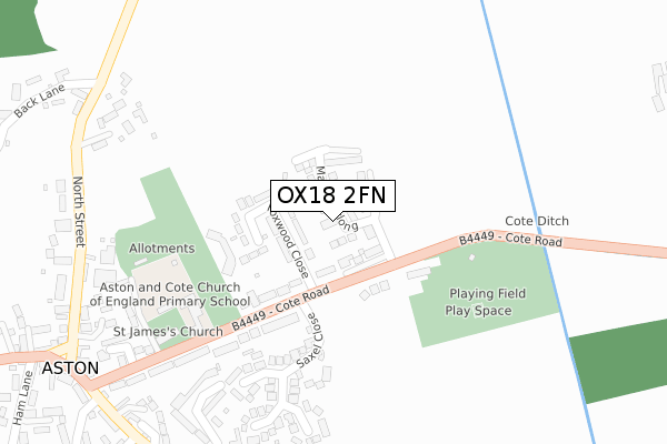
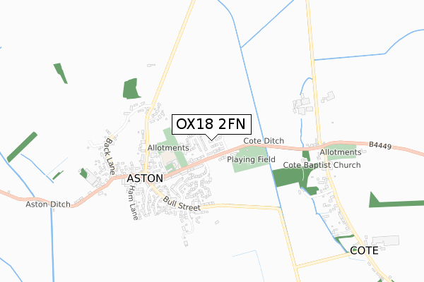
OX18 2FN maps


Licence: Open Government Licence (requires attribution)
Attribution: Contains OS data © Crown copyright and database right 2025
Source: Open Postcode Geo
Licence: Open Government Licence (requires attribution)
Attribution: Contains OS data © Crown copyright and database right 2025; Contains Royal Mail data © Royal Mail copyright and database right 2025; Source: Office for National Statistics licensed under the Open Government Licence v.3.0
OX18 2FN geodata
| Easting | 434482 |
| Northing | 203253 |
| Latitude | 51.726945 |
| Longitude | -1.502147 |
Where is OX18 2FN?
| Country | England |
| Postcode District | OX18 |
Politics
| Ward | Standlake, Aston And Stanton Harcourt |
|---|---|
| Constituency | Witney |
House Prices
Sales of detached houses in OX18 2FN
9, MARSH FURLONG, ASTON, BAMPTON, OX18 2FN 2025 1 AUG £765,000 |
2024 14 OCT £510,000 |
2024 1 AUG £525,000 |
45, MARSH FURLONG, ASTON, BAMPTON, OX18 2FN 2022 15 DEC £485,000 |
47, MARSH FURLONG, ASTON, BAMPTON, OX18 2FN 2022 9 DEC £490,000 |
2022 29 JUL £499,950 |
2022 2 MAR £495,000 |
43, MARSH FURLONG, ASTON, BAMPTON, OX18 2FN 2021 8 DEC £415,000 |
22, MARSH FURLONG, ASTON, BAMPTON, OX18 2FN 2021 10 NOV £428,000 |
16, MARSH FURLONG, ASTON, BAMPTON, OX18 2FN 2021 30 SEP £428,000 |
Licence: Contains HM Land Registry data © Crown copyright and database right 2025. This data is licensed under the Open Government Licence v3.0.
Transport
Nearest bus stops to OX18 2FN
| Foxwood (Cote Road) | Aston | 148m |
| Foxwood (Cote Road) | Aston | 151m |
| Cote Road | Aston | 446m |
| North Street | Aston | 446m |
| Cote Road | Aston | 446m |
Deprivation
6.7% of English postcodes are less deprived than OX18 2FN:Food Standards Agency
Three nearest food hygiene ratings to OX18 2FN (metres)


➜ Get more ratings from the Food Standards Agency
Nearest post box to OX18 2FN
| Last Collection | |||
|---|---|---|---|
| Location | Mon-Fri | Sat | Distance |
| Thorney Leys | 17:15 | 08:00 | 3,315m |
| Lew | 16:00 | 07:30 | 3,806m |
| Abingdon Road Brighthampton | 16:20 | 08:45 | 4,111m |
OX18 2FN ITL and OX18 2FN LAU
The below table lists the International Territorial Level (ITL) codes (formerly Nomenclature of Territorial Units for Statistics (NUTS) codes) and Local Administrative Units (LAU) codes for OX18 2FN:
| ITL 1 Code | Name |
|---|---|
| TLJ | South East (England) |
| ITL 2 Code | Name |
| TLJ1 | Berkshire, Buckinghamshire and Oxfordshire |
| ITL 3 Code | Name |
| TLJ14 | Oxfordshire CC |
| LAU 1 Code | Name |
| E07000181 | West Oxfordshire |
OX18 2FN census areas
The below table lists the Census Output Area (OA), Lower Layer Super Output Area (LSOA), and Middle Layer Super Output Area (MSOA) for OX18 2FN:
| Code | Name | |
|---|---|---|
| OA | E00146692 | |
| LSOA | E01028801 | West Oxfordshire 015C |
| MSOA | E02006007 | West Oxfordshire 015 |
Nearest postcodes to OX18 2FN
| OX18 2DZ | Foxwood | 110m |
| OX18 2EA | Foxwood Close | 161m |
| OX18 2DU | Cote Road | 291m |
| OX18 2EB | Saxel Close | 301m |
| OX18 2DY | Church Lane | 358m |
| OX18 2DB | Woodbridge Close | 374m |
| OX18 2DD | Manor Close | 388m |
| OX18 2DX | Cote Road | 400m |
| OX18 2BS | Church Farm Court | 427m |
| OX18 2DJ | North Street | 428m |