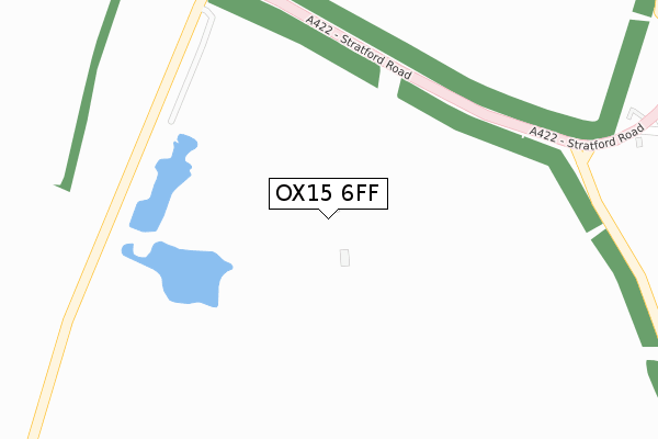
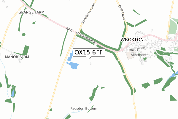
OX15 6FF open data databoard
OX15 6FF is located in the Cropredy, Sibfords and Wroxton electoral ward, within the local authority district of Cherwell and the English Parliamentary constituency of Banbury. The Sub Integrated Care Board (ICB) Location is NHS Buckinghamshire, Oxfordshire and Berkshire West ICB - 10Q and the police force is Thames Valley. This postcode has been in use since April 2019.
OX15 6FF maps


Licence: Open Government Licence (requires attribution)
Attribution: Contains OS data © Crown copyright and database right 2025
Source: Open Postcode Geo
Licence: Open Government Licence (requires attribution)
Attribution: Contains OS data © Crown copyright and database right 2025; Contains Royal Mail data © Royal Mail copyright and database right 2025; Source: Office for National Statistics licensed under the Open Government Licence v.3.0
OX15 6FF geodata
| Easting | 440514 |
| Northing | 241603 |
| Latitude | 52.071331 |
| Longitude | -1.410326 |
Where is OX15 6FF?
| Country | England |
| Postcode District | OX15 |
Politics
| Ward | Cropredy, Sibfords And Wroxton |
|---|---|
| Constituency | Banbury |
Transport
Nearest bus stops to OX15 6FF
| The Firs (Stratford Road) | Wroxton | 774m |
| The Firs (Stratford Road) | Wroxton | 817m |
| White Horse Ph (Stratford Road) | Wroxton | 1,103m |
| White Horse Ph (Stratford Road) | Wroxton | 1,103m |
| Church (Village Road) | Balscote | 1,510m |
Deprivation
41.6% of English postcodes are less deprived than OX15 6FF:Food Standards Agency
Three nearest food hygiene ratings to OX15 6FF (metres)

➜ Get more ratings from the Food Standards Agency
Nearest post box to OX15 6FF
| Last Collection | |||
|---|---|---|---|
| Location | Mon-Fri | Sat | Distance |
| Hanwell Post Office | 16:15 | 07:00 | 3,562m |
| Hornton Post Office | 16:00 | 08:00 | 3,563m |
| Shenington Post Office | 16:45 | 08:00 | 3,573m |
OX15 6FF ITL and OX15 6FF LAU
The below table lists the International Territorial Level (ITL) codes (formerly Nomenclature of Territorial Units for Statistics (NUTS) codes) and Local Administrative Units (LAU) codes for OX15 6FF:
| ITL 1 Code | Name |
|---|---|
| TLJ | South East (England) |
| ITL 2 Code | Name |
| TLJ1 | Berkshire, Buckinghamshire and Oxfordshire |
| ITL 3 Code | Name |
| TLJ14 | Oxfordshire CC |
| LAU 1 Code | Name |
| E07000177 | Cherwell |
OX15 6FF census areas
The below table lists the Census Output Area (OA), Lower Layer Super Output Area (LSOA), and Middle Layer Super Output Area (MSOA) for OX15 6FF:
| Code | Name | |
|---|---|---|
| OA | E00145248 | |
| LSOA | E01028509 | Cherwell 001D |
| MSOA | E02005921 | Cherwell 001 |
Nearest postcodes to OX15 6FF
| OX15 6QN | Stratford Road | 486m |
| OX15 6QL | Main Street | 584m |
| OX15 6QW | The Leys | 594m |
| OX15 6QT | Wroxton Court | 675m |
| OX15 6QH | Lampitts Green | 750m |
| OX15 6QR | Stratford Road | 781m |
| OX15 6QS | Stratford Road | 809m |
| OX15 6PT | Main Street | 833m |
| OX15 6QQ | Dark Lane | 837m |
| OX15 6PY | Mills Lane | 1001m |