OX15 0AE open data databoard
OX15 0AE is located in the Deddington electoral ward, within the local authority district of Cherwell and the English Parliamentary constituency of Banbury. The Sub Integrated Care Board (ICB) Location is NHS Buckinghamshire, Oxfordshire and Berkshire West ICB - 10Q and the police force is Thames Valley. This postcode has been in use since May 2018.
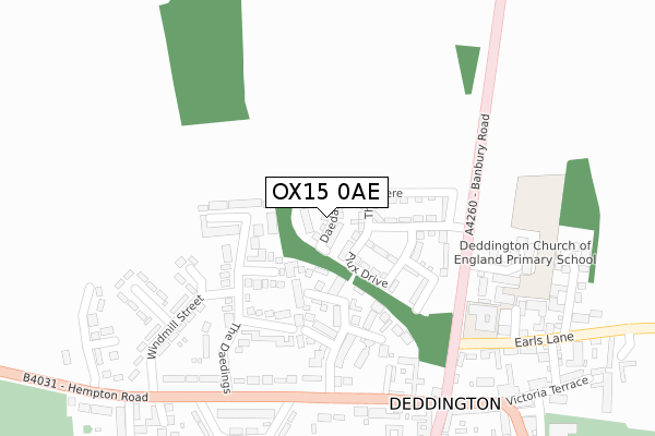
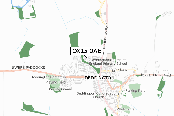
OX15 0AE maps


Licence: Open Government Licence (requires attribution)
Attribution: Contains OS data © Crown copyright and database right 2025
Source: Open Postcode Geo
Licence: Open Government Licence (requires attribution)
Attribution: Contains OS data © Crown copyright and database right 2025; Contains Royal Mail data © Royal Mail copyright and database right 2025; Source: Office for National Statistics licensed under the Open Government Licence v.3.0
OX15 0AE geodata
| Easting | 446396 |
| Northing | 232024 |
| Latitude | 51.984753 |
| Longitude | -1.325811 |
Where is OX15 0AE?
| Country | England |
| Postcode District | OX15 |
Politics
| Ward | Deddington |
|---|---|
| Constituency | Banbury |
House Prices
Sales of detached houses in OX15 0AE
2024 9 OCT £680,000 |
14, DAEDAS VIEW, DEDDINGTON, BANBURY, OX15 0AE 2020 16 JAN £685,000 |
6, DAEDAS VIEW, DEDDINGTON, BANBURY, OX15 0AE 2019 15 NOV £595,000 |
9, DAEDAS VIEW, DEDDINGTON, BANBURY, OX15 0AE 2019 30 AUG £725,000 |
12, DAEDAS VIEW, DEDDINGTON, BANBURY, OX15 0AE 2019 28 JUN £430,000 |
11, DAEDAS VIEW, DEDDINGTON, BANBURY, OX15 0AE 2019 21 JUN £400,000 |
8, DAEDAS VIEW, DEDDINGTON, BANBURY, OX15 0AE 2019 24 MAY £750,000 |
15, DAEDAS VIEW, DEDDINGTON, BANBURY, OX15 0AE 2019 28 MAR £765,000 |
13, DAEDAS VIEW, DEDDINGTON, BANBURY, OX15 0AE 2019 28 MAR £640,000 |
2019 8 MAR £595,000 |
Licence: Contains HM Land Registry data © Crown copyright and database right 2025. This data is licensed under the Open Government Licence v3.0.
Transport
Nearest bus stops to OX15 0AE
| The Paddocks (Hempton Road) | Deddington | 324m |
| The Paddocks (Hempton Road) | Deddington | 331m |
| Library (Horsefair) | Deddington | 359m |
| Market Place Post Office (Market Place) | Deddington | 478m |
| Hudson Street (New Street) | Deddington | 506m |
Nearest railway stations to OX15 0AE
| Kings Sutton Station | 5.1km |
Broadband
Broadband access in OX15 0AE (2020 data)
| Percentage of properties with Next Generation Access | 100.0% |
| Percentage of properties with Superfast Broadband | 100.0% |
| Percentage of properties with Ultrafast Broadband | 100.0% |
| Percentage of properties with Full Fibre Broadband | 100.0% |
Superfast Broadband is between 30Mbps and 300Mbps
Ultrafast Broadband is > 300Mbps
Broadband speed in OX15 0AE (2019 data)
Download
| Median download speed | 360.0Mbps |
| Average download speed | 360.0Mbps |
| Maximum download speed | 360.00Mbps |
Upload
| Median upload speed | 360.0Mbps |
| Average upload speed | 360.0Mbps |
| Maximum upload speed | 360.00Mbps |
Broadband limitations in OX15 0AE (2020 data)
| Percentage of properties unable to receive 2Mbps | 0.0% |
| Percentage of properties unable to receive 5Mbps | 0.0% |
| Percentage of properties unable to receive 10Mbps | 0.0% |
| Percentage of properties unable to receive 30Mbps | 0.0% |
Deprivation
12.3% of English postcodes are less deprived than OX15 0AE:Food Standards Agency
Three nearest food hygiene ratings to OX15 0AE (metres)


➜ Get more ratings from the Food Standards Agency
Nearest post box to OX15 0AE
| Last Collection | |||
|---|---|---|---|
| Location | Mon-Fri | Sat | Distance |
| Hempton Road | 16:00 | 09:00 | 330m |
| Deddington Post Office | 16:00 | 09:15 | 493m |
| Castle Street | 16:00 | 09:00 | 647m |
OX15 0AE ITL and OX15 0AE LAU
The below table lists the International Territorial Level (ITL) codes (formerly Nomenclature of Territorial Units for Statistics (NUTS) codes) and Local Administrative Units (LAU) codes for OX15 0AE:
| ITL 1 Code | Name |
|---|---|
| TLJ | South East (England) |
| ITL 2 Code | Name |
| TLJ1 | Berkshire, Buckinghamshire and Oxfordshire |
| ITL 3 Code | Name |
| TLJ14 | Oxfordshire CC |
| LAU 1 Code | Name |
| E07000177 | Cherwell |
OX15 0AE census areas
The below table lists the Census Output Area (OA), Lower Layer Super Output Area (LSOA), and Middle Layer Super Output Area (MSOA) for OX15 0AE:
| Code | Name | |
|---|---|---|
| OA | E00145128 | |
| LSOA | E01028482 | Cherwell 010B |
| MSOA | E02005930 | Cherwell 010 |
Nearest postcodes to OX15 0AE
| OX15 0RT | The Daedings | 153m |
| OX15 0NX | Gaveston Gardens | 157m |
| OX15 0QQ | Police Houses | 246m |
| OX15 0TN | Banbury Road | 263m |
| OX15 0UH | Piers Row | 266m |
| OX15 0TX | The Leyes | 282m |
| OX15 0QG | Hempton Road | 290m |
| OX15 0QW | Windmill Street | 302m |
| OX15 0QH | Hempton Road | 309m |
| OX15 0TL | Hempton Road | 316m |