OX12 9WR open data databoard
OX12 9WR is located in the Wantage & Grove Brook electoral ward, within the local authority district of Vale of White Horse and the English Parliamentary constituency of Wantage. The Sub Integrated Care Board (ICB) Location is NHS Buckinghamshire, Oxfordshire and Berkshire West ICB - 10Q and the police force is Thames Valley. This postcode has been in use since April 2018.
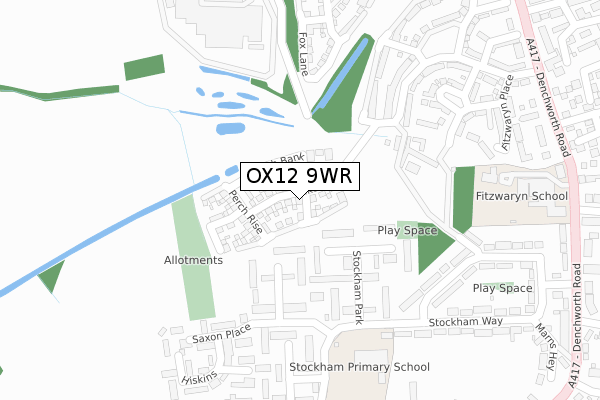
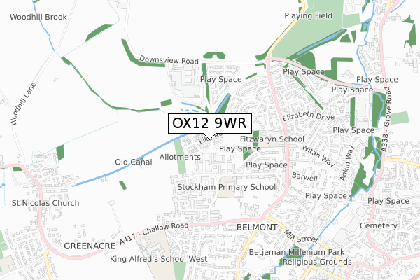
OX12 9WR maps


Licence: Open Government Licence (requires attribution)
Attribution: Contains OS data © Crown copyright and database right 2025
Source: Open Postcode Geo
Licence: Open Government Licence (requires attribution)
Attribution: Contains OS data © Crown copyright and database right 2025; Contains Royal Mail data © Royal Mail copyright and database right 2025; Source: Office for National Statistics licensed under the Open Government Licence v.3.0
OX12 9WR geodata
| Easting | 439045 |
| Northing | 188639 |
| Latitude | 51.595252 |
| Longitude | -1.437713 |
Where is OX12 9WR?
| Country | England |
| Postcode District | OX12 |
Politics
| Ward | Wantage & Grove Brook |
|---|---|
| Constituency | Wantage |
House Prices
Sales of detached houses in OX12 9WR
2024 13 JUN £425,000 |
2023 28 JUN £400,000 |
4, PIKE REACH, WANTAGE, OX12 9WR 2020 22 SEP £480,000 |
2020 30 MAR £395,000 |
2, PIKE REACH, WANTAGE, OX12 9WR 2020 31 JAN £335,000 |
5, PIKE REACH, WANTAGE, OX12 9WR 2019 23 MAY £399,995 |
9, PIKE REACH, WANTAGE, OX12 9WR 2019 11 APR £467,000 |
16, PIKE REACH, WANTAGE, OX12 9WR 2019 28 MAR £475,000 |
10, PIKE REACH, WANTAGE, OX12 9WR 2019 10 JAN £489,995 |
25, PIKE REACH, WANTAGE, OX12 9WR 2018 14 DEC £344,995 |
Licence: Contains HM Land Registry data © Crown copyright and database right 2025. This data is licensed under the Open Government Licence v3.0.
Transport
Nearest bus stops to OX12 9WR
| Stockham Primary School (Stockham Way) | Wantage | 251m |
| Stockham Primary School (Stockham Way) | Wantage | 265m |
| Dean Butler Close (Winchester Way) | Wantage | 415m |
| Fitzwaryn School (Denchworth Road) | Wantage | 457m |
| Dean Butler Close (Winchester Way) | Wantage | 457m |
Broadband
Broadband access in OX12 9WR (2020 data)
| Percentage of properties with Next Generation Access | 100.0% |
| Percentage of properties with Superfast Broadband | 100.0% |
| Percentage of properties with Ultrafast Broadband | 0.0% |
| Percentage of properties with Full Fibre Broadband | 0.0% |
Superfast Broadband is between 30Mbps and 300Mbps
Ultrafast Broadband is > 300Mbps
Broadband speed in OX12 9WR (2019 data)
Download
| Median download speed | 32.4Mbps |
| Average download speed | 28.5Mbps |
| Maximum download speed | 48.74Mbps |
Upload
| Median upload speed | 7.6Mbps |
| Average upload speed | 5.9Mbps |
| Maximum upload speed | 8.85Mbps |
Broadband limitations in OX12 9WR (2020 data)
| Percentage of properties unable to receive 2Mbps | 0.0% |
| Percentage of properties unable to receive 5Mbps | 0.0% |
| Percentage of properties unable to receive 10Mbps | 0.0% |
| Percentage of properties unable to receive 30Mbps | 0.0% |
Deprivation
19% of English postcodes are less deprived than OX12 9WR:Food Standards Agency
Three nearest food hygiene ratings to OX12 9WR (metres)


➜ Get more ratings from the Food Standards Agency
Nearest post box to OX12 9WR
| Last Collection | |||
|---|---|---|---|
| Location | Mon-Fri | Sat | Distance |
| Naldertown | 17:00 | 09:00 | 550m |
| Roman Way | 17:00 | 08:30 | 583m |
| Hamfield | 17:00 | 09:00 | 790m |
OX12 9WR ITL and OX12 9WR LAU
The below table lists the International Territorial Level (ITL) codes (formerly Nomenclature of Territorial Units for Statistics (NUTS) codes) and Local Administrative Units (LAU) codes for OX12 9WR:
| ITL 1 Code | Name |
|---|---|
| TLJ | South East (England) |
| ITL 2 Code | Name |
| TLJ1 | Berkshire, Buckinghamshire and Oxfordshire |
| ITL 3 Code | Name |
| TLJ14 | Oxfordshire CC |
| LAU 1 Code | Name |
| E07000180 | Vale of White Horse |
OX12 9WR census areas
The below table lists the Census Output Area (OA), Lower Layer Super Output Area (LSOA), and Middle Layer Super Output Area (MSOA) for OX12 9WR:
| Code | Name | |
|---|---|---|
| OA | E00146483 | |
| LSOA | E01028759 | Vale of White Horse 014D |
| MSOA | E02005991 | Vale of White Horse 014 |
Nearest postcodes to OX12 9WR
| OX12 9HH | Stockham Park | 130m |
| OX12 9HQ | Stockham Park | 144m |
| OX12 9HG | Stockham Park | 171m |
| OX12 9BQ | Wasbrough Avenue | 260m |
| OX12 9HX | Saxon Place | 273m |
| OX12 9HJ | Stockham Park | 282m |
| OX12 9GE | Lime Kiln | 288m |
| OX12 9HU | Hiskins | 324m |
| OX12 9BD | Wasbrough Avenue | 350m |
| OX12 9GB | Whittington Crescent | 359m |