OX12 9AL open data databoard
OX12 9AL is located in the Wantage & Grove Brook electoral ward, within the local authority district of Vale of White Horse and the English Parliamentary constituency of Wantage. The Sub Integrated Care Board (ICB) Location is NHS Buckinghamshire, Oxfordshire and Berkshire West ICB - 10Q and the police force is Thames Valley. This postcode has been in use since February 2020.
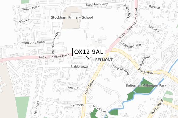
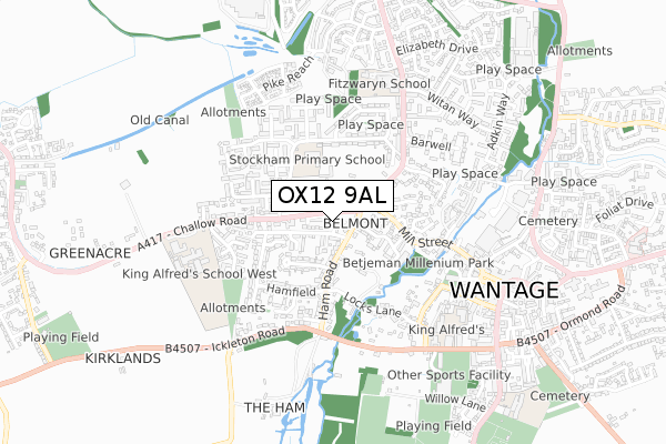
OX12 9AL maps


Licence: Open Government Licence (requires attribution)
Attribution: Contains OS data © Crown copyright and database right 2025
Source: Open Postcode Geo
Licence: Open Government Licence (requires attribution)
Attribution: Contains OS data © Crown copyright and database right 2025; Contains Royal Mail data © Royal Mail copyright and database right 2025; Source: Office for National Statistics licensed under the Open Government Licence v.3.0
OX12 9AL geodata
| Easting | 439200 |
| Northing | 188134 |
| Latitude | 51.590701 |
| Longitude | -1.435532 |
Where is OX12 9AL?
| Country | England |
| Postcode District | OX12 |
Politics
| Ward | Wantage & Grove Brook |
|---|---|
| Constituency | Wantage |
House Prices
Sales of detached houses in OX12 9AL
2025 19 MAR £390,000 |
2024 23 OCT £540,000 |
17, WOODFIELD, WANTAGE, OX12 9AL 2020 2 OCT £405,000 |
4, WOODFIELD, WANTAGE, OX12 9AL 2020 30 SEP £365,000 |
19, WOODFIELD, WANTAGE, OX12 9AL 2020 30 SEP £410,000 |
29, WOODFIELD, WANTAGE, OX12 9AL 2020 30 JUL £411,000 |
6, WOODFIELD, WANTAGE, OX12 9AL 2020 2 JUL £417,500 |
2020 12 MAR £423,000 |
8, WOODFIELD, WANTAGE, OX12 9AL 2020 21 FEB £440,000 |
2020 21 FEB £370,000 |
Licence: Contains HM Land Registry data © Crown copyright and database right 2025. This data is licensed under the Open Government Licence v3.0.
Transport
Nearest bus stops to OX12 9AL
| Naldertown | Wantage | 111m |
| Dean Butler Close (Winchester Way) | Wantage | 174m |
| Dean Butler Close (Winchester Way) | Wantage | 181m |
| Mill Street | Wantage | 283m |
| Mill Street | Wantage | 290m |
Deprivation
19% of English postcodes are less deprived than OX12 9AL:Food Standards Agency
Three nearest food hygiene ratings to OX12 9AL (metres)


➜ Get more ratings from the Food Standards Agency
Nearest post box to OX12 9AL
| Last Collection | |||
|---|---|---|---|
| Location | Mon-Fri | Sat | Distance |
| Naldertown | 17:00 | 09:00 | 129m |
| Hamfield | 17:00 | 09:00 | 266m |
| Mill Street | 17:00 | 09:00 | 479m |
OX12 9AL ITL and OX12 9AL LAU
The below table lists the International Territorial Level (ITL) codes (formerly Nomenclature of Territorial Units for Statistics (NUTS) codes) and Local Administrative Units (LAU) codes for OX12 9AL:
| ITL 1 Code | Name |
|---|---|
| TLJ | South East (England) |
| ITL 2 Code | Name |
| TLJ1 | Berkshire, Buckinghamshire and Oxfordshire |
| ITL 3 Code | Name |
| TLJ14 | Oxfordshire CC |
| LAU 1 Code | Name |
| E07000180 | Vale of White Horse |
OX12 9AL census areas
The below table lists the Census Output Area (OA), Lower Layer Super Output Area (LSOA), and Middle Layer Super Output Area (MSOA) for OX12 9AL:
| Code | Name | |
|---|---|---|
| OA | E00146489 | |
| LSOA | E01028759 | Vale of White Horse 014D |
| MSOA | E02005991 | Vale of White Horse 014 |
Nearest postcodes to OX12 9AL
| OX12 9EB | Naldertown | 80m |
| OX12 9ED | Ham Croft | 112m |
| OX12 9NY | Leverton Gardens | 117m |
| OX12 9EJ | Dean Butler Close | 154m |
| OX12 9EF | West Hill | 160m |
| OX12 9EW | Winchester Way | 178m |
| OX12 9EA | Naldertown | 200m |
| OX12 9EP | Bec Close | 214m |
| OX12 9XR | Segsbury Road | 226m |
| OX12 9DZ | Framlands Close | 238m |