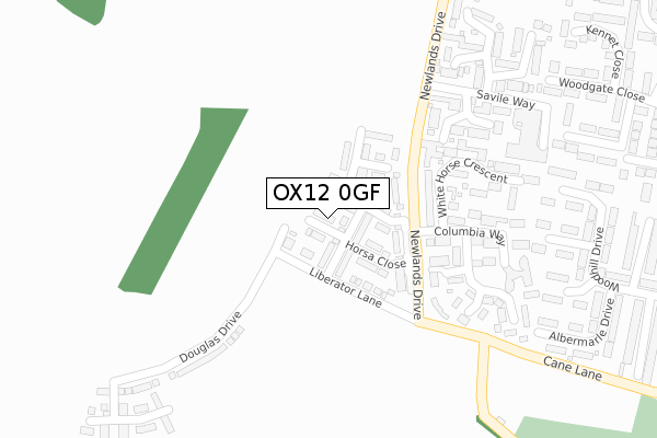
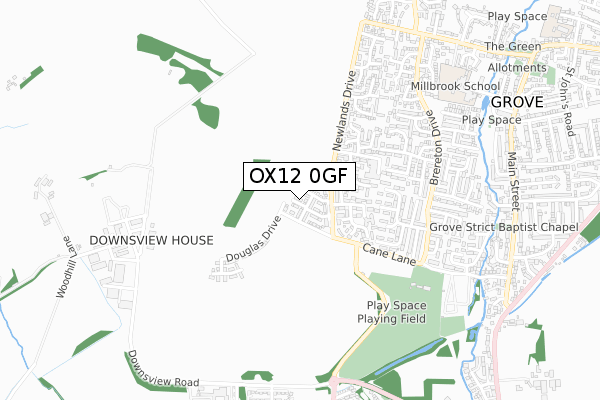
OX12 0GF is located in the Grove North electoral ward, within the local authority district of Vale of White Horse and the English Parliamentary constituency of Wantage. The Sub Integrated Care Board (ICB) Location is NHS Buckinghamshire, Oxfordshire and Berkshire West ICB - 10Q and the police force is Thames Valley. This postcode has been in use since December 2019.


GetTheData
Source: OS Open Zoomstack (Ordnance Survey)
Licence: Open Government Licence (requires attribution)
Attribution: Contains OS data © Crown copyright and database right 2025
Source: Open Postcode Geo
Licence: Open Government Licence (requires attribution)
Attribution: Contains OS data © Crown copyright and database right 2025; Contains Royal Mail data © Royal Mail copyright and database right 2025; Source: Office for National Statistics licensed under the Open Government Licence v.3.0
| Easting | 439245 |
| Northing | 189879 |
| Latitude | 51.606387 |
| Longitude | -1.434687 |
GetTheData
Source: Open Postcode Geo
Licence: Open Government Licence
| Country | England |
| Postcode District | OX12 |
➜ See where OX12 is on a map ➜ Where is Grove? | |
GetTheData
Source: Land Registry Price Paid Data
Licence: Open Government Licence
| Ward | Grove North |
| Constituency | Wantage |
GetTheData
Source: ONS Postcode Database
Licence: Open Government Licence
2024 23 FEB £365,000 |
15, WELLINGTON STREET, GROVE, WANTAGE, OX12 0GF 2020 21 DEC £324,995 |
2020 18 DEC £320,000 |
1, WELLINGTON STREET, GROVE, WANTAGE, OX12 0GF 2020 29 JAN £309,995 |
3, WELLINGTON STREET, GROVE, WANTAGE, OX12 0GF 2019 29 NOV £287,995 |
11, WELLINGTON STREET, GROVE, WANTAGE, OX12 0GF 2019 29 NOV £290,000 |
2, WELLINGTON STREET, GROVE, WANTAGE, OX12 0GF 2019 8 NOV £329,995 |
GetTheData
Source: HM Land Registry Price Paid Data
Licence: Contains HM Land Registry data © Crown copyright and database right 2025. This data is licensed under the Open Government Licence v3.0.
| Cane Lane | Grove | 389m |
| Cane Lane | Grove | 391m |
| Wessex Way (Brereton Drive) | Grove | 541m |
| Wessex Way (Brereton Drive) | Grove | 548m |
| Evenlode Close (Brereton Drive) | Grove | 648m |
GetTheData
Source: NaPTAN
Licence: Open Government Licence
GetTheData
Source: ONS Postcode Database
Licence: Open Government Licence


➜ Get more ratings from the Food Standards Agency
GetTheData
Source: Food Standards Agency
Licence: FSA terms & conditions
| Last Collection | |||
|---|---|---|---|
| Location | Mon-Fri | Sat | Distance |
| Saville Way | 16:50 | 08:30 | 374m |
| Roman Way | 17:00 | 08:30 | 869m |
| Grove Post Office | 18:30 | 11:30 | 935m |
GetTheData
Source: Dracos
Licence: Creative Commons Attribution-ShareAlike
The below table lists the International Territorial Level (ITL) codes (formerly Nomenclature of Territorial Units for Statistics (NUTS) codes) and Local Administrative Units (LAU) codes for OX12 0GF:
| ITL 1 Code | Name |
|---|---|
| TLJ | South East (England) |
| ITL 2 Code | Name |
| TLJ1 | Berkshire, Buckinghamshire and Oxfordshire |
| ITL 3 Code | Name |
| TLJ14 | Oxfordshire CC |
| LAU 1 Code | Name |
| E07000180 | Vale of White Horse |
GetTheData
Source: ONS Postcode Directory
Licence: Open Government Licence
The below table lists the Census Output Area (OA), Lower Layer Super Output Area (LSOA), and Middle Layer Super Output Area (MSOA) for OX12 0GF:
| Code | Name | |
|---|---|---|
| OA | E00146292 | |
| LSOA | E01028725 | Vale of White Horse 011E |
| MSOA | E02005988 | Vale of White Horse 011 |
GetTheData
Source: ONS Postcode Directory
Licence: Open Government Licence
| OX12 0QL | Princess Gardens | 216m |
| OX12 0PU | Carlton Close | 228m |
| OX12 0QJ | Columbia Way | 239m |
| OX12 0PZ | White Horse Crescent | 246m |
| OX12 0PY | White Horse Crescent | 255m |
| OX12 0PX | Hunters Close | 297m |
| OX12 0QN | Princess Gardens | 302m |
| OX12 0PT | Savile Way | 336m |
| OX12 0NE | Boucher Close | 360m |
| OX12 0NP | Blenheim Gardens | 366m |
GetTheData
Source: Open Postcode Geo; Land Registry Price Paid Data
Licence: Open Government Licence