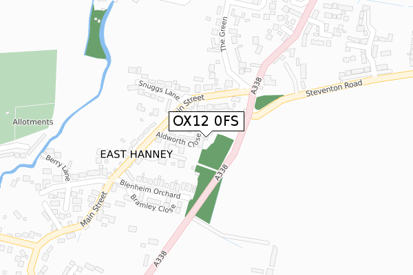
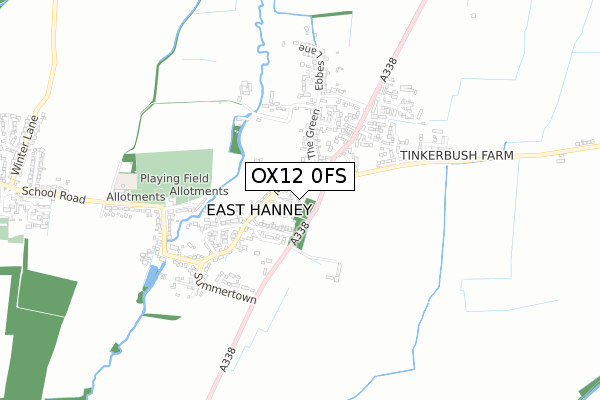
OX12 0FS is located in the Steventon & the Hanneys electoral ward, within the local authority district of Vale of White Horse and the English Parliamentary constituency of Wantage. The Sub Integrated Care Board (ICB) Location is NHS Buckinghamshire, Oxfordshire and Berkshire West ICB - 10Q and the police force is Thames Valley. This postcode has been in use since January 2019.


GetTheData
Source: OS Open Zoomstack (Ordnance Survey)
Licence: Open Government Licence (requires attribution)
Attribution: Contains OS data © Crown copyright and database right 2025
Source: Open Postcode Geo
Licence: Open Government Licence (requires attribution)
Attribution: Contains OS data © Crown copyright and database right 2025; Contains Royal Mail data © Royal Mail copyright and database right 2025; Source: Office for National Statistics licensed under the Open Government Licence v.3.0
| Easting | 441859 |
| Northing | 192902 |
| Latitude | 51.633379 |
| Longitude | -1.396583 |
GetTheData
Source: Open Postcode Geo
Licence: Open Government Licence
| Country | England |
| Postcode District | OX12 |
➜ See where OX12 is on a map ➜ Where is East Hanney? | |
GetTheData
Source: Land Registry Price Paid Data
Licence: Open Government Licence
| Ward | Steventon & The Hanneys |
| Constituency | Wantage |
GetTheData
Source: ONS Postcode Database
Licence: Open Government Licence
2019 16 MAY £516,000 |
5, ALDWORTH CLOSE, EAST HANNEY, WANTAGE, OX12 0FS 2019 4 MAR £625,000 |
6, ALDWORTH CLOSE, EAST HANNEY, WANTAGE, OX12 0FS 2019 28 FEB £640,000 |
3, ALDWORTH CLOSE, EAST HANNEY, WANTAGE, OX12 0FS 2019 28 JAN £620,000 |
2, ALDWORTH CLOSE, EAST HANNEY, WANTAGE, OX12 0FS 2019 25 JAN £625,000 |
4, ALDWORTH CLOSE, EAST HANNEY, WANTAGE, OX12 0FS 2018 21 DEC £620,000 |
GetTheData
Source: HM Land Registry Price Paid Data
Licence: Contains HM Land Registry data © Crown copyright and database right 2025. This data is licensed under the Open Government Licence v3.0.
| St James View (Main Street) | East Hanney | 103m |
| St James View (Main Street) | East Hanney | 110m |
| The Black Horse Ph (Main Street) | East Hanney | 225m |
| The Black Horse Ph (Main Street) | East Hanney | 230m |
| The Mulberries (Main Street) | East Hanney | 430m |
GetTheData
Source: NaPTAN
Licence: Open Government Licence
| Percentage of properties with Next Generation Access | 100.0% |
| Percentage of properties with Superfast Broadband | 100.0% |
| Percentage of properties with Ultrafast Broadband | 0.0% |
| Percentage of properties with Full Fibre Broadband | 0.0% |
Superfast Broadband is between 30Mbps and 300Mbps
Ultrafast Broadband is > 300Mbps
| Median download speed | 49.2Mbps |
| Average download speed | 43.3Mbps |
| Maximum download speed | 70.68Mbps |
| Median upload speed | 10.0Mbps |
| Average upload speed | 10.0Mbps |
| Maximum upload speed | 17.10Mbps |
| Percentage of properties unable to receive 2Mbps | 0.0% |
| Percentage of properties unable to receive 5Mbps | 0.0% |
| Percentage of properties unable to receive 10Mbps | 0.0% |
| Percentage of properties unable to receive 30Mbps | 0.0% |
GetTheData
Source: Ofcom
Licence: Ofcom Terms of Use (requires attribution)
GetTheData
Source: ONS Postcode Database
Licence: Open Government Licence


➜ Get more ratings from the Food Standards Agency
GetTheData
Source: Food Standards Agency
Licence: FSA terms & conditions
| Last Collection | |||
|---|---|---|---|
| Location | Mon-Fri | Sat | Distance |
| Mayfield Avenue | 16:45 | 08:00 | 2,783m |
| Grove Post Office | 18:30 | 11:30 | 3,181m |
| Hawthorn Crescent | 16:45 | 08:00 | 3,362m |
GetTheData
Source: Dracos
Licence: Creative Commons Attribution-ShareAlike
The below table lists the International Territorial Level (ITL) codes (formerly Nomenclature of Territorial Units for Statistics (NUTS) codes) and Local Administrative Units (LAU) codes for OX12 0FS:
| ITL 1 Code | Name |
|---|---|
| TLJ | South East (England) |
| ITL 2 Code | Name |
| TLJ1 | Berkshire, Buckinghamshire and Oxfordshire |
| ITL 3 Code | Name |
| TLJ14 | Oxfordshire CC |
| LAU 1 Code | Name |
| E07000180 | Vale of White Horse |
GetTheData
Source: ONS Postcode Directory
Licence: Open Government Licence
The below table lists the Census Output Area (OA), Lower Layer Super Output Area (LSOA), and Middle Layer Super Output Area (MSOA) for OX12 0FS:
| Code | Name | |
|---|---|---|
| OA | E00146313 | |
| LSOA | E01028726 | Vale of White Horse 007A |
| MSOA | E02005984 | Vale of White Horse 007 |
GetTheData
Source: ONS Postcode Directory
Licence: Open Government Licence
| OX12 0HT | Main Street | 80m |
| OX12 0HX | Main Street | 118m |
| OX12 0HG | Main Street | 123m |
| OX12 0JA | Blenheim Orchard | 153m |
| OX12 0HY | The Medway | 157m |
| OX12 0HU | Snuggs Lane | 164m |
| OX12 0JX | Bramley Close | 207m |
| OX12 0HH | The Green | 223m |
| OX12 0HQ | The Green | 249m |
| OX12 0HR | Oxford Road | 291m |
GetTheData
Source: Open Postcode Geo; Land Registry Price Paid Data
Licence: Open Government Licence