Property/Postcode Data Search:
NW4 1AB maps, stats, and open data
NW4 1AB is located in the Hendon electoral ward, within the London borough of Barnet and the English Parliamentary constituency of Hendon. The Sub Integrated Care Board (ICB) Location is NHS North Central London ICB - 93C and the police force is Metropolitan Police. This postcode has been in use since December 2017.
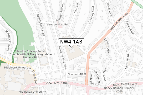
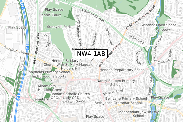
NW4 1AB maps


Source: OS Open Zoomstack (Ordnance Survey)
Licence: Open Government Licence (requires attribution)
Attribution: Contains OS data © Crown copyright and database right 2025
Source: Open Postcode Geo
Licence: Open Government Licence (requires attribution)
Attribution: Contains OS data © Crown copyright and database right 2025; Contains Royal Mail data © Royal Mail copyright and database right 2025; Source: Office for National Statistics licensed under the Open Government Licence v.3.0
Licence: Open Government Licence (requires attribution)
Attribution: Contains OS data © Crown copyright and database right 2025
Source: Open Postcode Geo
Licence: Open Government Licence (requires attribution)
Attribution: Contains OS data © Crown copyright and database right 2025; Contains Royal Mail data © Royal Mail copyright and database right 2025; Source: Office for National Statistics licensed under the Open Government Licence v.3.0
NW4 1AB geodata
| Easting | 523185 |
| Northing | 189646 |
| Latitude | 51.592209 |
| Longitude | -0.223092 |
Where is NW4 1AB?
| Country | England |
| Postcode District | NW4 |
Politics
| Ward | Hendon |
|---|---|
| Constituency | Hendon |
Transport
Nearest bus stops to NW4 1AB
| Downage | Hendon | 178m |
| Florence Street | Hendon | 217m |
| Church End (Nw4) | Hendon | 289m |
| Ashley Lane | Hendon | 297m |
| The Quadrant Hendon | Hendon | 333m |
Nearest underground/metro/tram to NW4 1AB
| Hendon Central Underground Station | Hendon Central | 1,017m |
Nearest railway stations to NW4 1AB
| Hendon Station | 1.7km |
| Mill Hill Broadway Station | 2.9km |
| Cricklewood Station | 3.8km |
Deprivation
38.6% of English postcodes are less deprived than NW4 1AB:Food Standards Agency
Three nearest food hygiene ratings to NW4 1AB (metres)
St Mary's And St John's CE School - Stamford Raffles

St Marys And St Johns C Of E School Downage London
34m
St Marys & St Johns - Stamford Raffes

2 Downage London
97m
Heddon Street Kitchen

3-9 HEDDON STREET
174m
➜ Get more ratings from the Food Standards Agency
Nearest post box to NW4 1AB
| Last Collection | |||
|---|---|---|---|
| Location | Mon-Fri | Sat | Distance |
| Downage/Sherwood Road | 17:30 | 12:00 | 64m |
| 36 Sunny Gardens Road | 17:30 | 12:00 | 127m |
| Sunnyfields Road | 17:30 | 12:00 | 284m |
NW4 1AB ITL and NW4 1AB LAU
The below table lists the International Territorial Level (ITL) codes (formerly Nomenclature of Territorial Units for Statistics (NUTS) codes) and Local Administrative Units (LAU) codes for NW4 1AB:
| ITL 1 Code | Name |
|---|---|
| TLI | London |
| ITL 2 Code | Name |
| TLI7 | Outer London - West and North West |
| ITL 3 Code | Name |
| TLI71 | Barnet |
| LAU 1 Code | Name |
| E09000003 | Barnet |
NW4 1AB census areas
The below table lists the Census Output Area (OA), Lower Layer Super Output Area (LSOA), and Middle Layer Super Output Area (MSOA) for NW4 1AB:
| Code | Name | |
|---|---|---|
| OA | E00001188 | |
| LSOA | E01000243 | Barnet 032C |
| MSOA | E02000055 | Barnet 032 |
Nearest postcodes to NW4 1AB
| NW4 1RX | Sunny Gardens Road | 75m |
| NW4 1AA | Downage | 80m |
| NW4 1SL | Sunny Gardens Road | 97m |
| NW4 1QW | Mulberry Close | 103m |
| NW4 1QU | Parson Street | 114m |
| NW4 1QP | Mulberry Close | 117m |
| NW4 1AR | Downage | 118m |
| NW4 1QN | Mulberry Close | 136m |
| NW4 4QL | Fuller Street | 140m |
| NW4 1QT | Parson Street | 166m |