Property/Postcode Data Search:
NR9 3GT maps, stats, and open data
NR9 3GT is located in the Hethersett electoral ward, within the local authority district of South Norfolk and the English Parliamentary constituency of South Norfolk. The Sub Integrated Care Board (ICB) Location is NHS Norfolk and Waveney ICB - 26A and the police force is Norfolk. This postcode has been in use since August 2019.
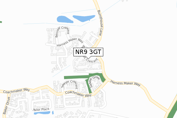
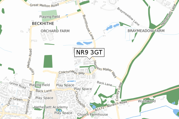
NR9 3GT maps


Source: OS Open Zoomstack (Ordnance Survey)
Licence: Open Government Licence (requires attribution)
Attribution: Contains OS data © Crown copyright and database right 2025
Source: Open Postcode Geo
Licence: Open Government Licence (requires attribution)
Attribution: Contains OS data © Crown copyright and database right 2025; Contains Royal Mail data © Royal Mail copyright and database right 2025; Source: Office for National Statistics licensed under the Open Government Licence v.3.0
Licence: Open Government Licence (requires attribution)
Attribution: Contains OS data © Crown copyright and database right 2025
Source: Open Postcode Geo
Licence: Open Government Licence (requires attribution)
Attribution: Contains OS data © Crown copyright and database right 2025; Contains Royal Mail data © Royal Mail copyright and database right 2025; Source: Office for National Statistics licensed under the Open Government Licence v.3.0
NR9 3GT geodata
| Easting | 616180 |
| Northing | 305836 |
| Latitude | 52.607289 |
| Longitude | 1.191295 |
Where is NR9 3GT?
| Country | England |
| Postcode District | NR9 |
Politics
| Ward | Hethersett |
|---|---|
| Constituency | South Norfolk |
House Prices
Sales of detached houses in NR9 3GT
2021 31 MAR £400,000 |
20, BEAUMONT CRESCENT, HETHERSETT, NORWICH, NR9 3GT 2020 28 FEB £266,995 |
35, BEAUMONT CRESCENT, HETHERSETT, NORWICH, NR9 3GT 2019 18 DEC £250,995 |
18, BEAUMONT CRESCENT, HETHERSETT, NORWICH, NR9 3GT 2019 18 DEC £272,995 |
16, BEAUMONT CRESCENT, HETHERSETT, NORWICH, NR9 3GT 2019 13 DEC £262,995 |
2, BEAUMONT CRESCENT, HETHERSETT, NORWICH, NR9 3GT 2019 6 DEC £299,995 |
8, BEAUMONT CRESCENT, HETHERSETT, NORWICH, NR9 3GT 2019 6 DEC £299,995 |
37, BEAUMONT CRESCENT, HETHERSETT, NORWICH, NR9 3GT 2019 29 NOV £260,995 |
2019 30 AUG £363,995 |
5, BEAUMONT CRESCENT, HETHERSETT, NORWICH, NR9 3GT 2019 30 AUG £304,995 |
Source: HM Land Registry Price Paid Data
Licence: Contains HM Land Registry data © Crown copyright and database right 2025. This data is licensed under the Open Government Licence v3.0.
Licence: Contains HM Land Registry data © Crown copyright and database right 2025. This data is licensed under the Open Government Licence v3.0.
Transport
Nearest bus stops to NR9 3GT
| Lakeland Way (Churchfields) | Hethersett | 529m |
| Lakeland Way (Churchfields) | Hethersett | 550m |
| Deacon Drive (Churchfields) | Hethersett | 573m |
| Deacon Drive (Churchfields) | Hethersett | 573m |
| Admirals Way (Churchfields) | Hethersett | 666m |
Nearest railway stations to NR9 3GT
| Wymondham Station | 6.8km |
Deprivation
8.1% of English postcodes are less deprived than NR9 3GT:Food Standards Agency
Three nearest food hygiene ratings to NR9 3GT (metres)
Mindful Snacker
Little Melton Food Park (RS Baker & Sons)
688m
Farmer Barnes Butchery

Church Farm Barn
770m
Church Farm Shop

Church Farm House
770m
➜ Get more ratings from the Food Standards Agency
Nearest post box to NR9 3GT
| Last Collection | |||
|---|---|---|---|
| Location | Mon-Fri | Sat | Distance |
| Station Road | 16:45 | 09:00 | 728m |
| Crossways / Burnthouse Lane | 17:00 | 11:15 | 875m |
| School Lane Post Office | 17:00 | 11:00 | 1,219m |
NR9 3GT ITL and NR9 3GT LAU
The below table lists the International Territorial Level (ITL) codes (formerly Nomenclature of Territorial Units for Statistics (NUTS) codes) and Local Administrative Units (LAU) codes for NR9 3GT:
| ITL 1 Code | Name |
|---|---|
| TLH | East |
| ITL 2 Code | Name |
| TLH1 | East Anglia |
| ITL 3 Code | Name |
| TLH17 | Breckland and South Norfolk |
| LAU 1 Code | Name |
| E07000149 | South Norfolk |
NR9 3GT census areas
The below table lists the Census Output Area (OA), Lower Layer Super Output Area (LSOA), and Middle Layer Super Output Area (MSOA) for NR9 3GT:
| Code | Name | |
|---|---|---|
| OA | E00136857 | |
| LSOA | E01026908 | South Norfolk 003D |
| MSOA | E02005599 | South Norfolk 003 |
Nearest postcodes to NR9 3GT
| NR9 3QA | Lakeland Way | 385m |
| NR9 3QH | Birch Road | 394m |
| NR9 3BB | Back Lane | 450m |
| NR9 3RE | Ash Close | 468m |
| NR9 3BD | Shop Lane | 510m |
| NR9 3AF | Churchfields | 539m |
| NR9 3PN | Ambleside | 540m |
| NR9 3QB | Coniston Close | 546m |
| NR9 3PH | Churchfields | 558m |
| NR9 3PW | Kendal Close | 558m |