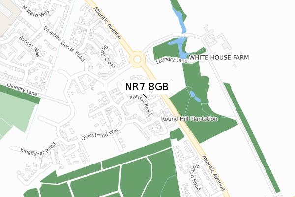
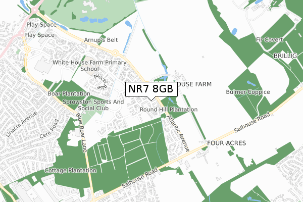
NR7 8GB is located in the Sprowston East electoral ward, within the local authority district of Broadland and the English Parliamentary constituency of Norwich North. The Sub Integrated Care Board (ICB) Location is NHS Norfolk and Waveney ICB - 26A and the police force is Norfolk. This postcode has been in use since May 2019.


GetTheData
Source: OS Open Zoomstack (Ordnance Survey)
Licence: Open Government Licence (requires attribution)
Attribution: Contains OS data © Crown copyright and database right 2025
Source: Open Postcode Geo
Licence: Open Government Licence (requires attribution)
Attribution: Contains OS data © Crown copyright and database right 2025; Contains Royal Mail data © Royal Mail copyright and database right 2025; Source: Office for National Statistics licensed under the Open Government Licence v.3.0
| Easting | 626545 |
| Northing | 311834 |
| Latitude | 52.656899 |
| Longitude | 1.348208 |
GetTheData
Source: Open Postcode Geo
Licence: Open Government Licence
| Country | England |
| Postcode District | NR7 |
➜ See where NR7 is on a map ➜ Where is Norwich? | |
GetTheData
Source: Land Registry Price Paid Data
Licence: Open Government Licence
| Ward | Sprowston East |
| Constituency | Norwich North |
GetTheData
Source: ONS Postcode Database
Licence: Open Government Licence
| Harrisons Drive (Salhouse Road) | Heartsease | 621m |
| Harrisons Drive (Salhouse Road) | Heartsease | 628m |
| Bp Garage (Salhouse Road) | Heartsease | 877m |
| Gage Road (Linacre Avenue) | Sprowston | 899m |
| Bp Garage (Salhouse Road) | Heartsease | 899m |
| Salhouse Station | 3.6km |
| Norwich Station | 4.3km |
| Brundall Gardens Station | 6km |
GetTheData
Source: NaPTAN
Licence: Open Government Licence
| Percentage of properties with Next Generation Access | 100.0% |
| Percentage of properties with Superfast Broadband | 100.0% |
| Percentage of properties with Ultrafast Broadband | 100.0% |
| Percentage of properties with Full Fibre Broadband | 100.0% |
Superfast Broadband is between 30Mbps and 300Mbps
Ultrafast Broadband is > 300Mbps
| Percentage of properties unable to receive 2Mbps | 0.0% |
| Percentage of properties unable to receive 5Mbps | 0.0% |
| Percentage of properties unable to receive 10Mbps | 0.0% |
| Percentage of properties unable to receive 30Mbps | 0.0% |
GetTheData
Source: Ofcom
Licence: Ofcom Terms of Use (requires attribution)
GetTheData
Source: ONS Postcode Database
Licence: Open Government Licence


➜ Get more ratings from the Food Standards Agency
GetTheData
Source: Food Standards Agency
Licence: FSA terms & conditions
| Last Collection | |||
|---|---|---|---|
| Location | Mon-Fri | Sat | Distance |
| Cere Road | 17:30 | 11:00 | 966m |
| Woodside Road | 17:45 | 11:00 | 972m |
| Tesco Store | 17:30 | 11:00 | 989m |
GetTheData
Source: Dracos
Licence: Creative Commons Attribution-ShareAlike
The below table lists the International Territorial Level (ITL) codes (formerly Nomenclature of Territorial Units for Statistics (NUTS) codes) and Local Administrative Units (LAU) codes for NR7 8GB:
| ITL 1 Code | Name |
|---|---|
| TLH | East |
| ITL 2 Code | Name |
| TLH1 | East Anglia |
| ITL 3 Code | Name |
| TLH15 | Norwich and East Norfolk |
| LAU 1 Code | Name |
| E07000144 | Broadland |
GetTheData
Source: ONS Postcode Directory
Licence: Open Government Licence
The below table lists the Census Output Area (OA), Lower Layer Super Output Area (LSOA), and Middle Layer Super Output Area (MSOA) for NR7 8GB:
| Code | Name | |
|---|---|---|
| OA | E00134951 | |
| LSOA | E01026558 | Broadland 013B |
| MSOA | E02005532 | Broadland 013 |
GetTheData
Source: ONS Postcode Directory
Licence: Open Government Licence
| NR7 8HW | Corbet Avenue | 277m |
| NR13 6LB | Salhouse Road | 287m |
| NR7 8DN | Mallard Way | 602m |
| NR7 9AE | Salhouse Road | 716m |
| NR7 9HU | Harrisons Drive | 736m |
| NR7 9HT | Hammond Close | 738m |
| NR7 8LN | Hornbeam Close | 741m |
| NR7 8LQ | Yew Court | 747m |
| NR7 8LG | Ilex Court | 785m |
| NR7 8LW | Hornbeam Close | 789m |
GetTheData
Source: Open Postcode Geo; Land Registry Price Paid Data
Licence: Open Government Licence