Property/Postcode Data Search:
NR32 4XR maps, stats, and open data
NR32 4XR is located in the Gunton & St Margarets electoral ward, within the local authority district of East Suffolk and the English Parliamentary constituency of Waveney. The Sub Integrated Care Board (ICB) Location is NHS Norfolk and Waveney ICB - 26A and the police force is Suffolk. This postcode has been in use since October 2019.
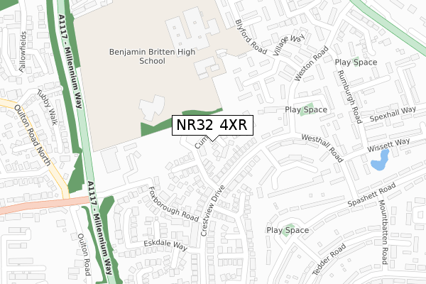
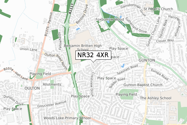
NR32 4XR maps


Source: OS Open Zoomstack (Ordnance Survey)
Licence: Open Government Licence (requires attribution)
Attribution: Contains OS data © Crown copyright and database right 2025
Source: Open Postcode Geo
Licence: Open Government Licence (requires attribution)
Attribution: Contains OS data © Crown copyright and database right 2025; Contains Royal Mail data © Royal Mail copyright and database right 2025; Source: Office for National Statistics licensed under the Open Government Licence v.3.0
Licence: Open Government Licence (requires attribution)
Attribution: Contains OS data © Crown copyright and database right 2025
Source: Open Postcode Geo
Licence: Open Government Licence (requires attribution)
Attribution: Contains OS data © Crown copyright and database right 2025; Contains Royal Mail data © Royal Mail copyright and database right 2025; Source: Office for National Statistics licensed under the Open Government Licence v.3.0
NR32 4XR geodata
| Easting | 653368 |
| Northing | 295019 |
| Latitude | 52.494202 |
| Longitude | 1.731091 |
Where is NR32 4XR?
| Country | England |
| Postcode District | NR32 |
Politics
| Ward | Gunton & St Margarets |
|---|---|
| Constituency | Waveney |
House Prices
Sales of detached houses in NR32 4XR
1, ENNERDALE CLOSE, LOWESTOFT, NR32 4XR 2023 10 MAR £365,000 |
4, ENNERDALE CLOSE, LOWESTOFT, NR32 4XR 2022 29 JUL £300,000 |
2, ENNERDALE CLOSE, LOWESTOFT, NR32 4XR 2021 29 SEP £333,500 |
6, ENNERDALE CLOSE, LOWESTOFT, NR32 4XR 2021 31 MAR £338,500 |
8, ENNERDALE CLOSE, LOWESTOFT, NR32 4XR 2019 27 SEP £263,500 |
Source: HM Land Registry Price Paid Data
Licence: Contains HM Land Registry data © Crown copyright and database right 2025. This data is licensed under the Open Government Licence v3.0.
Licence: Contains HM Land Registry data © Crown copyright and database right 2025. This data is licensed under the Open Government Licence v3.0.
Transport
Nearest bus stops to NR32 4XR
| Frostenden Crescent (Crestview Drive) | Gunton | 151m |
| Stoven Close (Weston Road) | Gunton | 203m |
| Stoven Close (Weston Road) | Gunton | 209m |
| Eskdale Way (Crestview Drive) | Gunton | 219m |
| Eskdale Way (Crestview Drive) | Gunton | 234m |
Nearest railway stations to NR32 4XR
| Oulton Broad North Station | 2.1km |
| Lowestoft Station | 2.5km |
| Oulton Broad South Station | 3.2km |
Deprivation
73.2% of English postcodes are less deprived than NR32 4XR:Food Standards Agency
Three nearest food hygiene ratings to NR32 4XR (metres)
Rawmores

2 Village Rise
231m
Premier Supermarket

7 Village Rise
231m
Village Rise Fish And Chips

3 Village Rise
231m
➜ Get more ratings from the Food Standards Agency
Nearest post box to NR32 4XR
| Last Collection | |||
|---|---|---|---|
| Location | Mon-Fri | Sat | Distance |
| Hollingworth Road Post Office | 17:30 | 12:00 | 674m |
| Tesco Foxburrow Hill | 16:15 | 12:00 | 1,064m |
| Fir Lane | 18:00 | 12:45 | 1,239m |
NR32 4XR ITL and NR32 4XR LAU
The below table lists the International Territorial Level (ITL) codes (formerly Nomenclature of Territorial Units for Statistics (NUTS) codes) and Local Administrative Units (LAU) codes for NR32 4XR:
| ITL 1 Code | Name |
|---|---|
| TLH | East |
| ITL 2 Code | Name |
| TLH1 | East Anglia |
| ITL 3 Code | Name |
| TLH14 | Suffolk CC |
| LAU 1 Code | Name |
| E07000244 | East Suffolk |
NR32 4XR census areas
The below table lists the Census Output Area (OA), Lower Layer Super Output Area (LSOA), and Middle Layer Super Output Area (MSOA) for NR32 4XR:
| Code | Name | |
|---|---|---|
| OA | E00154437 | |
| LSOA | E01030278 | Waveney 003D |
| MSOA | E02006304 | Waveney 003 |
Nearest postcodes to NR32 4XR
| NR32 4FD | Coniston Walk | 97m |
| NR32 4TW | Crestview Drive | 108m |
| NR32 4GN | Ambleside Gardens | 142m |
| NR32 4PU | Uggeshall Close | 148m |
| NR32 4SP | Henham Road | 150m |
| NR32 4JQ | Westhall Road | 150m |
| NR32 4UE | Culzean Gardens | 151m |
| NR32 4SN | Foxborough Road | 166m |
| NR32 4GW | Grasmere Drive | 203m |
| NR32 4JG | Frostenden Crescent | 211m |