NR32 3QY maps, stats, and open data
NR32 3QY is located in the Oulton Broad electoral ward, within the local authority district of East Suffolk and the English Parliamentary constituency of Waveney. The Sub Integrated Care Board (ICB) Location is NHS Norfolk and Waveney ICB - 26A and the police force is Suffolk. This postcode has been in use since January 2018.
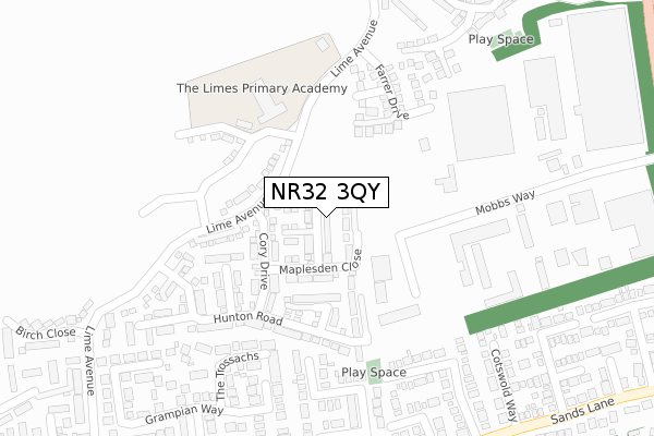
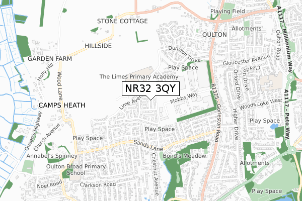
NR32 3QY maps


Licence: Open Government Licence (requires attribution)
Attribution: Contains OS data © Crown copyright and database right 2025
Source: Open Postcode Geo
Licence: Open Government Licence (requires attribution)
Attribution: Contains OS data © Crown copyright and database right 2025; Contains Royal Mail data © Royal Mail copyright and database right 2025; Source: Office for National Statistics licensed under the Open Government Licence v.3.0
NR32 3QY geodata
| Easting | 652016 |
| Northing | 294140 |
| Latitude | 52.486942 |
| Longitude | 1.710555 |
Where is NR32 3QY?
| Country | England |
| Postcode District | NR32 |
Politics
| Ward | Oulton Broad |
|---|---|
| Constituency | Waveney |
House Prices
Sales of detached houses in NR32 3QY
2025 31 MAR £285,000 |
2024 19 DEC £303,000 |
2023 4 MAY £295,000 |
2022 25 MAR £310,000 |
2022 18 FEB £299,950 |
2021 13 SEP £302,000 |
2021 29 JUN £285,000 |
2020 29 JUN £270,000 |
2019 8 FEB £262,995 |
47, PRITCHARD CLOSE, OULTON, LOWESTOFT, NR32 3QY 2019 31 JAN £271,995 |
Licence: Contains HM Land Registry data © Crown copyright and database right 2025. This data is licensed under the Open Government Licence v3.0.
Transport
Nearest bus stops to NR32 3QY
| Cambrian Crescent (Sands Lane) | Oulton | 366m |
| Cambrian Crescent (Sands Lane) | Oulton | 383m |
| Mendip Road (Sands Lane) | Oulton | 410m |
| Mendip Road (Sands Lane) | Oulton | 421m |
| Lime Avenue (Sands Lane) | Oulton | 476m |
Nearest railway stations to NR32 3QY
| Oulton Broad North Station | 1.1km |
| Oulton Broad South Station | 1.9km |
| Lowestoft Station | 3km |
Broadband
Broadband access in NR32 3QY (2020 data)
| Percentage of properties with Next Generation Access | 100.0% |
| Percentage of properties with Superfast Broadband | 100.0% |
| Percentage of properties with Ultrafast Broadband | 100.0% |
| Percentage of properties with Full Fibre Broadband | 100.0% |
Superfast Broadband is between 30Mbps and 300Mbps
Ultrafast Broadband is > 300Mbps
Broadband speed in NR32 3QY (2019 data)
Download
| Median download speed | 360.0Mbps |
| Average download speed | 360.0Mbps |
| Maximum download speed | 360.00Mbps |
Upload
| Median upload speed | 360.0Mbps |
| Average upload speed | 360.0Mbps |
| Maximum upload speed | 360.00Mbps |
Broadband limitations in NR32 3QY (2020 data)
| Percentage of properties unable to receive 2Mbps | 0.0% |
| Percentage of properties unable to receive 5Mbps | 0.0% |
| Percentage of properties unable to receive 10Mbps | 0.0% |
| Percentage of properties unable to receive 30Mbps | 0.0% |
Deprivation
62.7% of English postcodes are less deprived than NR32 3QY:Food Standards Agency
Three nearest food hygiene ratings to NR32 3QY (metres)


➜ Get more ratings from the Food Standards Agency
Nearest post box to NR32 3QY
| Last Collection | |||
|---|---|---|---|
| Location | Mon-Fri | Sat | Distance |
| Royal Mail Barnard Way | 18:30 | 12:00 | 295m |
| 68 Sands Lane | 17:30 | 11:45 | 403m |
| 22 Sands Lane | 17:30 | 11:45 | 501m |
NR32 3QY ITL and NR32 3QY LAU
The below table lists the International Territorial Level (ITL) codes (formerly Nomenclature of Territorial Units for Statistics (NUTS) codes) and Local Administrative Units (LAU) codes for NR32 3QY:
| ITL 1 Code | Name |
|---|---|
| TLH | East |
| ITL 2 Code | Name |
| TLH1 | East Anglia |
| ITL 3 Code | Name |
| TLH14 | Suffolk CC |
| LAU 1 Code | Name |
| E07000244 | East Suffolk |
NR32 3QY census areas
The below table lists the Census Output Area (OA), Lower Layer Super Output Area (LSOA), and Middle Layer Super Output Area (MSOA) for NR32 3QY:
| Code | Name | |
|---|---|---|
| OA | E00154376 | |
| LSOA | E01030267 | Waveney 003B |
| MSOA | E02006304 | Waveney 003 |
Nearest postcodes to NR32 3QY
| NR32 3FA | Wolsley Business Park | 151m |
| NR32 3QP | Hunton Road | 164m |
| NR32 3HL | Brendon Close | 251m |
| NR32 3HP | The Trossachs | 275m |
| NR32 3EW | Grampian Way | 294m |
| NR32 3HW | Cambrian Crescent | 300m |
| NR32 3QG | Lime Avenue | 302m |
| NR32 3BH | Hobart Close | 321m |
| NR32 3HJ | Mendip Road | 341m |
| NR32 3HU | Sands Lane | 342m |