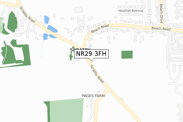
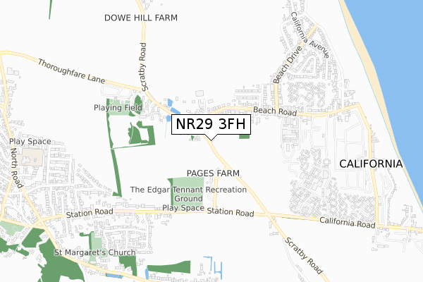
NR29 3FH is located in the Ormesby electoral ward, within the local authority district of Great Yarmouth and the English Parliamentary constituency of Great Yarmouth. The Sub Integrated Care Board (ICB) Location is NHS Norfolk and Waveney ICB - 26A and the police force is Norfolk. This postcode has been in use since October 2019.


GetTheData
Source: OS Open Zoomstack (Ordnance Survey)
Licence: Open Government Licence (requires attribution)
Attribution: Contains OS data © Crown copyright and database right 2025
Source: Open Postcode Geo
Licence: Open Government Licence (requires attribution)
Attribution: Contains OS data © Crown copyright and database right 2025; Contains Royal Mail data © Royal Mail copyright and database right 2025; Source: Office for National Statistics licensed under the Open Government Licence v.3.0
| Easting | 650584 |
| Northing | 315297 |
| Latitude | 52.677404 |
| Longitude | 1.705501 |
GetTheData
Source: Open Postcode Geo
Licence: Open Government Licence
| Country | England |
| Postcode District | NR29 |
➜ See where NR29 is on a map ➜ Where is Scratby? | |
GetTheData
Source: Land Registry Price Paid Data
Licence: Open Government Licence
| Ward | Ormesby |
| Constituency | Great Yarmouth |
GetTheData
Source: ONS Postcode Database
Licence: Open Government Licence
2024 5 FEB £340,000 |
2022 9 SEP £370,000 |
7, WOODLANDS CLOSE, SCRATBY, GREAT YARMOUTH, NR29 3FH 2021 22 MAR £273,000 |
3, WOODLANDS CLOSE, SCRATBY, GREAT YARMOUTH, NR29 3FH 2021 19 JAN £273,450 |
4, WOODLANDS CLOSE, SCRATBY, GREAT YARMOUTH, NR29 3FH 2020 3 DEC £284,950 |
2020 27 NOV £272,750 |
2020 16 OCT £272,500 |
2020 14 OCT £320,000 |
2020 14 MAY £274,950 |
2003 24 NOV £315,000 |
GetTheData
Source: HM Land Registry Price Paid Data
Licence: Contains HM Land Registry data © Crown copyright and database right 2025. This data is licensed under the Open Government Licence v3.0.
| Beach Road (Scratby Road) | Ormesby | 80m |
| Beach Road (Scratby Road) | Ormesby | 80m |
| Beach Drive (Beach Road) | Scratby | 396m |
| Beach Drive (Beach Road) | Scratby | 506m |
| California Road (Scratby Road) | Ormesby | 656m |
GetTheData
Source: NaPTAN
Licence: Open Government Licence
GetTheData
Source: ONS Postcode Database
Licence: Open Government Licence


➜ Get more ratings from the Food Standards Agency
GetTheData
Source: Food Standards Agency
Licence: FSA terms & conditions
| Last Collection | |||
|---|---|---|---|
| Location | Mon-Fri | Sat | Distance |
| Queens Road | 17:45 | 12:15 | 4,196m |
| Winterton Post Office | 17:00 | 12:00 | 4,347m |
| Main Road | 16:00 | 09:00 | 5,369m |
GetTheData
Source: Dracos
Licence: Creative Commons Attribution-ShareAlike
The below table lists the International Territorial Level (ITL) codes (formerly Nomenclature of Territorial Units for Statistics (NUTS) codes) and Local Administrative Units (LAU) codes for NR29 3FH:
| ITL 1 Code | Name |
|---|---|
| TLH | East |
| ITL 2 Code | Name |
| TLH1 | East Anglia |
| ITL 3 Code | Name |
| TLH15 | Norwich and East Norfolk |
| LAU 1 Code | Name |
| E07000145 | Great Yarmouth |
GetTheData
Source: ONS Postcode Directory
Licence: Open Government Licence
The below table lists the Census Output Area (OA), Lower Layer Super Output Area (LSOA), and Middle Layer Super Output Area (MSOA) for NR29 3FH:
| Code | Name | |
|---|---|---|
| OA | E00135317 | |
| LSOA | E01026627 | Great Yarmouth 001D |
| MSOA | E02005538 | Great Yarmouth 001 |
GetTheData
Source: ONS Postcode Directory
Licence: Open Government Licence
| NR29 3AJ | Beach Road | 204m |
| NR29 3NN | Heather Avenue | 351m |
| NR29 3PQ | Scratby Road | 369m |
| NR29 3NB | Lady Hamilton Lane | 408m |
| NR29 3NJ | Station Road | 466m |
| NR29 3NW | Beach Road | 513m |
| NR29 3NP | Beach Drive | 603m |
| NR29 3QJ | Gordon Cottages | 644m |
| NR29 3NH | Station Road | 687m |
| NR29 3NR | Nightingale Close | 688m |
GetTheData
Source: Open Postcode Geo; Land Registry Price Paid Data
Licence: Open Government Licence