Property/Postcode Data Search:
NR28 9NF maps, stats, and open data
NR28 9NF is located in the North Walsham East electoral ward, within the local authority district of North Norfolk and the English Parliamentary constituency of North Norfolk. The Sub Integrated Care Board (ICB) Location is NHS Norfolk and Waveney ICB - 26A and the police force is Norfolk. This postcode has been in use since February 2019.
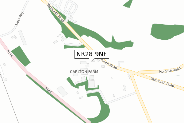
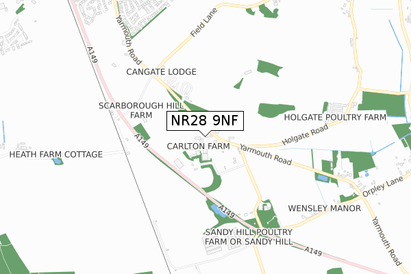
NR28 9NF maps


Source: OS Open Zoomstack (Ordnance Survey)
Licence: Open Government Licence (requires attribution)
Attribution: Contains OS data © Crown copyright and database right 2025
Source: Open Postcode Geo
Licence: Open Government Licence (requires attribution)
Attribution: Contains OS data © Crown copyright and database right 2025; Contains Royal Mail data © Royal Mail copyright and database right 2025; Source: Office for National Statistics licensed under the Open Government Licence v.3.0
Licence: Open Government Licence (requires attribution)
Attribution: Contains OS data © Crown copyright and database right 2025
Source: Open Postcode Geo
Licence: Open Government Licence (requires attribution)
Attribution: Contains OS data © Crown copyright and database right 2025; Contains Royal Mail data © Royal Mail copyright and database right 2025; Source: Office for National Statistics licensed under the Open Government Licence v.3.0
NR28 9NF geodata
| Easting | 629434 |
| Northing | 328831 |
| Latitude | 52.808215 |
| Longitude | 1.402708 |
Where is NR28 9NF?
| Country | England |
| Postcode District | NR28 |
Politics
| Ward | North Walsham East |
|---|---|
| Constituency | North Norfolk |
Transport
Nearest bus stops to NR28 9NF
| Council Houses (Happisburgh Road) | White Horse Common | 903m |
| Council Houses (Happisburgh Road) | White Horse Common | 917m |
| Spenser Avenue | North Walsham | 933m |
| Redman Road (Thirlby Road) | North Walsham | 974m |
| Litester Close (Spenser Avenue) | North Walsham | 979m |
Nearest railway stations to NR28 9NF
| North Walsham Station | 1.6km |
| Worstead Station | 3.4km |
Deprivation
41.1% of English postcodes are less deprived than NR28 9NF:Food Standards Agency
Three nearest food hygiene ratings to NR28 9NF (metres)
Lily's Tearoom

Lilys Tearoom
468m
Scarborough Hill Country Inn

Scarborough Hill House
468m
Two Mills Touring Park
Yarmouth Road
468m
➜ Get more ratings from the Food Standards Agency
Nearest post box to NR28 9NF
| Last Collection | |||
|---|---|---|---|
| Location | Mon-Fri | Sat | Distance |
| Spenser Ave | 16:00 | 11:00 | 899m |
| Brick Kiln Road | 16:00 | 10:00 | 1,384m |
| Station Arch | 16:30 | 11:10 | 1,650m |
NR28 9NF ITL and NR28 9NF LAU
The below table lists the International Territorial Level (ITL) codes (formerly Nomenclature of Territorial Units for Statistics (NUTS) codes) and Local Administrative Units (LAU) codes for NR28 9NF:
| ITL 1 Code | Name |
|---|---|
| TLH | East |
| ITL 2 Code | Name |
| TLH1 | East Anglia |
| ITL 3 Code | Name |
| TLH16 | North and West Norfolk |
| LAU 1 Code | Name |
| E07000147 | North Norfolk |
NR28 9NF census areas
The below table lists the Census Output Area (OA), Lower Layer Super Output Area (LSOA), and Middle Layer Super Output Area (MSOA) for NR28 9NF:
| Code | Name | |
|---|---|---|
| OA | E00136021 | |
| LSOA | E01026755 | North Norfolk 010C |
| MSOA | E02005579 | North Norfolk 010 |
Nearest postcodes to NR28 9NF
| NR28 9NA | Yarmouth Road | 465m |
| NR28 9JF | Thirlby Road | 646m |
| NR28 9HU | Furze Hill Drive | 686m |
| NR28 9JG | Cradlewood Road | 688m |
| NR28 9HX | Furze Hill Drive | 714m |
| NR28 9LP | Holgate Road | 715m |
| NR28 9EZ | Mill Road | 738m |
| NR28 9JB | Thirlby Road | 745m |
| NR28 9YA | Long Barrow Drive | 754m |
| NR28 9JD | Spurdens Crescent | 767m |