Property/Postcode Data Search:
NR21 8QG maps, stats, and open data
NR21 8QG is located in the Lancaster North electoral ward, within the local authority district of North Norfolk and the English Parliamentary constituency of Broadland. The Sub Integrated Care Board (ICB) Location is NHS Norfolk and Waveney ICB - 26A and the police force is Norfolk. This postcode has been in use since November 2019.
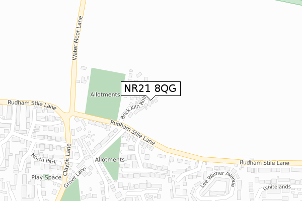
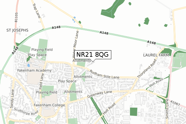
NR21 8QG maps


Source: OS Open Zoomstack (Ordnance Survey)
Licence: Open Government Licence (requires attribution)
Attribution: Contains OS data © Crown copyright and database right 2025
Source: Open Postcode Geo
Licence: Open Government Licence (requires attribution)
Attribution: Contains OS data © Crown copyright and database right 2025; Contains Royal Mail data © Royal Mail copyright and database right 2025; Source: Office for National Statistics licensed under the Open Government Licence v.3.0
Licence: Open Government Licence (requires attribution)
Attribution: Contains OS data © Crown copyright and database right 2025
Source: Open Postcode Geo
Licence: Open Government Licence (requires attribution)
Attribution: Contains OS data © Crown copyright and database right 2025; Contains Royal Mail data © Royal Mail copyright and database right 2025; Source: Office for National Statistics licensed under the Open Government Licence v.3.0
NR21 8QG geodata
| Easting | 592486 |
| Northing | 330891 |
| Latitude | 52.841150 |
| Longitude | 0.856531 |
Where is NR21 8QG?
| Country | England |
| Postcode District | NR21 |
Politics
| Ward | Lancaster North |
|---|---|
| Constituency | Broadland |
House Prices
Sales of detached houses in NR21 8QG
2022 9 SEP £420,000 |
2022 27 JUL £425,000 |
24, FARM DRIVE, FAKENHAM, NR21 8QG 2021 8 SEP £380,000 |
19, FARM DRIVE, FAKENHAM, NR21 8QG 2021 20 AUG £365,000 |
23, FARM DRIVE, FAKENHAM, NR21 8QG 2021 30 JUN £350,000 |
2021 18 JUN £350,000 |
2021 30 APR £385,000 |
30, FARM DRIVE, FAKENHAM, NR21 8QG 2021 23 APR £285,000 |
8, FARM DRIVE, FAKENHAM, NR21 8QG 2021 22 APR £385,000 |
2, FARM DRIVE, FAKENHAM, NR21 8QG 2021 9 APR £285,000 |
Source: HM Land Registry Price Paid Data
Licence: Contains HM Land Registry data © Crown copyright and database right 2025. This data is licensed under the Open Government Licence v3.0.
Licence: Contains HM Land Registry data © Crown copyright and database right 2025. This data is licensed under the Open Government Licence v3.0.
Transport
Nearest bus stops to NR21 8QG
| Silverlands Close (Claypit Lane) | Fakenham | 398m |
| North Park | Fakenham | 457m |
| Henry Iv (Greenway Lane) | Fakenham | 492m |
| Henry Iv (Greenway Lane) | Fakenham | 506m |
| Whitelands (Greenway Lane) | Fakenham | 564m |
Deprivation
55.6% of English postcodes are less deprived than NR21 8QG:Food Standards Agency
Three nearest food hygiene ratings to NR21 8QG (metres)
The Ficarra's Spa

The Ficarras Spa
476m
Fakenham Fires Ltd
1-3 North Drive
484m
Nelson Cafe

Unit 2 At
554m
➜ Get more ratings from the Food Standards Agency
Nearest post box to NR21 8QG
| Last Collection | |||
|---|---|---|---|
| Location | Mon-Fri | Sat | Distance |
| Lee Warner Avenue | 16:45 | 11:15 | 489m |
| Safeways Clipbush Road | 16:30 | 11:00 | 906m |
| Wells Road Post Office | 16:45 | 11:45 | 1,091m |
NR21 8QG ITL and NR21 8QG LAU
The below table lists the International Territorial Level (ITL) codes (formerly Nomenclature of Territorial Units for Statistics (NUTS) codes) and Local Administrative Units (LAU) codes for NR21 8QG:
| ITL 1 Code | Name |
|---|---|
| TLH | East |
| ITL 2 Code | Name |
| TLH1 | East Anglia |
| ITL 3 Code | Name |
| TLH16 | North and West Norfolk |
| LAU 1 Code | Name |
| E07000147 | North Norfolk |
NR21 8QG census areas
The below table lists the Census Output Area (OA), Lower Layer Super Output Area (LSOA), and Middle Layer Super Output Area (MSOA) for NR21 8QG:
| Code | Name | |
|---|---|---|
| OA | E00135975 | |
| LSOA | E01026745 | North Norfolk 011A |
| MSOA | E02005580 | North Norfolk 011 |
Nearest postcodes to NR21 8QG
| NR21 8JW | Rudham Stile Lane | 238m |
| NR21 8JX | Charles Road | 258m |
| NR21 8JP | Rudham Stile Lane | 268m |
| NR21 8JT | Grove Lane | 284m |
| NR21 8JU | Elizabeth Avenue | 297m |
| NR21 8QA | Bridge Close | 320m |
| NR21 8AS | West Close | 332m |
| NR21 8JZ | Copper Beech Close | 344m |
| NR21 8JY | Edinburgh Drive | 349m |
| NR21 8AR | Silverlands Close | 385m |