Property/Postcode Data Search:
NR20 3UQ maps, stats, and open data
NR20 3UQ is located in the Mattishall electoral ward, within the local authority district of Breckland and the English Parliamentary constituency of Mid Norfolk. The Sub Integrated Care Board (ICB) Location is NHS Norfolk and Waveney ICB - 26A and the police force is Norfolk. This postcode has been in use since January 2020.
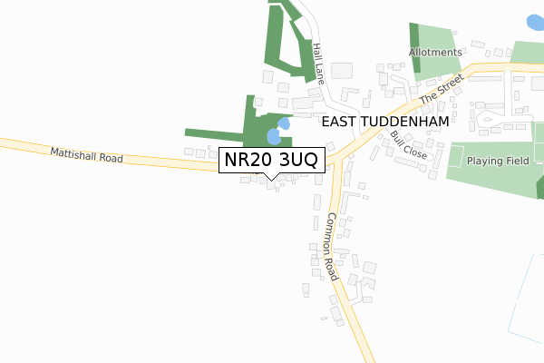
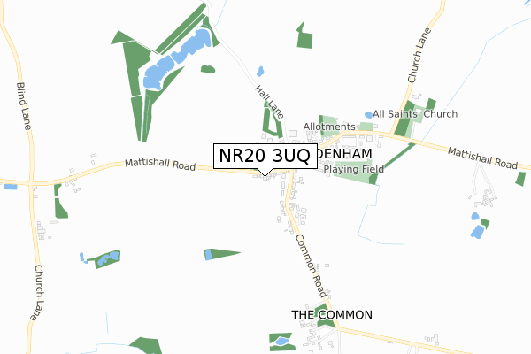
NR20 3UQ maps


Source: OS Open Zoomstack (Ordnance Survey)
Licence: Open Government Licence (requires attribution)
Attribution: Contains OS data © Crown copyright and database right 2025
Source: Open Postcode Geo
Licence: Open Government Licence (requires attribution)
Attribution: Contains OS data © Crown copyright and database right 2025; Contains Royal Mail data © Royal Mail copyright and database right 2025; Source: Office for National Statistics licensed under the Open Government Licence v.3.0
Licence: Open Government Licence (requires attribution)
Attribution: Contains OS data © Crown copyright and database right 2025
Source: Open Postcode Geo
Licence: Open Government Licence (requires attribution)
Attribution: Contains OS data © Crown copyright and database right 2025; Contains Royal Mail data © Royal Mail copyright and database right 2025; Source: Office for National Statistics licensed under the Open Government Licence v.3.0
NR20 3UQ geodata
| Easting | 607950 |
| Northing | 311381 |
| Latitude | 52.660275 |
| Longitude | 1.073432 |
Where is NR20 3UQ?
| Country | England |
| Postcode District | NR20 |
Politics
| Ward | Mattishall |
|---|---|
| Constituency | Mid Norfolk |
Transport
Nearest bus stops to NR20 3UQ
| Pump (The Street) | East Tuddenham | 115m |
| Pump (The Street) | East Tuddenham | 140m |
| Tilney Road (The Street) | East Tuddenham | 333m |
| Tilney Road (The Street) | East Tuddenham | 395m |
Deprivation
59.2% of English postcodes are less deprived than NR20 3UQ:Food Standards Agency
Three nearest food hygiene ratings to NR20 3UQ (metres)
East Tuddenham Village Hall & Social CLub

Jubilee Hall Mattishall Road
342m
Nightingale Care Home

Church Lane
1,593m
Ailwyn Hall Residential Care Home

Ailwyn Hall Berrys Lane
1,618m
➜ Get more ratings from the Food Standards Agency
Nearest post box to NR20 3UQ
| Last Collection | |||
|---|---|---|---|
| Location | Mon-Fri | Sat | Distance |
| Common Road | 16:00 | 10:00 | 81m |
| Rotton Row | 16:00 | 10:30 | 1,467m |
| The School / Cross Roads | 17:15 | 10:30 | 1,690m |
NR20 3UQ ITL and NR20 3UQ LAU
The below table lists the International Territorial Level (ITL) codes (formerly Nomenclature of Territorial Units for Statistics (NUTS) codes) and Local Administrative Units (LAU) codes for NR20 3UQ:
| ITL 1 Code | Name |
|---|---|
| TLH | East |
| ITL 2 Code | Name |
| TLH1 | East Anglia |
| ITL 3 Code | Name |
| TLH17 | Breckland and South Norfolk |
| LAU 1 Code | Name |
| E07000143 | Breckland |
NR20 3UQ census areas
The below table lists the Census Output Area (OA), Lower Layer Super Output Area (LSOA), and Middle Layer Super Output Area (MSOA) for NR20 3UQ:
| Code | Name | |
|---|---|---|
| OA | E00134564 | |
| LSOA | E01026481 | Breckland 006C |
| MSOA | E02005508 | Breckland 006 |
Nearest postcodes to NR20 3UQ
| NR20 3SH | Bay Field | 62m |
| NR20 3LT | Mattishall Road | 113m |
| NR20 3LX | Bull Close | 154m |
| NR20 3LU | Barrack Close | 167m |
| NR20 3LR | Mattishall Road | 196m |
| NR20 3LZ | Tilney Road | 261m |
| NR20 3LY | Mattishall Road | 282m |
| NR20 3LP | Council Houses | 284m |
| NR20 3AH | Common Road | 312m |
| NR20 3ND | Mattishall Road | 933m |