NR20 3GS maps, stats, and open data
NR20 3GS is located in the Mattishall electoral ward, within the local authority district of Breckland and the English Parliamentary constituency of Mid Norfolk. The Sub Integrated Care Board (ICB) Location is NHS Norfolk and Waveney ICB - 26A and the police force is Norfolk. This postcode has been in use since September 2018.
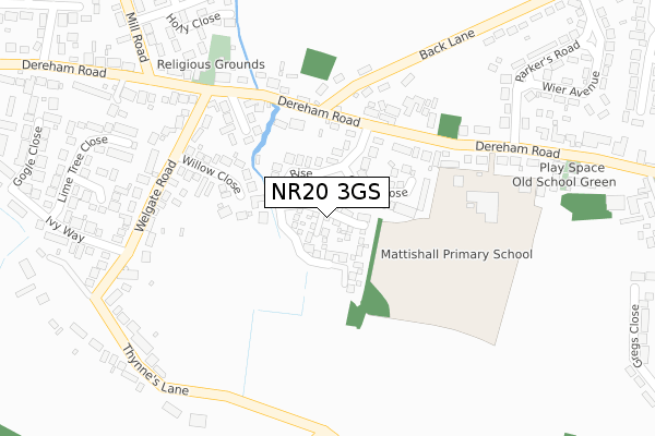
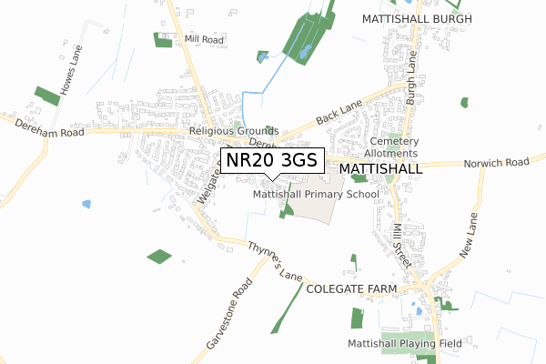
NR20 3GS maps


Licence: Open Government Licence (requires attribution)
Attribution: Contains OS data © Crown copyright and database right 2025
Source: Open Postcode Geo
Licence: Open Government Licence (requires attribution)
Attribution: Contains OS data © Crown copyright and database right 2025; Contains Royal Mail data © Royal Mail copyright and database right 2025; Source: Office for National Statistics licensed under the Open Government Licence v.3.0
NR20 3GS geodata
| Easting | 604806 |
| Northing | 311026 |
| Latitude | 52.658283 |
| Longitude | 1.026795 |
Where is NR20 3GS?
| Country | England |
| Postcode District | NR20 |
Politics
| Ward | Mattishall |
|---|---|
| Constituency | Mid Norfolk |
House Prices
Sales of detached houses in NR20 3GS
2021 26 FEB £293,000 |
10, WALNUT TREE ROAD, MATTISHALL, DEREHAM, NR20 3GS 2019 11 OCT £285,000 |
2019 30 AUG £295,000 |
28, WALNUT TREE ROAD, MATTISHALL, DEREHAM, NR20 3GS 2019 8 JUL £330,000 |
32, WALNUT TREE ROAD, MATTISHALL, DEREHAM, NR20 3GS 2019 12 APR £300,000 |
14, WALNUT TREE ROAD, MATTISHALL, DEREHAM, NR20 3GS 2018 17 DEC £440,000 |
30, WALNUT TREE ROAD, MATTISHALL, DEREHAM, NR20 3GS 2018 14 DEC £300,000 |
24, WALNUT TREE ROAD, MATTISHALL, DEREHAM, NR20 3GS 2018 30 NOV £300,000 |
2, WALNUT TREE ROAD, MATTISHALL, DEREHAM, NR20 3GS 2018 16 NOV £295,000 |
12, WALNUT TREE ROAD, MATTISHALL, DEREHAM, NR20 3GS 2018 19 OCT £285,000 |
Licence: Contains HM Land Registry data © Crown copyright and database right 2025. This data is licensed under the Open Government Licence v3.0.
Transport
Nearest bus stops to NR20 3GS
| Cedar Rise (Dereham Road) | Mattishall | 163m |
| Cedar Rise (Dereham Road) | Mattishall | 166m |
| Welgate Road (Dereham Road) | Mattishall | 255m |
| Welgate Road (Dereham Road) | Mattishall | 270m |
| Church (Dereham Road) | Mattishall | 431m |
Broadband
Broadband access in NR20 3GS (2020 data)
| Percentage of properties with Next Generation Access | 100.0% |
| Percentage of properties with Superfast Broadband | 100.0% |
| Percentage of properties with Ultrafast Broadband | 100.0% |
| Percentage of properties with Full Fibre Broadband | 100.0% |
Superfast Broadband is between 30Mbps and 300Mbps
Ultrafast Broadband is > 300Mbps
Broadband limitations in NR20 3GS (2020 data)
| Percentage of properties unable to receive 2Mbps | 0.0% |
| Percentage of properties unable to receive 5Mbps | 0.0% |
| Percentage of properties unable to receive 10Mbps | 0.0% |
| Percentage of properties unable to receive 30Mbps | 0.0% |
Deprivation
28.4% of English postcodes are less deprived than NR20 3GS:Food Standards Agency
Three nearest food hygiene ratings to NR20 3GS (metres)


➜ Get more ratings from the Food Standards Agency
Nearest post box to NR20 3GS
| Last Collection | |||
|---|---|---|---|
| Location | Mon-Fri | Sat | Distance |
| Welgate Close | 16:15 | 11:00 | 229m |
| Dereham Road Post Office | 16:15 | 10:30 | 408m |
| Old Hall | 16:15 | 10:00 | 982m |
NR20 3GS ITL and NR20 3GS LAU
The below table lists the International Territorial Level (ITL) codes (formerly Nomenclature of Territorial Units for Statistics (NUTS) codes) and Local Administrative Units (LAU) codes for NR20 3GS:
| ITL 1 Code | Name |
|---|---|
| TLH | East |
| ITL 2 Code | Name |
| TLH1 | East Anglia |
| ITL 3 Code | Name |
| TLH17 | Breckland and South Norfolk |
| LAU 1 Code | Name |
| E07000143 | Breckland |
NR20 3GS census areas
The below table lists the Census Output Area (OA), Lower Layer Super Output Area (LSOA), and Middle Layer Super Output Area (MSOA) for NR20 3GS:
| Code | Name | |
|---|---|---|
| OA | E00134574 | |
| LSOA | E01026480 | Breckland 006B |
| MSOA | E02005508 | Breckland 006 |
Nearest postcodes to NR20 3GS
| NR20 3NN | Cedar Rise | 46m |
| NR20 3NW | Cedar Close | 105m |
| NR20 3PQ | Willow Close | 165m |
| NR20 3NL | Dereham Road | 181m |
| NR20 3NR | Welgate Close | 200m |
| NR20 3NP | Dereham Road | 211m |
| NR20 3PH | Welgate | 270m |
| NR20 3PJ | Welgate | 274m |
| NR20 3NS | Dereham Road | 309m |
| NR20 3PR | Cherry Tree Close | 325m |