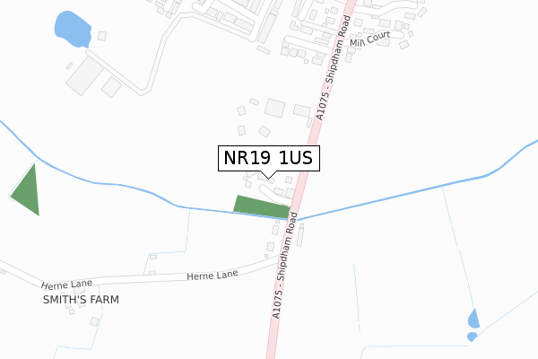
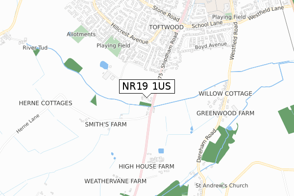
NR19 1US is located in the Dereham Toftwood electoral ward, within the local authority district of Breckland and the English Parliamentary constituency of Mid Norfolk. The Sub Integrated Care Board (ICB) Location is NHS Norfolk and Waveney ICB - 26A and the police force is Norfolk. This postcode has been in use since November 2017.


GetTheData
Source: OS Open Zoomstack (Ordnance Survey)
Licence: Open Government Licence (requires attribution)
Attribution: Contains OS data © Crown copyright and database right 2025
Source: Open Postcode Geo
Licence: Open Government Licence (requires attribution)
Attribution: Contains OS data © Crown copyright and database right 2025; Contains Royal Mail data © Royal Mail copyright and database right 2025; Source: Office for National Statistics licensed under the Open Government Licence v.3.0
| Easting | 598651 |
| Northing | 310668 |
| Latitude | 52.657356 |
| Longitude | 0.935705 |
GetTheData
Source: Open Postcode Geo
Licence: Open Government Licence
| Country | England |
| Postcode District | NR19 |
➜ See where NR19 is on a map ➜ Where is Dereham? | |
GetTheData
Source: Land Registry Price Paid Data
Licence: Open Government Licence
| Ward | Dereham Toftwood |
| Constituency | Mid Norfolk |
GetTheData
Source: ONS Postcode Database
Licence: Open Government Licence
| Holland Court (Shipdham Road) | Toftwood | 353m |
| Holland Court (Shipdham Road) | Toftwood | 411m |
| Andrew Goodhall Close (Hillcrest Avenue) | Toftwood | 485m |
| Margaret Close (Hillcrest Avenue) | Toftwood | 620m |
| William Way (Hillcrest Avenue) | Toftwood | 705m |
GetTheData
Source: NaPTAN
Licence: Open Government Licence
| Percentage of properties with Next Generation Access | 100.0% |
| Percentage of properties with Superfast Broadband | 100.0% |
| Percentage of properties with Ultrafast Broadband | 0.0% |
| Percentage of properties with Full Fibre Broadband | 0.0% |
Superfast Broadband is between 30Mbps and 300Mbps
Ultrafast Broadband is > 300Mbps
| Median download speed | 39.1Mbps |
| Average download speed | 34.3Mbps |
| Maximum download speed | 44.45Mbps |
| Median upload speed | 10.0Mbps |
| Average upload speed | 8.3Mbps |
| Maximum upload speed | 10.00Mbps |
| Percentage of properties unable to receive 2Mbps | 0.0% |
| Percentage of properties unable to receive 5Mbps | 0.0% |
| Percentage of properties unable to receive 10Mbps | 0.0% |
| Percentage of properties unable to receive 30Mbps | 0.0% |
GetTheData
Source: Ofcom
Licence: Ofcom Terms of Use (requires attribution)
GetTheData
Source: ONS Postcode Database
Licence: Open Government Licence


➜ Get more ratings from the Food Standards Agency
GetTheData
Source: Food Standards Agency
Licence: FSA terms & conditions
| Last Collection | |||
|---|---|---|---|
| Location | Mon-Fri | Sat | Distance |
| Hillcrest Ave | 17:00 | 08:30 | 544m |
| Shipham Road Post Office | 17:15 | 11:00 | 683m |
| Boyd Avenue | 17:15 | 12:00 | 759m |
GetTheData
Source: Dracos
Licence: Creative Commons Attribution-ShareAlike
The below table lists the International Territorial Level (ITL) codes (formerly Nomenclature of Territorial Units for Statistics (NUTS) codes) and Local Administrative Units (LAU) codes for NR19 1US:
| ITL 1 Code | Name |
|---|---|
| TLH | East |
| ITL 2 Code | Name |
| TLH1 | East Anglia |
| ITL 3 Code | Name |
| TLH17 | Breckland and South Norfolk |
| LAU 1 Code | Name |
| E07000143 | Breckland |
GetTheData
Source: ONS Postcode Directory
Licence: Open Government Licence
The below table lists the Census Output Area (OA), Lower Layer Super Output Area (LSOA), and Middle Layer Super Output Area (MSOA) for NR19 1US:
| Code | Name | |
|---|---|---|
| OA | E00134313 | |
| LSOA | E01026433 | Breckland 005E |
| MSOA | E02005507 | Breckland 005 |
GetTheData
Source: ONS Postcode Directory
Licence: Open Government Licence
| NR19 1NP | Shipdham Road | 125m |
| NR19 1FL | Nidus Gardens | 238m |
| NR19 1NS | Heidi Close | 342m |
| NR19 1NL | Colleen Close | 358m |
| NR19 1NW | Holland Court | 359m |
| NR19 1UX | Mill Court | 361m |
| NR19 1SG | Suffolk Place | 388m |
| NR19 1SP | Andrew Goodall Close | 412m |
| NR19 1LW | Elizabeth Close | 426m |
| NR19 1GZ | Dowling Close | 438m |
GetTheData
Source: Open Postcode Geo; Land Registry Price Paid Data
Licence: Open Government Licence