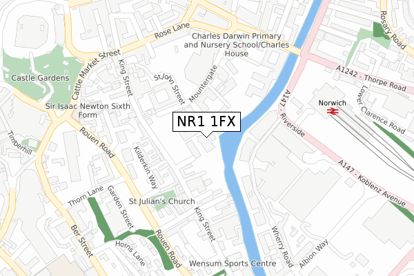
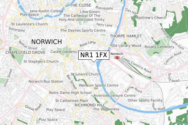
NR1 1FX is located in the Thorpe Hamlet electoral ward, within the local authority district of Norwich and the English Parliamentary constituency of Norwich South. The Sub Integrated Care Board (ICB) Location is NHS Norfolk and Waveney ICB - 26A and the police force is Norfolk. This postcode has been in use since June 2019.


GetTheData
Source: OS Open Zoomstack (Ordnance Survey)
Licence: Open Government Licence (requires attribution)
Attribution: Contains OS data © Crown copyright and database right 2025
Source: Open Postcode Geo
Licence: Open Government Licence (requires attribution)
Attribution: Contains OS data © Crown copyright and database right 2025; Contains Royal Mail data © Royal Mail copyright and database right 2025; Source: Office for National Statistics licensed under the Open Government Licence v.3.0
| Easting | 623608 |
| Northing | 308270 |
| Latitude | 52.626130 |
| Longitude | 1.302449 |
GetTheData
Source: Open Postcode Geo
Licence: Open Government Licence
| Country | England |
| Postcode District | NR1 |
➜ See where NR1 is on a map ➜ Where is Norwich? | |
GetTheData
Source: Land Registry Price Paid Data
Licence: Open Government Licence
| Ward | Thorpe Hamlet |
| Constituency | Norwich South |
GetTheData
Source: ONS Postcode Database
Licence: Open Government Licence
| Music House (Kings Street) | Norwich | 232m |
| Riverside Road | Norwich | 243m |
| Rose Lane | Norwich | 271m |
| Prince Of Wales Road | Norwich | 277m |
| Railway Station (Thorpe Road) | Norwich | 332m |
| Norwich Station | 0.3km |
GetTheData
Source: NaPTAN
Licence: Open Government Licence
GetTheData
Source: ONS Postcode Database
Licence: Open Government Licence


➜ Get more ratings from the Food Standards Agency
GetTheData
Source: Food Standards Agency
Licence: FSA terms & conditions
| Last Collection | |||
|---|---|---|---|
| Location | Mon-Fri | Sat | Distance |
| King Street | 18:30 | 11:00 | 206m |
| Thorpe Railway Station | 17:30 | 11:00 | 287m |
| Prince Of Wales Road | 18:30 | 11:00 | 306m |
GetTheData
Source: Dracos
Licence: Creative Commons Attribution-ShareAlike
The below table lists the International Territorial Level (ITL) codes (formerly Nomenclature of Territorial Units for Statistics (NUTS) codes) and Local Administrative Units (LAU) codes for NR1 1FX:
| ITL 1 Code | Name |
|---|---|
| TLH | East |
| ITL 2 Code | Name |
| TLH1 | East Anglia |
| ITL 3 Code | Name |
| TLH15 | Norwich and East Norfolk |
| LAU 1 Code | Name |
| E07000148 | Norwich |
GetTheData
Source: ONS Postcode Directory
Licence: Open Government Licence
The below table lists the Census Output Area (OA), Lower Layer Super Output Area (LSOA), and Middle Layer Super Output Area (MSOA) for NR1 1FX:
| Code | Name | |
|---|---|---|
| OA | E00173858 | |
| LSOA | E01033440 | Norwich 014C |
| MSOA | E02006907 | Norwich 014 |
GetTheData
Source: ONS Postcode Directory
Licence: Open Government Licence
| NR1 1QA | Baltic Wharf | 61m |
| NR1 1QE | King Street | 120m |
| NR1 1RL | Drays Yard | 121m |
| NR1 1RQ | Maltsters Yard | 123m |
| NR1 1QJ | Abbey Lane | 137m |
| NR1 1RW | Fuggles Yard | 141m |
| NR1 1RG | Polypin Yard | 147m |
| NR1 1RD | Kilderkin Way | 152m |
| NR1 1QD | St Julians Alley | 155m |
| NR1 1PQ | Raven Yard | 175m |
GetTheData
Source: Open Postcode Geo; Land Registry Price Paid Data
Licence: Open Government Licence