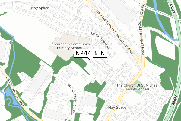
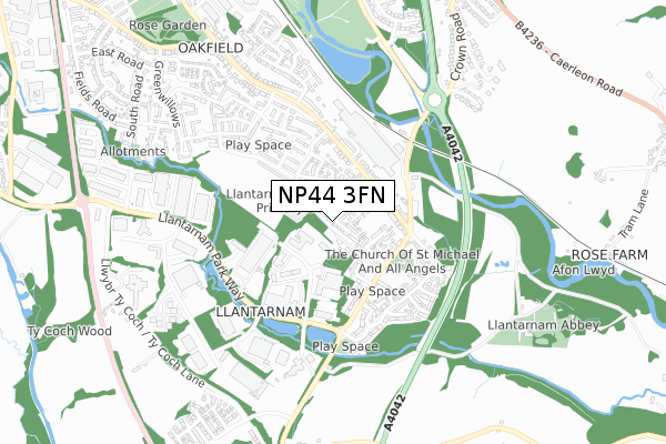
NP44 3FN is located in the Llantarnam electoral ward, within the unitary authority of Torfaen and the Welsh Parliamentary constituency of Torfaen. The Local Health Board is Aneurin Bevan University and the police force is Gwent. This postcode has been in use since December 2019.


GetTheData
Source: OS Open Zoomstack (Ordnance Survey)
Licence: Open Government Licence (requires attribution)
Attribution: Contains OS data © Crown copyright and database right 2025
Source: Open Postcode Geo
Licence: Open Government Licence (requires attribution)
Attribution: Contains OS data © Crown copyright and database right 2025; Contains Royal Mail data © Royal Mail copyright and database right 2025; Source: Office for National Statistics licensed under the Open Government Licence v.3.0
| Easting | 330568 |
| Northing | 193314 |
| Latitude | 51.634334 |
| Longitude | -3.004616 |
GetTheData
Source: Open Postcode Geo
Licence: Open Government Licence
| Country | Wales |
| Postcode District | NP44 |
➜ See where NP44 is on a map ➜ Where is Cwmbrân? | |
GetTheData
Source: Land Registry Price Paid Data
Licence: Open Government Licence
| Ward | Llantarnam |
| Constituency | Torfaen |
GetTheData
Source: ONS Postcode Database
Licence: Open Government Licence
179, JAMES PROSSER WAY, LLANTARNAM, CWMBRAN, NP44 3FN 2024 13 DEC £325,000 |
217, JAMES PROSSER WAY, LLANTARNAM, CWMBRAN, NP44 3FN 2024 19 JUL £380,000 |
181, JAMES PROSSER WAY, LLANTARNAM, CWMBRAN, NP44 3FN 2023 1 DEC £365,000 |
211, JAMES PROSSER WAY, LLANTARNAM, CWMBRAN, NP44 3FN 2023 17 FEB £420,000 |
157, JAMES PROSSER WAY, LLANTARNAM, CWMBRAN, NP44 3FN 2021 19 FEB £272,500 |
169, JAMES PROSSER WAY, LLANTARNAM, CWMBRAN, NP44 3FN 2021 12 FEB £299,995 |
159, JAMES PROSSER WAY, LLANTARNAM, CWMBRAN, NP44 3FN 2021 12 FEB £277,995 |
167, JAMES PROSSER WAY, LLANTARNAM, CWMBRAN, NP44 3FN 2021 29 JAN £345,995 |
165, JAMES PROSSER WAY, LLANTARNAM, CWMBRAN, NP44 3FN 2021 29 JAN £296,995 |
171, JAMES PROSSER WAY, LLANTARNAM, CWMBRAN, NP44 3FN 2020 18 DEC £289,995 |
GetTheData
Source: HM Land Registry Price Paid Data
Licence: Contains HM Land Registry data © Crown copyright and database right 2025. This data is licensed under the Open Government Licence v3.0.
| Greenhouse (Newport Road) | Llantarnam | 164m |
| Burtons (Newport Road) | Llantarnam | 175m |
| Burtons (Newport Road) | Llantarnam | 186m |
| Star Row (Llantarnam Road) | Llantarnam | 187m |
| Greenhouse (Newport Road) | Llantarnam | 235m |
| Cwmbran Station | 2.6km |
| Rogerstone Station | 6.1km |
GetTheData
Source: NaPTAN
Licence: Open Government Licence
GetTheData
Source: ONS Postcode Database
Licence: Open Government Licence


➜ Get more ratings from the Food Standards Agency
GetTheData
Source: Food Standards Agency
Licence: FSA terms & conditions
| Last Collection | |||
|---|---|---|---|
| Location | Mon-Fri | Sat | Distance |
| Llantarnam Road | 17:30 | 11:00 | 1,244m |
| Ponthir Post Office | 16:15 | 11:45 | 2,043m |
| Radnor Way | 17:30 | 11:00 | 2,101m |
GetTheData
Source: Dracos
Licence: Creative Commons Attribution-ShareAlike
The below table lists the International Territorial Level (ITL) codes (formerly Nomenclature of Territorial Units for Statistics (NUTS) codes) and Local Administrative Units (LAU) codes for NP44 3FN:
| ITL 1 Code | Name |
|---|---|
| TLL | Wales |
| ITL 2 Code | Name |
| TLL1 | West Wales and The Valleys |
| ITL 3 Code | Name |
| TLL16 | Gwent Valleys |
| LAU 1 Code | Name |
| W06000020 | Torfaen |
GetTheData
Source: ONS Postcode Directory
Licence: Open Government Licence
The below table lists the Census Output Area (OA), Lower Layer Super Output Area (LSOA), and Middle Layer Super Output Area (MSOA) for NP44 3FN:
| Code | Name | |
|---|---|---|
| OA | W00007867 | |
| LSOA | W01001505 | Torfaen 013B |
| MSOA | W02000335 | Torfaen 013 |
GetTheData
Source: ONS Postcode Directory
Licence: Open Government Licence
| NP44 3BW | Llantarnam Road | 82m |
| NP44 3JJ | John Fielding Gardens | 111m |
| NP44 3BN | Llantarnam Road | 125m |
| NP44 3BP | Newport Road | 168m |
| NP44 3HN | Llantarnam Gardens | 174m |
| NP44 3BL | Llantarnam Road | 230m |
| NP44 3BR | Abbey Cottages | 255m |
| NP44 3GH | Burtons Place | 285m |
| NP44 3AB | William Browne Close | 287m |
| NP44 3HG | Montresor Court | 289m |
GetTheData
Source: Open Postcode Geo; Land Registry Price Paid Data
Licence: Open Government Licence