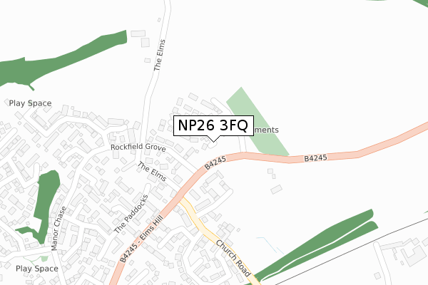
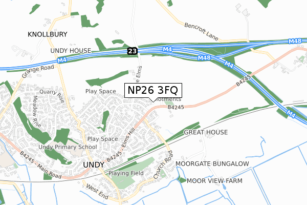
NP26 3FQ is located in the Magor East with Undy electoral ward, within the unitary authority of Monmouthshire and the Welsh Parliamentary constituency of Newport East. The Local Health Board is Aneurin Bevan University and the police force is Gwent. This postcode has been in use since December 2019.


GetTheData
Source: OS Open Zoomstack (Ordnance Survey)
Licence: Open Government Licence (requires attribution)
Attribution: Contains OS data © Crown copyright and database right 2025
Source: Open Postcode Geo
Licence: Open Government Licence (requires attribution)
Attribution: Contains OS data © Crown copyright and database right 2025; Contains Royal Mail data © Royal Mail copyright and database right 2025; Source: Office for National Statistics licensed under the Open Government Licence v.3.0
| Easting | 343845 |
| Northing | 187555 |
| Latitude | 51.584041 |
| Longitude | -2.811876 |
GetTheData
Source: Open Postcode Geo
Licence: Open Government Licence
| Country | Wales |
| Postcode District | NP26 |
➜ See where NP26 is on a map ➜ Where is Undy? | |
GetTheData
Source: Land Registry Price Paid Data
Licence: Open Government Licence
| Ward | Magor East With Undy |
| Constituency | Newport East |
GetTheData
Source: ONS Postcode Database
Licence: Open Government Licence
13, SIR HOWEL CRESCENT, UNDY, CALDICOT, NP26 3FQ 2022 16 DEC £449,995 |
15, SIR HOWEL CRESCENT, UNDY, CALDICOT, NP26 3FQ 2022 16 DEC £484,995 |
8, SIR HOWEL CRESCENT, UNDY, CALDICOT, NP26 3FQ 2021 26 MAR £338,995 |
14, SIR HOWEL CRESCENT, UNDY, CALDICOT, NP26 3FQ 2021 12 FEB £402,000 |
9, SIR HOWEL CRESCENT, UNDY, CALDICOT, NP26 3FQ 2020 4 DEC £338,995 |
51, SIR HOWEL CRESCENT, UNDY, CALDICOT, NP26 3FQ 2020 27 NOV £469,995 |
53, SIR HOWEL CRESCENT, UNDY, CALDICOT, NP26 3FQ 2020 13 NOV £464,995 |
6, SIR HOWEL CRESCENT, UNDY, CALDICOT, NP26 3FQ 2020 14 AUG £289,995 |
49, SIR HOWEL CRESCENT, UNDY, CALDICOT, NP26 3FQ 2020 12 AUG £369,995 |
11, SIR HOWEL CRESCENT, UNDY, CALDICOT, NP26 3FQ 2020 22 MAY £338,995 |
GetTheData
Source: HM Land Registry Price Paid Data
Licence: Contains HM Land Registry data © Crown copyright and database right 2025. This data is licensed under the Open Government Licence v3.0.
| Rockfield (Elms Hill) | Undy | 136m |
| Rockfield (Elms Hill) | Undy | 143m |
| Tudor Court (Main Road) | Undy | 643m |
| Tudor Court (Main Road) | Undy | 648m |
| Vinegar Hill (Pennyfarthing Lane) | Magor | 750m |
| Severn Tunnel Junction Station | 2.4km |
| Caldicot Station | 3.6km |
GetTheData
Source: NaPTAN
Licence: Open Government Licence
GetTheData
Source: ONS Postcode Database
Licence: Open Government Licence


➜ Get more ratings from the Food Standards Agency
GetTheData
Source: Food Standards Agency
Licence: FSA terms & conditions
| Last Collection | |||
|---|---|---|---|
| Location | Mon-Fri | Sat | Distance |
| Station Road Rogiet | 16:00 | 07:30 | 2,184m |
| Magor Post Office | 18:00 | 12:00 | 3,225m |
| Redwick | 16:00 | 08:45 | 4,287m |
GetTheData
Source: Dracos
Licence: Creative Commons Attribution-ShareAlike
The below table lists the International Territorial Level (ITL) codes (formerly Nomenclature of Territorial Units for Statistics (NUTS) codes) and Local Administrative Units (LAU) codes for NP26 3FQ:
| ITL 1 Code | Name |
|---|---|
| TLL | Wales |
| ITL 2 Code | Name |
| TLL2 | East Wales |
| ITL 3 Code | Name |
| TLL21 | Monmouthshire and Newport |
| LAU 1 Code | Name |
| W06000021 | Monmouthshire |
GetTheData
Source: ONS Postcode Directory
Licence: Open Government Licence
The below table lists the Census Output Area (OA), Lower Layer Super Output Area (LSOA), and Middle Layer Super Output Area (MSOA) for NP26 3FQ:
| Code | Name | |
|---|---|---|
| OA | W00008285 | |
| LSOA | W01001591 | Monmouthshire 011E |
| MSOA | W02000346 | Monmouthshire 011 |
GetTheData
Source: ONS Postcode Directory
Licence: Open Government Licence
| NP26 3FB | Rockfield Grove | 133m |
| NP26 3QD | Pembroke Close | 146m |
| NP26 3EL | 165m | |
| NP26 3PZ | Pembroke Court | 191m |
| NP26 3TD | The Paddocks | 213m |
| NP26 3FD | Rockfield Way | 224m |
| NP26 3TE | Old Barn Court | 232m |
| NP26 3PU | St Stephens Place | 248m |
| NP26 3FH | Rockfield Crescent | 273m |
| NP26 3FG | Rockfield Rise | 280m |
GetTheData
Source: Open Postcode Geo; Land Registry Price Paid Data
Licence: Open Government Licence