NP19 4DX maps, stats, and open data
- Home
- Postcode
- NP
- NP19
- NP19 4
NP19 4DX is located in the Llanwern electoral ward, within the unitary authority of Newport and the Welsh Parliamentary constituency of Newport East. The Local Health Board is Aneurin Bevan University and the police force is Gwent. This postcode has been in use since March 2018.
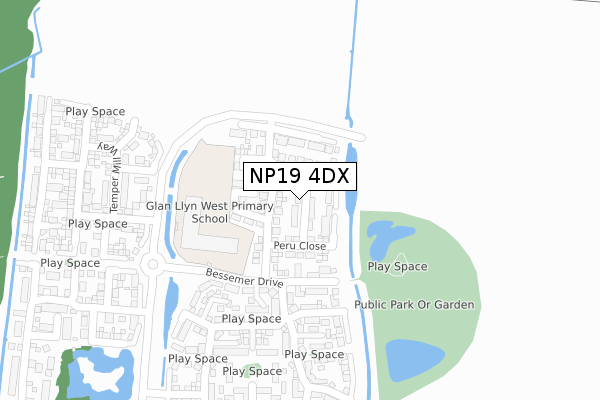
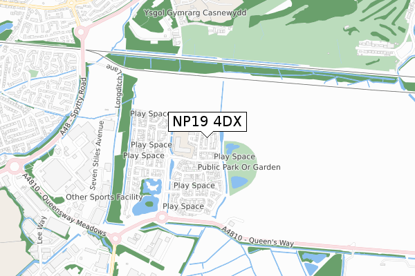
NP19 4DX maps


Source: OS Open Zoomstack (Ordnance Survey)
Licence: Open Government Licence (requires attribution)
Attribution: Contains OS data © Crown copyright and database right 2025
Source: Open Postcode GeoLicence: Open Government Licence (requires attribution)
Attribution: Contains OS data © Crown copyright and database right 2025; Contains Royal Mail data © Royal Mail copyright and database right 2025; Source: Office for National Statistics licensed under the Open Government Licence v.3.0
NP19 4DX geodata
| Easting | 335446 |
| Northing | 186989 |
| Latitude | 51.578052 |
| Longitude | -2.932977 |
Where is NP19 4DX?
| Country | Wales |
| Postcode District | NP19 |
Politics
| Ward | Llanwern |
|---|
| Constituency | Newport East |
|---|
Transport
Nearest bus stops to NP19 4DX
| P&r East (Queen's Way) | Llanwern | 429m |
| Llanwern High School (Hartridge Farm Rd) | Newport | 798m |
| Spytty Retail Park (Central Avenue) | Liswerry | 826m |
| Newport Retail Park (Central Avenue) | Liswerry | 827m |
| Broadmead Park | Liswerry | 864m |
Nearest railway stations to NP19 4DX
| Newport (S Wales) Station | 4.8km |
Broadband
Broadband access in NP19 4DX (2020 data)
| Percentage of properties with Next Generation Access | 100.0% |
| Percentage of properties with Superfast Broadband | 100.0% |
| Percentage of properties with Ultrafast Broadband | 100.0% |
| Percentage of properties with Full Fibre Broadband | 100.0% |
Superfast Broadband is between 30Mbps and 300Mbps
Ultrafast Broadband is > 300Mbps
Broadband limitations in NP19 4DX (2020 data)
| Percentage of properties unable to receive 2Mbps | 0.0% |
| Percentage of properties unable to receive 5Mbps | 0.0% |
| Percentage of properties unable to receive 10Mbps | 0.0% |
| Percentage of properties unable to receive 30Mbps | 0.0% |
Deprivation
50.7% of Welsh postcodes are less deprived than
NP19 4DX:
Food Standards Agency
Three nearest food hygiene ratings to NP19 4DX (metres)
The Llanwern Bull
Innoflate
McDonalds
➜ Get more ratings from the Food Standards Agency
Nearest post box to NP19 4DX
| | Last Collection | |
|---|
| Location | Mon-Fri | Sat | Distance |
|---|
| Nelson Drive | 17:30 | 11:45 | 1,398m |
| Aberthaw Circle | 17:30 | 11:15 | 1,905m |
| Barnardstown | 17:30 | 12:00 | 2,983m |
NP19 4DX ITL and NP19 4DX LAU
The below table lists the International Territorial Level (ITL) codes (formerly Nomenclature of Territorial Units for Statistics (NUTS) codes) and Local Administrative Units (LAU) codes for NP19 4DX:
| ITL 1 Code | Name |
|---|
| TLL | Wales |
| ITL 2 Code | Name |
|---|
| TLL2 | East Wales |
| ITL 3 Code | Name |
|---|
| TLL21 | Monmouthshire and Newport |
| LAU 1 Code | Name |
|---|
| W06000022 | Newport |
NP19 4DX census areas
The below table lists the Census Output Area (OA), Lower Layer Super Output Area (LSOA), and Middle Layer Super Output Area (MSOA) for NP19 4DX:
| Code | Name |
|---|
| OA | W00008568 | |
|---|
| LSOA | W01001649 | Newport 004D |
|---|
| MSOA | W02000350 | Newport 004 |
|---|
Nearest postcodes to NP19 4DX


