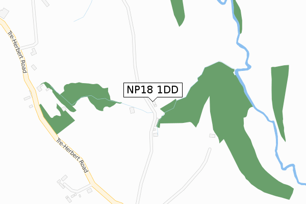
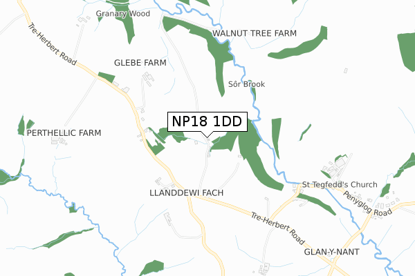
NP18 1DD is located in the Llangybi Fawr electoral ward, within the unitary authority of Monmouthshire and the Welsh Parliamentary constituency of Monmouth. The Local Health Board is Aneurin Bevan University and the police force is Gwent. This postcode has been in use since February 2020.


GetTheData
Source: OS Open Zoomstack (Ordnance Survey)
Licence: Open Government Licence (requires attribution)
Attribution: Contains OS data © Crown copyright and database right 2025
Source: Open Postcode Geo
Licence: Open Government Licence (requires attribution)
Attribution: Contains OS data © Crown copyright and database right 2025; Contains Royal Mail data © Royal Mail copyright and database right 2025; Source: Office for National Statistics licensed under the Open Government Licence v.3.0
| Easting | 333011 |
| Northing | 195991 |
| Latitude | 51.658696 |
| Longitude | -2.969836 |
GetTheData
Source: Open Postcode Geo
Licence: Open Government Licence
| Country | Wales |
| Postcode District | NP18 |
➜ See where NP18 is on a map ➜ Where is Llanddewi Fach? | |
GetTheData
Source: Land Registry Price Paid Data
Licence: Open Government Licence
| Ward | Llangybi Fawr |
| Constituency | Monmouth |
GetTheData
Source: ONS Postcode Database
Licence: Open Government Licence
| Cwmbran Station | 3.2km |
| Pontypool & New Inn Station | 5.3km |
GetTheData
Source: NaPTAN
Licence: Open Government Licence
GetTheData
Source: ONS Postcode Database
Licence: Open Government Licence
| Last Collection | |||
|---|---|---|---|
| Location | Mon-Fri | Sat | Distance |
| North Road | 17:30 | 11:00 | 2,433m |
| Edlogan Square Post Office | 17:00 | 12:00 | 2,878m |
| Ponthir Post Office | 16:15 | 11:45 | 3,040m |
GetTheData
Source: Dracos
Licence: Creative Commons Attribution-ShareAlike
The below table lists the International Territorial Level (ITL) codes (formerly Nomenclature of Territorial Units for Statistics (NUTS) codes) and Local Administrative Units (LAU) codes for NP18 1DD:
| ITL 1 Code | Name |
|---|---|
| TLL | Wales |
| ITL 2 Code | Name |
| TLL2 | East Wales |
| ITL 3 Code | Name |
| TLL21 | Monmouthshire and Newport |
| LAU 1 Code | Name |
| W06000021 | Monmouthshire |
GetTheData
Source: ONS Postcode Directory
Licence: Open Government Licence
The below table lists the Census Output Area (OA), Lower Layer Super Output Area (LSOA), and Middle Layer Super Output Area (MSOA) for NP18 1DD:
| Code | Name | |
|---|---|---|
| OA | W00008157 | |
| LSOA | W01001565 | Monmouthshire 006D |
| MSOA | W02000341 | Monmouthshire 006 |
GetTheData
Source: ONS Postcode Directory
Licence: Open Government Licence
| NP44 2DE | 643m | |
| NP18 1HX | 695m | |
| NP18 1JA | Church Road | 993m |
| NP18 1HY | Nantsor Road | 1101m |
| NP18 1HZ | Pen Y Glog Road | 1130m |
| NP18 1HW | 1258m | |
| NP44 2DF | 1562m | |
| NP44 2DB | 1996m | |
| NP18 1HU | Candwr Road | 2014m |
| NP44 2AS | Pen Bedw | 2062m |
GetTheData
Source: Open Postcode Geo; Land Registry Price Paid Data
Licence: Open Government Licence