Property/Postcode Data Search:
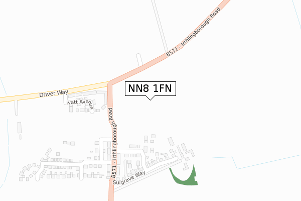
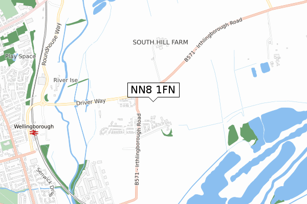
NN8 1FN maps, stats, and open data
NN8 1FN is located in the Finedon electoral ward, within the unitary authority of North Northamptonshire and the English Parliamentary constituency of Wellingborough. The Sub Integrated Care Board (ICB) Location is NHS Northamptonshire ICB - 78H and the police force is Northamptonshire. This postcode has been in use since August 2019.
NN8 1FN maps


Source: OS Open Zoomstack (Ordnance Survey)
Licence: Open Government Licence (requires attribution)
Attribution: Contains OS data © Crown copyright and database right 2025
Source: Open Postcode Geo
Licence: Open Government Licence (requires attribution)
Attribution: Contains OS data © Crown copyright and database right 2025; Contains Royal Mail data © Royal Mail copyright and database right 2025; Source: Office for National Statistics licensed under the Open Government Licence v.3.0
Licence: Open Government Licence (requires attribution)
Attribution: Contains OS data © Crown copyright and database right 2025
Source: Open Postcode Geo
Licence: Open Government Licence (requires attribution)
Attribution: Contains OS data © Crown copyright and database right 2025; Contains Royal Mail data © Royal Mail copyright and database right 2025; Source: Office for National Statistics licensed under the Open Government Licence v.3.0
NN8 1FN geodata
| Easting | 491314 |
| Northing | 268331 |
| Latitude | 52.305529 |
| Longitude | -0.662150 |
Where is NN8 1FN?
| Country | England |
| Postcode District | NN8 |
Politics
| Ward | Finedon |
|---|---|
| Constituency | Wellingborough |
House Prices
Sales of detached houses in NN8 1FN
2024 13 SEP £355,000 |
2022 1 AUG £350,000 |
12, FOTHERINGHAY ROAD, WELLINGBOROUGH, NN8 1FN 2022 22 MAR £300,000 |
10, FOTHERINGHAY ROAD, WELLINGBOROUGH, NN8 1FN 2022 18 FEB £300,000 |
1, FOTHERINGHAY ROAD, WELLINGBOROUGH, NN8 1FN 2022 24 JAN £350,000 |
2, FOTHERINGHAY ROAD, WELLINGBOROUGH, NN8 1FN 2021 30 SEP £365,000 |
3, FOTHERINGHAY ROAD, WELLINGBOROUGH, NN8 1FN 2021 10 SEP £300,000 |
Source: HM Land Registry Price Paid Data
Licence: Contains HM Land Registry data © Crown copyright and database right 2025. This data is licensed under the Open Government Licence v3.0.
Licence: Contains HM Land Registry data © Crown copyright and database right 2025. This data is licensed under the Open Government Licence v3.0.
Transport
Nearest bus stops to NN8 1FN
| Rail Station Forecourt (Midland Road) | Wellingborough | 1,019m |
| 107 Senwick Drive (Senwick Drive) | Wellingborough | 1,045m |
| Leyland View (Senwick Drive) | Wellingborough | 1,121m |
| Colwell Road (Senwick Road) | Wellingborough | 1,146m |
| Colwell Road (Senwick Road) | Wellingborough | 1,157m |
Nearest railway stations to NN8 1FN
| Wellingborough Station | 1km |
Deprivation
60.8% of English postcodes are less deprived than NN8 1FN:Food Standards Agency
Three nearest food hygiene ratings to NN8 1FN (metres)
Good Food

45 Irthlingborough Road North
201m
Dolce Limited At Stanton Cross Primary School

Primary School
241m
Crazy 4 Kids Stanton Cross

Primary School
241m
➜ Get more ratings from the Food Standards Agency
Nearest post box to NN8 1FN
| Last Collection | |||
|---|---|---|---|
| Location | Mon-Fri | Sat | Distance |
| Royal Mail Wellingborough | 18:30 | 11:00 | 1,053m |
| Senwick Road | 16:00 | 11:00 | 1,257m |
| Eastfield Road | 17:00 | 11:00 | 1,670m |
NN8 1FN ITL and NN8 1FN LAU
The below table lists the International Territorial Level (ITL) codes (formerly Nomenclature of Territorial Units for Statistics (NUTS) codes) and Local Administrative Units (LAU) codes for NN8 1FN:
| ITL 1 Code | Name |
|---|---|
| TLF | East Midlands (England) |
| ITL 2 Code | Name |
| TLF2 | Leicestershire, Rutland and Northamptonshire |
| ITL 3 Code | Name |
| TLF25 | North Northamptonshire |
| LAU 1 Code | Name |
| E07000156 | Wellingborough |
NN8 1FN census areas
The below table lists the Census Output Area (OA), Lower Layer Super Output Area (LSOA), and Middle Layer Super Output Area (MSOA) for NN8 1FN:
| Code | Name | |
|---|---|---|
| OA | E00169316 | |
| LSOA | E01027315 | Wellingborough 004C |
| MSOA | E02005695 | Wellingborough 004 |
Nearest postcodes to NN8 1FN
| NN8 1RG | Irthlingborough Road | 207m |
| NN8 1RT | Laurence Leyland Complex | 754m |
| NN8 1RZ | Senwick Drive | 1010m |
| NN8 1RX | Senwick Drive | 1043m |
| NN8 1QN | Mill Road | 1053m |
| NN8 1QH | Talbot Road | 1060m |
| NN8 1EQ | Talbot Road | 1065m |
| NN8 1LA | Leyland View | 1071m |
| NN8 1SS | Neptune Way | 1073m |
| NN8 1RY | Senwick Drive | 1074m |