NN7 3BF maps, stats, and open data
NN7 3BF is located in the Bugbrooke electoral ward, within the unitary authority of West Northamptonshire and the English Parliamentary constituency of South Northamptonshire. The Sub Integrated Care Board (ICB) Location is NHS Northamptonshire ICB - 78H and the police force is Northamptonshire. This postcode has been in use since January 2018.
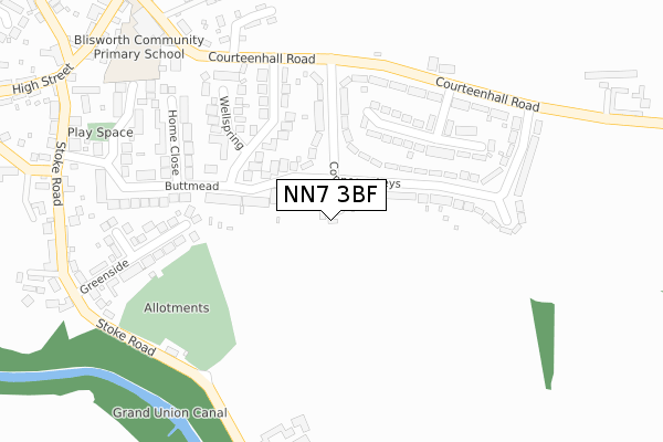
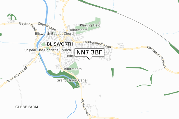
NN7 3BF maps


Licence: Open Government Licence (requires attribution)
Attribution: Contains OS data © Crown copyright and database right 2025
Source: Open Postcode Geo
Licence: Open Government Licence (requires attribution)
Attribution: Contains OS data © Crown copyright and database right 2025; Contains Royal Mail data © Royal Mail copyright and database right 2025; Source: Office for National Statistics licensed under the Open Government Licence v.3.0
NN7 3BF geodata
| Easting | 473112 |
| Northing | 253274 |
| Latitude | 52.172906 |
| Longitude | -0.932306 |
Where is NN7 3BF?
| Country | England |
| Postcode District | NN7 |
Politics
| Ward | Bugbrooke |
|---|---|
| Constituency | South Northamptonshire |
Transport
Nearest bus stops to NN7 3BF
| 30 Connegar Leys (Connegar Leys) | Blisworth | 88m |
| 30 Connegar Leys (Connegar Leys) | Blisworth | 107m |
| Windmill Avenue (Courteenhall Road) | Blisworth | 247m |
| Greenaway Close (Courteenhall Road) | Blisworth | 260m |
| Home Close (Buttmead) | Blisworth | 277m |
Broadband
Broadband access in NN7 3BF (2020 data)
| Percentage of properties with Next Generation Access | 100.0% |
| Percentage of properties with Superfast Broadband | 100.0% |
| Percentage of properties with Ultrafast Broadband | 0.0% |
| Percentage of properties with Full Fibre Broadband | 0.0% |
Superfast Broadband is between 30Mbps and 300Mbps
Ultrafast Broadband is > 300Mbps
Broadband limitations in NN7 3BF (2020 data)
| Percentage of properties unable to receive 2Mbps | 0.0% |
| Percentage of properties unable to receive 5Mbps | 0.0% |
| Percentage of properties unable to receive 10Mbps | 0.0% |
| Percentage of properties unable to receive 30Mbps | 0.0% |
Deprivation
14.6% of English postcodes are less deprived than NN7 3BF:Food Standards Agency
Three nearest food hygiene ratings to NN7 3BF (metres)


➜ Get more ratings from the Food Standards Agency
Nearest post box to NN7 3BF
| Last Collection | |||
|---|---|---|---|
| Location | Mon-Fri | Sat | Distance |
| Courteenhall Road | 16:45 | 10:00 | 240m |
| Blisworth Tso | 16:45 | 10:15 | 497m |
| Pons Bank | 16:30 | 10:15 | 713m |
NN7 3BF ITL and NN7 3BF LAU
The below table lists the International Territorial Level (ITL) codes (formerly Nomenclature of Territorial Units for Statistics (NUTS) codes) and Local Administrative Units (LAU) codes for NN7 3BF:
| ITL 1 Code | Name |
|---|---|
| TLF | East Midlands (England) |
| ITL 2 Code | Name |
| TLF2 | Leicestershire, Rutland and Northamptonshire |
| ITL 3 Code | Name |
| TLF24 | West Northamptonshire |
| LAU 1 Code | Name |
| E07000155 | South Northamptonshire |
NN7 3BF census areas
The below table lists the Census Output Area (OA), Lower Layer Super Output Area (LSOA), and Middle Layer Super Output Area (MSOA) for NN7 3BF:
| Code | Name | |
|---|---|---|
| OA | E00138690 | |
| LSOA | E01027263 | South Northamptonshire 003A |
| MSOA | E02005683 | South Northamptonshire 003 |
Nearest postcodes to NN7 3BF
| NN7 3DE | Connegar Leys | 151m |
| NN7 3DF | Connegar Leys | 164m |
| NN7 3DQ | Buttmead | 182m |
| NN7 3EQ | Windmill Avenue | 191m |
| NN7 3EJ | Greenaway Close | 204m |
| NN7 3DD | Courteenhall Road | 219m |
| NN7 3EH | Wellspring | 245m |
| NN7 3DJ | Home Close | 254m |
| NN7 3BY | Greenside | 292m |
| NN7 3GJ | Ladyfield | 321m |