Property/Postcode Data Search:
NN6 8FB maps, stats, and open data
NN6 8FB is located in the Long Buckby electoral ward, within the unitary authority of West Northamptonshire and the English Parliamentary constituency of Daventry. The Sub Integrated Care Board (ICB) Location is NHS Northamptonshire ICB - 78H and the police force is Northamptonshire. This postcode has been in use since August 2017.
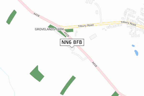
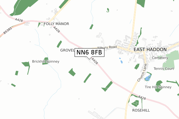
NN6 8FB maps


Source: OS Open Zoomstack (Ordnance Survey)
Licence: Open Government Licence (requires attribution)
Attribution: Contains OS data © Crown copyright and database right 2025
Source: Open Postcode Geo
Licence: Open Government Licence (requires attribution)
Attribution: Contains OS data © Crown copyright and database right 2025; Contains Royal Mail data © Royal Mail copyright and database right 2025; Source: Office for National Statistics licensed under the Open Government Licence v.3.0
Licence: Open Government Licence (requires attribution)
Attribution: Contains OS data © Crown copyright and database right 2025
Source: Open Postcode Geo
Licence: Open Government Licence (requires attribution)
Attribution: Contains OS data © Crown copyright and database right 2025; Contains Royal Mail data © Royal Mail copyright and database right 2025; Source: Office for National Statistics licensed under the Open Government Licence v.3.0
NN6 8FB geodata
| Easting | 466008 |
| Northing | 268011 |
| Latitude | 52.306274 |
| Longitude | -1.033296 |
Where is NN6 8FB?
| Country | England |
| Postcode District | NN6 |
Politics
| Ward | Long Buckby |
|---|---|
| Constituency | Daventry |
Transport
Nearest bus stops to NN6 8FB
| Tilbury Rise (Tilbury Road) | East Haddon | 324m |
| Tilbury Rise (Tilbury Road) | East Haddon | 368m |
| Hall Gardens (Ravensthorpe Road) | East Haddon | 587m |
| Hall Gardens (Ravensthorpe Road) | East Haddon | 613m |
| St Mary's Church (Main Street) | East Haddon | 651m |
Nearest railway stations to NN6 8FB
| Long Buckby Station | 3.8km |
Deprivation
17.2% of English postcodes are less deprived than NN6 8FB:Food Standards Agency
Three nearest food hygiene ratings to NN6 8FB (metres)
Kingswood at East Haddon CEV

East Haddon Church Of England Primary School
764m
East Haddon B&B

The Old House
845m
➜ Get more ratings from the Food Standards Agency
Nearest post box to NN6 8FB
| Last Collection | |||
|---|---|---|---|
| Location | Mon-Fri | Sat | Distance |
| East Haddon Tso | 16:00 | 10:30 | 688m |
| Buckby Folly | 17:00 | 10:45 | 767m |
| Cotton End | 16:00 | 09:30 | 2,328m |
NN6 8FB ITL and NN6 8FB LAU
The below table lists the International Territorial Level (ITL) codes (formerly Nomenclature of Territorial Units for Statistics (NUTS) codes) and Local Administrative Units (LAU) codes for NN6 8FB:
| ITL 1 Code | Name |
|---|---|
| TLF | East Midlands (England) |
| ITL 2 Code | Name |
| TLF2 | Leicestershire, Rutland and Northamptonshire |
| ITL 3 Code | Name |
| TLF24 | West Northamptonshire |
| LAU 1 Code | Name |
| E07000151 | Daventry |
NN6 8FB census areas
The below table lists the Census Output Area (OA), Lower Layer Super Output Area (LSOA), and Middle Layer Super Output Area (MSOA) for NN6 8FB:
| Code | Name | |
|---|---|---|
| OA | E00137425 | |
| LSOA | E01027021 | Daventry 004D |
| MSOA | E02005622 | Daventry 004 |
Nearest postcodes to NN6 8FB
| NN6 8BX | Tilbury Road | 418m |
| NN6 8BW | Tilbury Rise | 458m |
| NN6 8BT | Priestwell Court | 536m |
| NN6 8BJ | Northfield Green | 582m |
| NN6 8BL | Hall Gardens | 621m |
| NN6 8DA | Vicarage Lane | 622m |
| NN6 8BZ | Orchard Close | 673m |
| NN6 8BS | Barn Acre | 715m |
| NN6 8BY | Ravensthorpe Road | 724m |
| NN6 8DB | Church Lane | 767m |