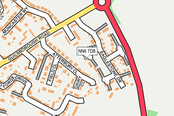
NN6 7DB is located in the Long Buckby electoral ward, within the unitary authority of West Northamptonshire and the English Parliamentary constituency of Daventry. The Sub Integrated Care Board (ICB) Location is NHS Northamptonshire ICB - 78H and the police force is Northamptonshire. This postcode has been in use since March 2017.


GetTheData
Source: OS OpenMap – Local (Ordnance Survey)
Source: OS VectorMap District (Ordnance Survey)
Licence: Open Government Licence (requires attribution)
| Easting | 463586 |
| Northing | 271969 |
| Latitude | 52.342138 |
| Longitude | -1.068067 |
GetTheData
Source: Open Postcode Geo
Licence: Open Government Licence
| Country | England |
| Postcode District | NN6 |
➜ See where NN6 is on a map ➜ Where is West Haddon? | |
GetTheData
Source: Land Registry Price Paid Data
Licence: Open Government Licence
| Ward | Long Buckby |
| Constituency | Daventry |
GetTheData
Source: ONS Postcode Database
Licence: Open Government Licence
2022 4 MAY £365,000 |
16, GOODMAN CLOSE, WEST HADDON, NORTHAMPTON, NN6 7DB 2017 30 AUG £364,995 |
14, GOODMAN CLOSE, WEST HADDON, NORTHAMPTON, NN6 7DB 2017 25 AUG £369,995 |
18, GOODMAN CLOSE, WEST HADDON, NORTHAMPTON, NN6 7DB 2017 28 JUL £299,995 |
12, GOODMAN CLOSE, WEST HADDON, NORTHAMPTON, NN6 7DB 2017 30 JUN £494,995 |
6, GOODMAN CLOSE, WEST HADDON, NORTHAMPTON, NN6 7DB 2017 31 MAY £378,000 |
8, GOODMAN CLOSE, WEST HADDON, NORTHAMPTON, NN6 7DB 2017 31 MAY £391,995 |
2017 28 APR £290,995 |
2, GOODMAN CLOSE, WEST HADDON, NORTHAMPTON, NN6 7DB 2017 31 MAR £289,995 |
GetTheData
Source: HM Land Registry Price Paid Data
Licence: Contains HM Land Registry data © Crown copyright and database right 2025. This data is licensed under the Open Government Licence v3.0.
| Morrison Park Road (Guilsborough Road) | West Haddon | 140m |
| Morrison Park Road (Guilsborough Road) | West Haddon | 148m |
| Elizabeth Road (Guilsborough Road) | West Haddon | 274m |
| Elizabeth Road (Guilsborough Road) | West Haddon | 285m |
| Crown Lane (High Street) | West Haddon | 500m |
GetTheData
Source: NaPTAN
Licence: Open Government Licence
| Percentage of properties with Next Generation Access | 100.0% |
| Percentage of properties with Superfast Broadband | 100.0% |
| Percentage of properties with Ultrafast Broadband | 100.0% |
| Percentage of properties with Full Fibre Broadband | 100.0% |
Superfast Broadband is between 30Mbps and 300Mbps
Ultrafast Broadband is > 300Mbps
| Percentage of properties unable to receive 2Mbps | 0.0% |
| Percentage of properties unable to receive 5Mbps | 0.0% |
| Percentage of properties unable to receive 10Mbps | 0.0% |
| Percentage of properties unable to receive 30Mbps | 0.0% |
GetTheData
Source: Ofcom
Licence: Ofcom Terms of Use (requires attribution)
GetTheData
Source: ONS Postcode Database
Licence: Open Government Licence


➜ Get more ratings from the Food Standards Agency
GetTheData
Source: Food Standards Agency
Licence: FSA terms & conditions
| Last Collection | |||
|---|---|---|---|
| Location | Mon-Fri | Sat | Distance |
| Guilsborough Road | 16:00 | 10:30 | 138m |
| West Haddon Tso | 16:15 | 10:30 | 437m |
| West End | 16:15 | 10:30 | 664m |
GetTheData
Source: Dracos
Licence: Creative Commons Attribution-ShareAlike
The below table lists the International Territorial Level (ITL) codes (formerly Nomenclature of Territorial Units for Statistics (NUTS) codes) and Local Administrative Units (LAU) codes for NN6 7DB:
| ITL 1 Code | Name |
|---|---|
| TLF | East Midlands (England) |
| ITL 2 Code | Name |
| TLF2 | Leicestershire, Rutland and Northamptonshire |
| ITL 3 Code | Name |
| TLF24 | West Northamptonshire |
| LAU 1 Code | Name |
| E07000151 | Daventry |
GetTheData
Source: ONS Postcode Directory
Licence: Open Government Licence
The below table lists the Census Output Area (OA), Lower Layer Super Output Area (LSOA), and Middle Layer Super Output Area (MSOA) for NN6 7DB:
| Code | Name | |
|---|---|---|
| OA | E00137464 | |
| LSOA | E01027027 | Daventry 004E |
| MSOA | E02005622 | Daventry 004 |
GetTheData
Source: ONS Postcode Directory
Licence: Open Government Licence
| NN6 7AA | Atterbury Close | 55m |
| NN6 7AE | Guilsborough Road | 96m |
| NN6 7AX | Dairy Close | 99m |
| NN6 7AB | Field Close | 166m |
| NN6 7GP | The Old Brick Yard | 180m |
| NN6 7ET | Old Forge Drive | 235m |
| NN6 7AD | Guilsborough Road | 254m |
| NN6 7DU | Muncaster Way | 273m |
| NN6 7GL | Lattimore Close | 357m |
| NN6 7AR | Northampton Road | 366m |
GetTheData
Source: Open Postcode Geo; Land Registry Price Paid Data
Licence: Open Government Licence