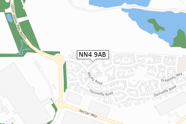
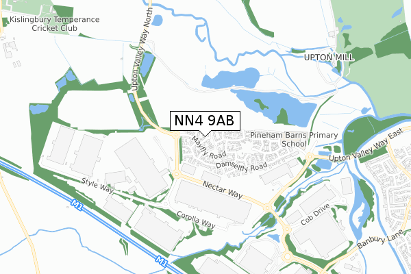
NN4 9AB is located in the Sixfields electoral ward, within the unitary authority of West Northamptonshire and the English Parliamentary constituency of South Northamptonshire. The Sub Integrated Care Board (ICB) Location is NHS Northamptonshire ICB - 78H and the police force is Northamptonshire. This postcode has been in use since May 2018.


GetTheData
Source: OS Open Zoomstack (Ordnance Survey)
Licence: Open Government Licence (requires attribution)
Attribution: Contains OS data © Crown copyright and database right 2025
Source: Open Postcode Geo
Licence: Open Government Licence (requires attribution)
Attribution: Contains OS data © Crown copyright and database right 2025; Contains Royal Mail data © Royal Mail copyright and database right 2025; Source: Office for National Statistics licensed under the Open Government Licence v.3.0
| Easting | 471309 |
| Northing | 258767 |
| Latitude | 52.222519 |
| Longitude | -0.957513 |
GetTheData
Source: Open Postcode Geo
Licence: Open Government Licence
| Country | England |
| Postcode District | NN4 |
➜ See where NN4 is on a map ➜ Where is Northampton? | |
GetTheData
Source: Land Registry Price Paid Data
Licence: Open Government Licence
| Ward | Sixfields |
| Constituency | South Northamptonshire |
GetTheData
Source: ONS Postcode Database
Licence: Open Government Licence
6, HARLEQUIN CLOSE, NORTHAMPTON, NN4 9AB 2018 28 AUG £440,000 |
8, HARLEQUIN CLOSE, NORTHAMPTON, NN4 9AB 2018 17 AUG £460,000 |
10, HARLEQUIN CLOSE, NORTHAMPTON, NN4 9AB 2018 29 JUN £440,000 |
7, HARLEQUIN CLOSE, NORTHAMPTON, NN4 9AB 2018 29 JUN £445,000 |
5, HARLEQUIN CLOSE, NORTHAMPTON, NN4 9AB 2018 8 JUN £395,000 |
2, HARLEQUIN CLOSE, NORTHAMPTON, NN4 9AB 2018 18 MAY £345,000 |
9, HARLEQUIN CLOSE, NORTHAMPTON, NN4 9AB 2018 4 MAY £410,000 |
1, HARLEQUIN CLOSE, NORTHAMPTON, NN4 9AB 2018 12 APR £299,995 |
GetTheData
Source: HM Land Registry Price Paid Data
Licence: Contains HM Land Registry data © Crown copyright and database right 2025. This data is licensed under the Open Government Licence v3.0.
| Sainsburys Distribution Centre (Upton Valley Way North) | Swan Valley | 188m |
| Sainsburys Distribution Centre (Upton Valley Way North) | Swan Valley | 200m |
| Sepals Way (Nectar Way) | Swan Valley | 264m |
| Sepals Way (Nectar Way) | Swan Valley | 281m |
| Sainsburys Distribution Centre (Sepals Way) | Swan Valley | 376m |
| Northampton Station | 3.9km |
GetTheData
Source: NaPTAN
Licence: Open Government Licence
| Percentage of properties with Next Generation Access | 100.0% |
| Percentage of properties with Superfast Broadband | 100.0% |
| Percentage of properties with Ultrafast Broadband | 0.0% |
| Percentage of properties with Full Fibre Broadband | 0.0% |
Superfast Broadband is between 30Mbps and 300Mbps
Ultrafast Broadband is > 300Mbps
| Percentage of properties unable to receive 2Mbps | 0.0% |
| Percentage of properties unable to receive 5Mbps | 0.0% |
| Percentage of properties unable to receive 10Mbps | 0.0% |
| Percentage of properties unable to receive 30Mbps | 0.0% |
GetTheData
Source: Ofcom
Licence: Ofcom Terms of Use (requires attribution)
GetTheData
Source: ONS Postcode Database
Licence: Open Government Licence

➜ Get more ratings from the Food Standards Agency
GetTheData
Source: Food Standards Agency
Licence: FSA terms & conditions
| Last Collection | |||
|---|---|---|---|
| Location | Mon-Fri | Sat | Distance |
| Samwell Way | 17:30 | 11:30 | 1,279m |
| Rothersthorpe M1 Services | 17:30 | 11:15 | 1,695m |
| Tansy Close | 17:30 | 11:30 | 1,698m |
GetTheData
Source: Dracos
Licence: Creative Commons Attribution-ShareAlike
The below table lists the International Territorial Level (ITL) codes (formerly Nomenclature of Territorial Units for Statistics (NUTS) codes) and Local Administrative Units (LAU) codes for NN4 9AB:
| ITL 1 Code | Name |
|---|---|
| TLF | East Midlands (England) |
| ITL 2 Code | Name |
| TLF2 | Leicestershire, Rutland and Northamptonshire |
| ITL 3 Code | Name |
| TLF24 | West Northamptonshire |
| LAU 1 Code | Name |
| E07000154 | Northampton |
GetTheData
Source: ONS Postcode Directory
Licence: Open Government Licence
The below table lists the Census Output Area (OA), Lower Layer Super Output Area (LSOA), and Middle Layer Super Output Area (MSOA) for NN4 9AB:
| Code | Name | |
|---|---|---|
| OA | E00169238 | |
| LSOA | E01032977 | Northampton 029G |
| MSOA | E02005678 | Northampton 029 |
GetTheData
Source: ONS Postcode Directory
Licence: Open Government Licence
| NN4 9EN | Mayfly Road | 146m |
| NN4 9EQ | Mayfly Road | 192m |
| NN4 9ES | Damselfly Road | 263m |
| NN4 9EW | Hawker Way | 287m |
| NN4 9EH | Dragonfly Way | 330m |
| NN4 9EL | Drake Way | 360m |
| NN4 9ET | Damselfly Road | 390m |
| NN4 9EG | Chaser Way | 394m |
| NN4 9ER | Clubtail Way | 407m |
| NN4 9EU | Darter Way | 467m |
GetTheData
Source: Open Postcode Geo; Land Registry Price Paid Data
Licence: Open Government Licence