NN4 6FT maps, stats, and open data
NN4 6FT is located in the Hackleton and Grange Park electoral ward, within the unitary authority of West Northamptonshire and the English Parliamentary constituency of South Northamptonshire. The Sub Integrated Care Board (ICB) Location is NHS Northamptonshire ICB - 78H and the police force is Northamptonshire. This postcode has been in use since April 2018.
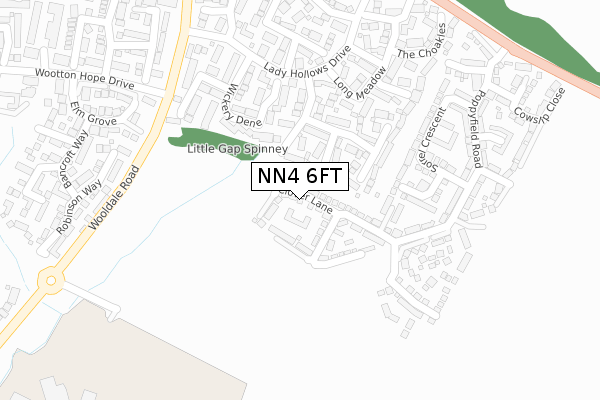
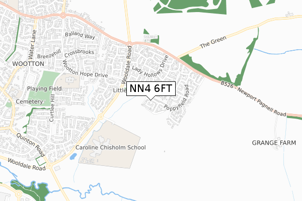
NN4 6FT maps


Licence: Open Government Licence (requires attribution)
Attribution: Contains OS data © Crown copyright and database right 2025
Source: Open Postcode Geo
Licence: Open Government Licence (requires attribution)
Attribution: Contains OS data © Crown copyright and database right 2025; Contains Royal Mail data © Royal Mail copyright and database right 2025; Source: Office for National Statistics licensed under the Open Government Licence v.3.0
NN4 6FT geodata
| Easting | 477414 |
| Northing | 256538 |
| Latitude | 52.201659 |
| Longitude | -0.868668 |
Where is NN4 6FT?
| Country | England |
| Postcode District | NN4 |
Politics
| Ward | Hackleton And Grange Park |
|---|---|
| Constituency | South Northamptonshire |
House Prices
Sales of detached houses in NN4 6FT
2024 24 OCT £415,000 |
2020 29 MAY £297,000 |
2019 27 SEP £375,750 |
37, CLOVER LANE, WOOTTON, NORTHAMPTON, NN4 6FT 2019 30 AUG £582,750 |
35, CLOVER LANE, WOOTTON, NORTHAMPTON, NN4 6FT 2019 30 MAY £422,750 |
41, CLOVER LANE, WOOTTON, NORTHAMPTON, NN4 6FT 2019 26 APR £607,750 |
31, CLOVER LANE, WOOTTON, NORTHAMPTON, NN4 6FT 2019 9 APR £430,750 |
39, CLOVER LANE, WOOTTON, NORTHAMPTON, NN4 6FT 2019 22 FEB £527,750 |
20, CLOVER LANE, WOOTTON, NORTHAMPTON, NN4 6FT 2018 19 DEC £427,750 |
2, CLOVER LANE, WOOTTON, NORTHAMPTON, NN4 6FT 2018 2 NOV £414,750 |
Licence: Contains HM Land Registry data © Crown copyright and database right 2025. This data is licensed under the Open Government Licence v3.0.
Transport
Nearest bus stops to NN4 6FT
| Wickery Dene (Lady Hollows Drive) | Wootton Fields | 230m |
| Wickery Dene (Lady Hollows Drive) | Wootton Fields | 275m |
| Middle Greeve (Lady Hollows Drive) | Wootton Fields | 292m |
| Lady Hollows Drive (Wooldale Road) | Wootton Fields | 325m |
| Middle Greeve (Lady Hollows Drive) | Wootton Fields | 373m |
Nearest railway stations to NN4 6FT
| Northampton Station | 4.8km |
Broadband
Broadband access in NN4 6FT (2020 data)
| Percentage of properties with Next Generation Access | 100.0% |
| Percentage of properties with Superfast Broadband | 100.0% |
| Percentage of properties with Ultrafast Broadband | 100.0% |
| Percentage of properties with Full Fibre Broadband | 100.0% |
Superfast Broadband is between 30Mbps and 300Mbps
Ultrafast Broadband is > 300Mbps
Broadband speed in NN4 6FT (2019 data)
Download
| Median download speed | 2.5Mbps |
| Average download speed | 2.5Mbps |
| Maximum download speed | 4.09Mbps |
Upload
| Median upload speed | 0.7Mbps |
| Average upload speed | 0.6Mbps |
| Maximum upload speed | 0.80Mbps |
Broadband limitations in NN4 6FT (2020 data)
| Percentage of properties unable to receive 2Mbps | 0.0% |
| Percentage of properties unable to receive 5Mbps | 0.0% |
| Percentage of properties unable to receive 10Mbps | 0.0% |
| Percentage of properties unable to receive 30Mbps | 0.0% |
Deprivation
6% of English postcodes are less deprived than NN4 6FT:Food Standards Agency
Three nearest food hygiene ratings to NN4 6FT (metres)

➜ Get more ratings from the Food Standards Agency
Nearest post box to NN4 6FT
| Last Collection | |||
|---|---|---|---|
| Location | Mon-Fri | Sat | Distance |
| Poppyridge | 17:30 | 11:30 | 347m |
| Hope Drive | 17:30 | 11:45 | 572m |
| Curtlee Hill | 17:00 | 12:00 | 961m |
NN4 6FT ITL and NN4 6FT LAU
The below table lists the International Territorial Level (ITL) codes (formerly Nomenclature of Territorial Units for Statistics (NUTS) codes) and Local Administrative Units (LAU) codes for NN4 6FT:
| ITL 1 Code | Name |
|---|---|
| TLF | East Midlands (England) |
| ITL 2 Code | Name |
| TLF2 | Leicestershire, Rutland and Northamptonshire |
| ITL 3 Code | Name |
| TLF24 | West Northamptonshire |
| LAU 1 Code | Name |
| E07000155 | South Northamptonshire |
NN4 6FT census areas
The below table lists the Census Output Area (OA), Lower Layer Super Output Area (LSOA), and Middle Layer Super Output Area (MSOA) for NN4 6FT:
| Code | Name | |
|---|---|---|
| OA | E00138741 | |
| LSOA | E01027274 | South Northamptonshire 002B |
| MSOA | E02005682 | South Northamptonshire 002 |
Nearest postcodes to NN4 6FT
| NN4 6AR | Thrupp Bridge | 123m |
| NN4 6AT | Milton Bridge | 125m |
| NN4 6NE | Poppyfield Road | 165m |
| NN4 6BE | Wickery Dene | 176m |
| NN4 6AQ | The Ashes | 231m |
| NN4 6BG | Whittles Cross | 248m |
| NN4 6BD | Low Greeve | 256m |
| NN4 6ND | Poppyfield Road | 269m |
| NN4 6AN | Long Meadow | 281m |
| NN4 6AP | The Choakles | 337m |