Property/Postcode Data Search:
NN3 7QA maps, stats, and open data
NN3 7QA is located in the Moulton electoral ward, within the unitary authority of West Northamptonshire and the English Parliamentary constituency of Daventry. The Sub Integrated Care Board (ICB) Location is NHS Northamptonshire ICB - 78H and the police force is Northamptonshire. This postcode has been in use since April 2020.
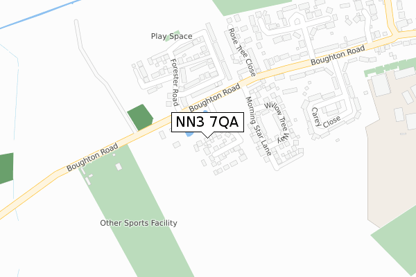
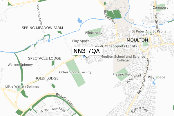
NN3 7QA maps


Source: OS Open Zoomstack (Ordnance Survey)
Licence: Open Government Licence (requires attribution)
Attribution: Contains OS data © Crown copyright and database right 2025
Source: Open Postcode Geo
Licence: Open Government Licence (requires attribution)
Attribution: Contains OS data © Crown copyright and database right 2025; Contains Royal Mail data © Royal Mail copyright and database right 2025; Source: Office for National Statistics licensed under the Open Government Licence v.3.0
Licence: Open Government Licence (requires attribution)
Attribution: Contains OS data © Crown copyright and database right 2025
Source: Open Postcode Geo
Licence: Open Government Licence (requires attribution)
Attribution: Contains OS data © Crown copyright and database right 2025; Contains Royal Mail data © Royal Mail copyright and database right 2025; Source: Office for National Statistics licensed under the Open Government Licence v.3.0
NN3 7QA geodata
| Easting | 477623 |
| Northing | 265953 |
| Latitude | 52.286258 |
| Longitude | -0.863451 |
Where is NN3 7QA?
| Country | England |
| Postcode District | NN3 |
Politics
| Ward | Moulton |
|---|---|
| Constituency | Daventry |
House Prices
Sales of detached houses in NN3 7QA
1, LANGLANDS DRIVE, MOULTON, NORTHAMPTON, NN3 7QA 2022 26 AUG £649,950 |
24, LANGLANDS DRIVE, MOULTON, NORTHAMPTON, NN3 7QA 2021 12 NOV £404,950 |
23, LANGLANDS DRIVE, MOULTON, NORTHAMPTON, NN3 7QA 2021 12 NOV £419,950 |
22, LANGLANDS DRIVE, MOULTON, NORTHAMPTON, NN3 7QA 2021 30 SEP £469,950 |
5, LANGLANDS DRIVE, MOULTON, NORTHAMPTON, NN3 7QA 2021 9 APR £500,000 |
4, LANGLANDS DRIVE, MOULTON, NORTHAMPTON, NN3 7QA 2021 31 MAR £454,950 |
14, LANGLANDS DRIVE, MOULTON, NORTHAMPTON, NN3 7QA 2020 27 NOV £414,950 |
15, LANGLANDS DRIVE, MOULTON, NORTHAMPTON, NN3 7QA 2020 27 NOV £399,950 |
12, LANGLANDS DRIVE, MOULTON, NORTHAMPTON, NN3 7QA 2020 30 OCT £369,950 |
11, LANGLANDS DRIVE, MOULTON, NORTHAMPTON, NN3 7QA 2020 28 AUG £409,950 |
Source: HM Land Registry Price Paid Data
Licence: Contains HM Land Registry data © Crown copyright and database right 2025. This data is licensed under the Open Government Licence v3.0.
Licence: Contains HM Land Registry data © Crown copyright and database right 2025. This data is licensed under the Open Government Licence v3.0.
Transport
Nearest bus stops to NN3 7QA
| Eynon Close (Boughton Road) | Moulton | 385m |
| Eynon Close (Boughton Road) | Moulton | 400m |
| The Paddocks (Pound Lane) | Moulton | 468m |
| Fuller Road (Northampton Lane North) | Moulton | 674m |
| Fuller Road (Northampton Lane North) | Moulton | 680m |
Deprivation
30.9% of English postcodes are less deprived than NN3 7QA:Food Standards Agency
Three nearest food hygiene ratings to NN3 7QA (metres)
Adventure Ways

The P & M Courtyard
304m
The Loving Chef
New Manor Farm
416m
Moulton Football Club

Brunting Road
448m
➜ Get more ratings from the Food Standards Agency
Nearest post box to NN3 7QA
| Last Collection | |||
|---|---|---|---|
| Location | Mon-Fri | Sat | Distance |
| Boughton Road | 17:30 | 09:30 | 451m |
| Northampton Lane | 17:30 | 09:30 | 693m |
| Moulton Tso | 17:30 | 11:15 | 746m |
NN3 7QA ITL and NN3 7QA LAU
The below table lists the International Territorial Level (ITL) codes (formerly Nomenclature of Territorial Units for Statistics (NUTS) codes) and Local Administrative Units (LAU) codes for NN3 7QA:
| ITL 1 Code | Name |
|---|---|
| TLF | East Midlands (England) |
| ITL 2 Code | Name |
| TLF2 | Leicestershire, Rutland and Northamptonshire |
| ITL 3 Code | Name |
| TLF24 | West Northamptonshire |
| LAU 1 Code | Name |
| E07000151 | Daventry |
NN3 7QA census areas
The below table lists the Census Output Area (OA), Lower Layer Super Output Area (LSOA), and Middle Layer Super Output Area (MSOA) for NN3 7QA:
| Code | Name | |
|---|---|---|
| OA | E00137416 | |
| LSOA | E01027019 | Daventry 005C |
| MSOA | E02005623 | Daventry 005 |
Nearest postcodes to NN3 7QA
| NN3 7SN | Carey Close | 251m |
| NN3 7SG | Boughton Road | 305m |
| NN3 7SJ | Boughton Road | 344m |
| NN3 7SU | Rose Tree Close | 374m |
| NN3 7SL | Arnsby Crescent | 395m |
| NN3 7QE | Whiting Court | 401m |
| NN3 7SQ | Boughton Road | 468m |
| NN3 7RB | Harvey Lane | 470m |
| NN3 7GH | Jeyes Close | 473m |
| NN3 7AP | Lunchfield Gardens | 485m |