NN3 7DN maps, stats, and open data
NN3 7DN is located in the Moulton electoral ward, within the unitary authority of West Northamptonshire and the English Parliamentary constituency of Daventry. The Sub Integrated Care Board (ICB) Location is NHS Northamptonshire ICB - 78H and the police force is Northamptonshire. This postcode has been in use since April 2018.
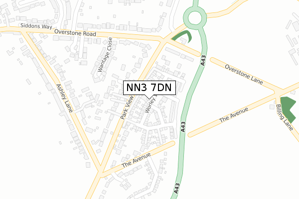
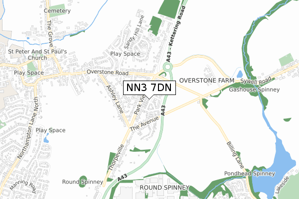
NN3 7DN maps


Licence: Open Government Licence (requires attribution)
Attribution: Contains OS data © Crown copyright and database right 2025
Source: Open Postcode Geo
Licence: Open Government Licence (requires attribution)
Attribution: Contains OS data © Crown copyright and database right 2025; Contains Royal Mail data © Royal Mail copyright and database right 2025; Source: Office for National Statistics licensed under the Open Government Licence v.3.0
NN3 7DN geodata
| Easting | 479286 |
| Northing | 266051 |
| Latitude | 52.286902 |
| Longitude | -0.839053 |
Where is NN3 7DN?
| Country | England |
| Postcode District | NN3 |
Politics
| Ward | Moulton |
|---|---|
| Constituency | Daventry |
House Prices
Sales of detached houses in NN3 7DN
2024 26 APR £645,000 |
2023 26 MAY £435,000 |
2022 2 MAR £412,000 |
2021 30 SEP £415,000 |
15, WORLEY WAY, MOULTON, NORTHAMPTON, NN3 7DN 2019 26 APR £439,995 |
19, WORLEY WAY, MOULTON, NORTHAMPTON, NN3 7DN 2019 29 MAR £514,995 |
17, WORLEY WAY, MOULTON, NORTHAMPTON, NN3 7DN 2018 21 DEC £519,995 |
4, WORLEY WAY, MOULTON, NORTHAMPTON, NN3 7DN 2018 20 DEC £389,995 |
2018 20 DEC £548,995 |
2, WORLEY WAY, MOULTON, NORTHAMPTON, NN3 7DN 2018 19 DEC £399,995 |
Licence: Contains HM Land Registry data © Crown copyright and database right 2025. This data is licensed under the Open Government Licence v3.0.
Transport
Nearest bus stops to NN3 7DN
| Overstone Road (Park View) | Moulton | 129m |
| Overstone Road | Moulton | 201m |
| Overstone Road (Park View) | Moulton | 258m |
| Ashley Lane (Park View) | Moulton | 263m |
| Overstone Road | Moulton | 271m |
Broadband
Broadband access in NN3 7DN (2020 data)
| Percentage of properties with Next Generation Access | 100.0% |
| Percentage of properties with Superfast Broadband | 100.0% |
| Percentage of properties with Ultrafast Broadband | 100.0% |
| Percentage of properties with Full Fibre Broadband | 100.0% |
Superfast Broadband is between 30Mbps and 300Mbps
Ultrafast Broadband is > 300Mbps
Broadband limitations in NN3 7DN (2020 data)
| Percentage of properties unable to receive 2Mbps | 0.0% |
| Percentage of properties unable to receive 5Mbps | 0.0% |
| Percentage of properties unable to receive 10Mbps | 0.0% |
| Percentage of properties unable to receive 30Mbps | 0.0% |
Deprivation
11.7% of English postcodes are less deprived than NN3 7DN:Food Standards Agency
Three nearest food hygiene ratings to NN3 7DN (metres)


➜ Get more ratings from the Food Standards Agency
Nearest post box to NN3 7DN
| Last Collection | |||
|---|---|---|---|
| Location | Mon-Fri | Sat | Distance |
| Overstone Road | 17:30 | 09:45 | 214m |
| Ashley Lane | 17:30 | 09:45 | 275m |
| Wantage Farm | 17:30 | 09:45 | 741m |
NN3 7DN ITL and NN3 7DN LAU
The below table lists the International Territorial Level (ITL) codes (formerly Nomenclature of Territorial Units for Statistics (NUTS) codes) and Local Administrative Units (LAU) codes for NN3 7DN:
| ITL 1 Code | Name |
|---|---|
| TLF | East Midlands (England) |
| ITL 2 Code | Name |
| TLF2 | Leicestershire, Rutland and Northamptonshire |
| ITL 3 Code | Name |
| TLF24 | West Northamptonshire |
| LAU 1 Code | Name |
| E07000151 | Daventry |
NN3 7DN census areas
The below table lists the Census Output Area (OA), Lower Layer Super Output Area (LSOA), and Middle Layer Super Output Area (MSOA) for NN3 7DN:
| Code | Name | |
|---|---|---|
| OA | E00137423 | |
| LSOA | E01027018 | Daventry 005B |
| MSOA | E02005623 | Daventry 005 |
Nearest postcodes to NN3 7DN
| NN3 7AU | Park View Close | 94m |
| NN3 7TP | Park View | 103m |
| NN3 7TN | Park View | 152m |
| NN3 7UY | Wantage Close | 182m |
| NN6 0AA | Overstone Lane | 183m |
| NN3 7TW | Park View | 184m |
| NN3 7AT | Ashley Close | 195m |
| NN3 7TL | The Avenue | 248m |
| NN3 7AF | Overstone Close | 262m |
| NN3 7UU | Overstone Road | 273m |