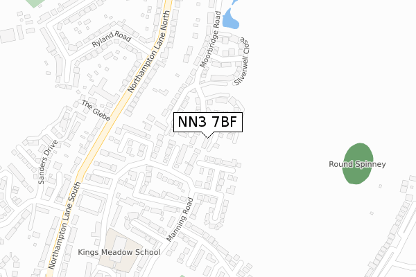
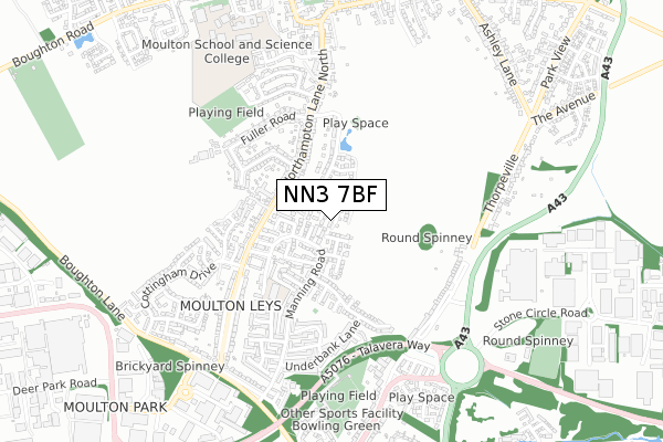
NN3 7BF is located in the Moulton electoral ward, within the unitary authority of West Northamptonshire and the English Parliamentary constituency of Daventry. The Sub Integrated Care Board (ICB) Location is NHS Northamptonshire ICB - 78H and the police force is Northamptonshire. This postcode has been in use since August 2017.


GetTheData
Source: OS Open Zoomstack (Ordnance Survey)
Licence: Open Government Licence (requires attribution)
Attribution: Contains OS data © Crown copyright and database right 2025
Source: Open Postcode Geo
Licence: Open Government Licence (requires attribution)
Attribution: Contains OS data © Crown copyright and database right 2025; Contains Royal Mail data © Royal Mail copyright and database right 2025; Source: Office for National Statistics licensed under the Open Government Licence v.3.0
| Easting | 478367 |
| Northing | 265424 |
| Latitude | 52.281398 |
| Longitude | -0.852669 |
GetTheData
Source: Open Postcode Geo
Licence: Open Government Licence
| Country | England |
| Postcode District | NN3 |
➜ See where NN3 is on a map ➜ Where is Northampton? | |
GetTheData
Source: Land Registry Price Paid Data
Licence: Open Government Licence
| Ward | Moulton |
| Constituency | Daventry |
GetTheData
Source: ONS Postcode Database
Licence: Open Government Licence
| Ryland Road (Northampton Lane South) | Moulton | 218m |
| Ryland Road (Northampton Lane South) | Moulton | 231m |
| Manning Court (Manning Road) | Moulton Leys | 291m |
| Manning Court (Manning Road) | Moulton Leys | 313m |
| Playing Fields (Manning Road) | Moulton Leys | 325m |
| Northampton Station | 6.1km |
GetTheData
Source: NaPTAN
Licence: Open Government Licence
| Percentage of properties with Next Generation Access | 100.0% |
| Percentage of properties with Superfast Broadband | 100.0% |
| Percentage of properties with Ultrafast Broadband | 100.0% |
| Percentage of properties with Full Fibre Broadband | 0.0% |
Superfast Broadband is between 30Mbps and 300Mbps
Ultrafast Broadband is > 300Mbps
| Median download speed | 35.7Mbps |
| Average download speed | 47.7Mbps |
| Maximum download speed | 100.00Mbps |
| Median upload speed | 3.0Mbps |
| Average upload speed | 4.4Mbps |
| Maximum upload speed | 9.71Mbps |
| Percentage of properties unable to receive 2Mbps | 0.0% |
| Percentage of properties unable to receive 5Mbps | 0.0% |
| Percentage of properties unable to receive 10Mbps | 0.0% |
| Percentage of properties unable to receive 30Mbps | 0.0% |
GetTheData
Source: Ofcom
Licence: Ofcom Terms of Use (requires attribution)
GetTheData
Source: ONS Postcode Database
Licence: Open Government Licence


➜ Get more ratings from the Food Standards Agency
GetTheData
Source: Food Standards Agency
Licence: FSA terms & conditions
| Last Collection | |||
|---|---|---|---|
| Location | Mon-Fri | Sat | Distance |
| Manning Road | 17:30 | 09:30 | 195m |
| Northampton Lane | 17:30 | 09:30 | 222m |
| Thorpeville | 17:30 | 12:30 | 530m |
GetTheData
Source: Dracos
Licence: Creative Commons Attribution-ShareAlike
The below table lists the International Territorial Level (ITL) codes (formerly Nomenclature of Territorial Units for Statistics (NUTS) codes) and Local Administrative Units (LAU) codes for NN3 7BF:
| ITL 1 Code | Name |
|---|---|
| TLF | East Midlands (England) |
| ITL 2 Code | Name |
| TLF2 | Leicestershire, Rutland and Northamptonshire |
| ITL 3 Code | Name |
| TLF24 | West Northamptonshire |
| LAU 1 Code | Name |
| E07000151 | Daventry |
GetTheData
Source: ONS Postcode Directory
Licence: Open Government Licence
The below table lists the Census Output Area (OA), Lower Layer Super Output Area (LSOA), and Middle Layer Super Output Area (MSOA) for NN3 7BF:
| Code | Name | |
|---|---|---|
| OA | E00137414 | |
| LSOA | E01027020 | Daventry 005D |
| MSOA | E02005623 | Daventry 005 |
GetTheData
Source: ONS Postcode Directory
Licence: Open Government Licence
| NN3 7TQ | North Leys Court | 97m |
| NN3 7BP | Groveleys Close | 116m |
| NN3 7TX | East Leys Court | 121m |
| NN3 7AA | Moorbridge Road | 169m |
| NN3 7XB | Horsewell Court | 185m |
| NN3 7BT | Silverwell Close | 186m |
| NN3 7UB | West Leys Court | 189m |
| NN3 7RQ | Northampton Lane North | 200m |
| NN3 7XD | Manning Road | 212m |
| NN3 7RF | Northampton Lane North | 238m |
GetTheData
Source: Open Postcode Geo; Land Registry Price Paid Data
Licence: Open Government Licence